

Size of this preview: 800 × 600 pixels. Other resolutions: 320 × 240 pixels | 640 × 480 pixels | 1,024 × 768 pixels | 1,280 × 960 pixels | 2,560 × 1,920 pixels | 3,648 × 2,736 pixels.
Original file (3,648 × 2,736 pixels, file size: 2.3 MB, MIME type: image/jpeg)
| This is a file from the Wikimedia Commons. Information from its description page there is shown below. Commons is a freely licensed media file repository. You can help. |
Summary
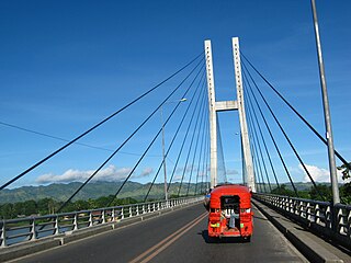
| Description | @ D. Macapagal Bridge | ||
| Date | Taken on 9 July 2010 | ||
| Source | https://web.archive.org/web/20161014231453/http://www.panoramio.com/photo/37763437 | ||
| Author | kbraner | ||
| Permission (Reusing this file) |
This file is licensed under the Creative Commons Attribution-Share Alike 3.0 Unported license. Attribution: kbraner
|
||
| Tags (from Panoramio photo page) | Butuan City |
| Camera location | | View this and other nearby images on: OpenStreetMap |
|---|
File history
Click on a date/time to view the file as it appeared at that time.
| Date/Time | Thumbnail | Dimensions | User | Comment | |
|---|---|---|---|---|---|
| current | 09:46, 16 December 2016 | | 3,648 × 2,736 (2.3 MB) | Panoramio upload bot | == {{int:filedesc}} == {{Information |description=@ D. Macapagal Bridge |date={{Taken on|2010-07-09}} |source=http://www.panoramio.com/photo/37763437 |author=[http://www.panoramio.com/user/2398128?with_photo_id=37763437 kbraner] |permission={{cc-by-sa-... |
File usage
The following pages on the English Wikipedia use this file (pages on other projects are not listed):
Global file usage
The following other wikis use this file:
- Usage on fr.wikipedia.org
- Usage on simple.wikipedia.org
- Usage on th.wikipedia.org
- Usage on tl.wikipedia.org
- Usage on zh.wikipedia.org