

Size of this preview: 800 × 600 pixels. Other resolutions: 320 × 240 pixels | 640 × 480 pixels | 1,024 × 768 pixels | 1,280 × 960 pixels | 2,560 × 1,920 pixels | 4,608 × 3,456 pixels.
Original file (4,608 × 3,456 pixels, file size: 6.37 MB, MIME type: image/jpeg)
| This is a file from the Wikimedia Commons. Information from its description page there is shown below. Commons is a freely licensed media file repository. You can help. |
Summary
| Description |
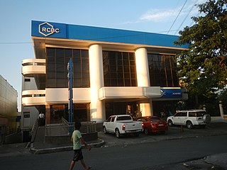
Avida Towers Alabang Honda Cars Alabang (Ayala Alabang, Muntinlupa City) City of Muntinlupa (Ayala Alabang) LPMDEO Boundary (Almanza Dos, Las Piñas City) Metropolitan Bank and Trust Corporation FAST Logistics - JAC Motors Alabang (Ayala Alabang, Muntinlupa City) JAC Motors CM Estrellita Center (Ayala Alabang, Muntinlupa City) Tierra Nueva Village (Ayala Alabang, Muntinlupa City) Alabang Medical Center (Ayala Alabang, Muntinlupa City) Abenson (Ayala Alabang, Muntinlupa City) RCBC Rizal Commercial Banking Corporation Richville Corporate Tower (Ayala Alabang, Muntinlupa City) Alabang Hills Village (Ayala Alabang, Muntinlupa City) Barangay Barangay 14°24'35"N 121°1'20"E Ayala Alabang City of Muntinlupa
Alabang–Zapote Road bounded by Almanza Dos 14°23'22"N 121°0'30"E Las Piñas (Note: Judge Florentino Floro, the owner, to repeat, Donor Florentino Floro of all these photos hereby donate gratuitously, freely and unconditionally Judge Floro all these photos to and for Wikimedia Commons, exclusively, for public use of the public domain, and again without any condition whatsoever). |
| Date | |
| Source | Own work |
| Author | Judgefloro |
| Camera location | | View this and other nearby images on: OpenStreetMap |
|---|
Barangay 14°24'35"N 121°1'20"E
Licensing
I, the copyright holder of this work, hereby publish it under the following license:
| This file is made available under the Creative Commons CC0 1.0 Universal Public Domain Dedication. | |
| The person who associated a work with this deed has dedicated the work to the public domain by waiving all of their rights to the work worldwide under copyright law, including all related and neighboring rights, to the extent allowed by law. You can copy, modify, distribute and perform the work, even for commercial purposes, all without asking permission.
|
File history
Click on a date/time to view the file as it appeared at that time.
| Date/Time | Thumbnail | Dimensions | User | Comment | |
|---|---|---|---|---|---|
| current | 06:50, 24 September 2018 | | 4,608 × 3,456 (6.37 MB) | Judgefloro | User created page with UploadWizard |
File usage
The following pages on the English Wikipedia use this file (pages on other projects are not listed):