

Size of this preview: 800 × 320 pixels. Other resolutions: 320 × 128 pixels | 640 × 256 pixels | 1,024 × 410 pixels | 1,280 × 513 pixels | 2,687 × 1,076 pixels.
Original file (2,687 × 1,076 pixels, file size: 247 KB, MIME type: image/png)
| This is a file from the Wikimedia Commons. Information from its description page there is shown below. Commons is a freely licensed media file repository. You can help. |
Summary
| Description |
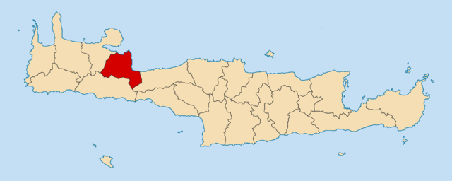
Locator map for Apokoronas municipality in Greek region Crete (2011)
|
| Date | |
| Source | Own work |
| Author | Pitichinaccio |
Licensing
I, the copyright holder of this work, hereby publish it under the following licenses:

|
Permission is granted to copy, distribute and/or modify this document under the terms of the GNU Free Documentation License, Version 1.2 or any later version published by the Free Software Foundation; with no Invariant Sections, no Front-Cover Texts, and no Back-Cover Texts. A copy of the license is included in the section entitled GNU Free Documentation License. |
This file is licensed under the Creative Commons Attribution 3.0 Unported license.
- You are free:
- to share – to copy, distribute and transmit the work
- to remix – to adapt the work
- Under the following conditions:
- attribution – You must give appropriate credit, provide a link to the license, and indicate if changes were made. You may do so in any reasonable manner, but not in any way that suggests the licensor endorses you or your use.
You may select the license of your choice.
File history
Click on a date/time to view the file as it appeared at that time.
| Date/Time | Thumbnail | Dimensions | User | Comment | |
|---|---|---|---|---|---|
| current | 23:00, 22 January 2014 | 2,687 × 1,076 (247 KB) | Pitichinaccio | corr. border between Anogia and Mylopotamos | |
| 21:20, 14 January 2014 | 2,687 × 1,076 (247 KB) | Pitichinaccio | now ... | ||
| 21:17, 14 January 2014 | 2,687 × 1,076 (247 KB) | Pitichinaccio | Corr.: Zoniana is part of Mylopotamos, not of Anogia | ||
| 22:06, 3 November 2010 | 1,200 × 481 (68 KB) | Pitichinaccio | == Summary == {{Information |Description={{en|1=Locator map for Apokoronas municipality in Greek region Crete (2011)}} {{de|1=Lage der Gemeinde Apokoronas in der griechischen Region Kreta (2011)}} |Source={{own}} |Author=[[User:Pitichinaccio|Pitichinaccio |
File usage
The following pages on the English Wikipedia use this file (pages on other projects are not listed):
Global file usage
The following other wikis use this file:
- Usage on ca.wikipedia.org
- Usage on de.wikipedia.org
- Usage on el.wikipedia.org
- Usage on es.wikipedia.org
- Usage on fi.wikipedia.org
- Usage on fr.wikipedia.org
- Georgioúpoli
- Kournás
- Embrosneros
- Vryses
- Vafés
- Apokóronas
- Vámos
- Kalyvès
- Stýlos
- Liste des dèmes de Grèce
- Así Goniá
- Modèle:Palette Dème d'Apokóronas
- Arméni (La Canée)
- Kryonerída (La Canée)
- Fres (La Canée)
- Kyriakoséllia
- Macherí
- Ramní (La Canée)
- Néo Chorió (La Canée)
- Fylakí (La Canée)
- Kástellos (La Canée)
- Kalamítsi Amygdáli
- Alíkambos
- Máza (La Canée)
- Chámbatha
- Nípos
- Melidóni (La Canée)
- Païdochóri
- Pemónia
- Tzitzifés
- Gavalochóri
- Káina
- Kalamítsi Alexándrou
- Kefalás (La Canée)
- Kókkino Chorió
- Likotinaréa
- Litsárda
- Pláka (La Canée)
- Xirostérni
View more global usage of this file.