
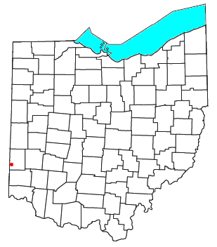

Fairhaven is an unincorporated community in eastern Israel Township, Preble County, Ohio, United States. It lies along State Route 177 at its intersection with Israel-Somers Road. Four Mile Creek, which feeds into Acton Lake in southern Preble County, runs on the western edge of Fairhaven. It is located 10½ miles (17 kilometers) southwest of Eaton, the county seat of Preble County.[1] The community is part of the Dayton Metropolitan Statistical Area. Fairhaven Church and Fairhaven Community Church are both located in Fairhaven along State Route 177. Fairhaven Community Church hosts a free annual Dinner Drama for the community. Fairhaven is home to the historic Bunker Hill house, a stop along the Underground Railroad.
YouTube Encyclopedic
-
1/3Views:9 637 3624 936453
-
Live PD: Most Viewed Moments from Streetsboro, OH | A&E
-
Akron | 2015 | Official Trailer [HD]
-
Discover the Regions East of Lake Ontario - Vacation Upstate New York
Transcription
History
Fairhaven was laid out and platted in 1832.[2] Fairhaven is a commendatory name for the scenic location of the original town site.[3] A post office was established at Fairhaven in 1833 and remained in operation until 1932.[4]
References
- ^ DeLorme. Ohio Atlas & Gazetteer. 5th ed. Yarmouth: DeLorme, 1999, p.64. ISBN 0-89933-233-1.
- ^ History of Preble County, Ohio, with illustrations and biographical sketches. H. Z. Williams & Bro. 1881. p. 238.
- ^ Overman, William Daniel (1958). Ohio Town Names. Akron, OH: Atlantic Press. p. 44.
- ^ "Preble County". Jim Forte Postal History. Archived from the original on December 22, 2015. Retrieved December 18, 2015.
Municipalities and communities of Preble County, Ohio, United States | ||
|---|---|---|
| City |  | |
| Villages | ||
| Townships | ||
| CDP | ||
| Unincorporated communities | ||
| Ghost towns | ||
| Footnotes | ‡This populated place also has portions in an adjacent county or counties | |
39°38′20″N 84°46′18″W / 39.63889°N 84.77167°W
| International | |
|---|---|
| National | |
This Preble County, Ohio state location article is a stub. You can help Wikipedia by expanding it. |