
Eyyübiye | |
|---|---|
District and municipality | |
 Balıklıgöl is located in the district | |
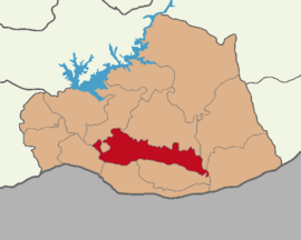 Map showing Eyyübiye District in Şanlıurfa Province | |
 Eyyübiye Location in Turkey  Eyyübiye Eyyübiye (Şanlıurfa) | |
| Coordinates: 37°07′58″N 38°47′55″E / 37.1328°N 38.7986°E | |
| Country | Turkey |
| Province | Şanlıurfa |
| Government | |
| • Mayor | Mehmet Kuş (AKP) |
| Area | 1,626 km2 (628 sq mi) |
| Population (2022)[1] | 391,795 |
| • Density | 240/km2 (620/sq mi) |
| Time zone | UTC+3 (TRT) |
| Area code | 0414 |
| Website | www |
Eyyübiye is a municipality and district of Şanlıurfa Province, Turkey.[2] Its area is 1,626 km2,[3] and its population is 391,795 (2022).[1] The district Eyyübiye was created at the 2013 reorganisation from part of the former central district of Şanlıurfa Province, along with the new districts Haliliye and Karaköprü.[4][5] It covers the central and southern part of the agglomeration of Şanlıurfa and the adjacent countryside. In the local elections of 31 March 2019, Mehmet Kuş (AKP) was elected mayor.[6] Mustafa Hamit Kıyıcı is the appointed district governor.[7]
Demography
A 2018 survey on first language conducted by the municipality showed that 56.8% of the district spoke Kurdish as their first language, followed by Arabic at 38.9% and Turkish at 4.3%.[8]
| Year | Pop. | ±% p.a. |
|---|---|---|
| 2013 | 360,509 | — |
| 2017 | 375,967 | +1.06% |
| 2022 | 391,795 | +0.83% |
| Source: TÜIK (2013-2022)[1] | ||
Composition
There are 163 neighbourhoods in Eyyübiye District:[9]
- 15 Temmuz
- Abdurrahmandede
- Açmalı
- Akabe
- Akçamesçit
- Akdilek
- Akmağara
- Akmeşhet
- Akören
- Akşemsettin
- Alkanlı
- Altın
- Altınbaşak
- Altıntepe
- Ambartepe
- Apalı
- Aşağıhemedan
- Aşağıkoçlu
- Aşağıyazıcı
- Asya
- Atlıkonak
- Ayrancı
- Bağış
- Bakırtaş
- Bakışlar
- Banarlı
- Başgök
- Başgöze
- Başören
- Batıkent
- Bayraklı
- Beşat
- Beyazyaprak
- Beykapısı
- Bıçakçılı
- Bildim
- Bozhöyük
- Buhara
- Bulduk
- Büyükdüzlük
- Büyükhan
- Büyükhancağız
- Büyükotluca
- Çalışkanlar
- Camikebir
- Çamurlu
- Dedeosman
- Dernek
- Dilimli
- Direkli
- Dolutepe
- Duruca
- Eyyubiye
- Eyyüpkent
- Eyyüpnebi
- Gelincik
- Göldere
- Göller
- Görenler
- Gözeller
- Gümüşkuşak
- Gümüşören
- Günbalı
- Güneş
- Güngören
- Güzelkuyu
- Hacıbayram
- Hacılar
- Haleplibahçe
- Hamzababa
- Hancığaz
- Hayatiharrani
- Hekimdede
- Horozköy
- İkizce
- Kadıkendi
- Kadıoğlu
- Kapköy
- Kaplanköy
- Karaali
- Karahisar
- Karakoyunlu
- Karaman
- Keberli
- Keçikıran
- Kendirci
- Keserdede
- Keskin
- Kınalı
- Kırçiçeği
- Kırkmağara
- Kızılkuyu
- Koçören
- Köprülük
- Kubacık
- Küçük Çamurlu
- Küçükdüzlük
- Küçükhan
- Külünçe
- Küpeli
- Kurtuluş
- Kurucuk
- Mance
- Mihraplı
- Muradiye
- Mutlukaya
- Nadire
- Olgunlar
- Olukyanı
- Onikiler
- Örenli
- Ortahemedan
- Osmanlı
- Ovabeyli
- Ozanlar
- Özlü
- Payamlı
- Pınarbaşı
- Ruha
- Sağlık
- Şahinalan
- Şahinler
- Seksenören
- Selçuklu
- Selman
- Şıhmaksut
- Süleymanşah
- Sultantepe
- Tarlabaşı
- Taşlıca
- Tekyamaç
- Tepe
- Topdağı
- Türkmeydanı
- Turluk
- Tuzluca
- Uğurlu
- Ulak
- Ulucanlar
- Uluköy
- Umuroba
- Üzerlik
- Vergili
- Yağmurlu
- Yakubiye
- Yamaçaltı
- Yanıkçöğür
- Yardımcı
- Yaşar
- Yaykılıç
- Yediyol
- Yeni
- Yenice
- Yeşildere
- Yolbaşı
- Yolbilir
- Yukarı Koçlu
- Yukarıçaykuyu
- Yukarıhemedan
- Yukarıyazıcı
- Yusuf
- Yusufpaşa
- Zeynepköy
References
- ^ a b c "Population Of SRE-1, SRE-2, Provinces and Districts". TÜIK. Retrieved 10 October 2023.
- ^ Büyükşehir İlçe Belediyesi, Turkey Civil Administration Departments Inventory. Retrieved 19 September 2023.
- ^ "İl ve İlçe Yüz ölçümleri". General Directorate of Mapping. Retrieved 19 September 2023.
- ^ "Law No. 6360". Official Gazette (in Turkish). 6 December 2012.
- ^ "İl İdaresi ve Mülki Bölümler Şube Müdürlüğü İstatistikleri - İl ve İlçe Kuruluş Tarihleri" (PDF) (in Turkish). p. 76. Retrieved 10 October 2023.
- ^ "Şanlıurfa Eyyübiye Seçim Sonuçları - 31 Mart 2019 Yerel Seçimleri". www.sabah.com.tr. Retrieved 2020-03-29.
- ^ "Özgeçmiş". Eyyübiye Kaymakamlığı. Retrieved 10 October 2023.
- ^ "Eyyübiye'de Ne Kadar Kürt, Arap Vatandaş Yaşıyor?" (in Turkish). 26 December 2018. Retrieved 19 October 2022.
- ^ Mahalle, Turkey Civil Administration Departments Inventory. Retrieved 19 September 2023.
Eyyübiye in Şanlıurfa Province of Turkey | |||||||||||||||||||||||||||
|---|---|---|---|---|---|---|---|---|---|---|---|---|---|---|---|---|---|---|---|---|---|---|---|---|---|---|---|
| Districts |   | ||||||||||||||||||||||||||
|
Metropolitan municipalities are bolded. | |||||||||||||||||||||||||||