
| Eungella Hinterland Queensland | |||||||||||||||
|---|---|---|---|---|---|---|---|---|---|---|---|---|---|---|---|
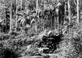 Eungella Range, circa 1931 | |||||||||||||||
 Eungella Hinterland | |||||||||||||||
| Coordinates | 20°55′21″S 148°25′21″E / 20.9225°S 148.4225°E | ||||||||||||||
| Population | 4 (SAL 2021)[1] | ||||||||||||||
| Postcode(s) | 4741 | ||||||||||||||
| Area | 1,306.2 km2 (504.3 sq mi) | ||||||||||||||
| Time zone | AEST (UTC+10:00) | ||||||||||||||
| Location | |||||||||||||||
| LGA(s) | Mackay Region | ||||||||||||||
| State electorate(s) | |||||||||||||||
| Federal division(s) | |||||||||||||||
| |||||||||||||||
Eungella Hinterland is a rural locality in the Mackay Region, Queensland, Australia.[2] In the 2021 census, Eungella Hinterland had a population of 4 people.[3]
Geography
Eungella Hinterland is mountainous undeveloped terrain with individual peaks including (from north to south):[4]
- Mount Macartney (20°49′52″S 148°33′18″E / 20.8310°S 148.5550°E) 972 metres (3,189 ft)[5][6]
- Mount Cauley (20°54′36″S 148°20′01″E / 20.9099°S 148.3336°E) 625 metres (2,051 ft)[5][7]
- Mount Margaret (20°54′48″S 148°38′24″E / 20.9134°S 148.6399°E) 664 metres (2,178 ft)[5][8]
- Mount Lilian (20°54′49″S 148°40′50″E / 20.9137°S 148.6805°E) 569 metres (1,867 ft)[5][9]
- Mount Consuelo (20°55′04″S 148°40′05″E / 20.9177°S 148.6681°E) 377 metres (1,237 ft)[5][10]
- Mount Omega (21°00′57″S 148°40′24″E / 21.0157°S 148.6732°E) 815 metres (2,674 ft)[5][11]
- Mount William (21°01′00″S 148°35′55″E / 21.0166°S 148.5985°E) 1,259 metres (4,131 ft)[5][12]
- Mount David (21°01′02″S 148°37′34″E / 21.0172°S 148.6262°E) 1,249 metres (4,098 ft)[5][13]
- Mount Dalrymple (21°01′41″S 148°38′26″E / 21.0280°S 148.6406°E) 1,260 metres (4,130 ft)[5][14]
The eastern half of the locality is a protected area, including the Macartney State Forest, Eungella National Park, Pelion Forest Reserve and Pelion State Forest.[4]
History
The locality takes its name from the town and pastoral run name, which in turn was named in July 1876 by explorer Ernest Favenc in July 1876. It is believed to be an Aboriginal word, meaning land of cloud.[2][15]
Demographics
In the 2016 census, Eungella Hinterland had a population of 3 people.[16]
In the 2021 census, Eungella Hinterland had a population of 4 people.[3]
Education
There are no schools in Eungella Hinterland. The nearest government primary schools are Eungella State School in Eungella to the south and Pindi Pindi State School in Pindi Pindi to the north-east. The nearest government secondary school is Calen District State College in neighbouring Calen to the north-east. However, due to the size of the locality, some areas may be too distant to attend these schools with distance education and boarding schools being the other options.[4]
References
- ^ Australian Bureau of Statistics (28 June 2022). "Eungella Hinterland (suburb and locality)". Australian Census 2021 QuickStats. Retrieved 28 June 2022.
- ^ a b "Eungella Hinterland – locality in Mackay Region (entry 46868)". Queensland Place Names. Queensland Government. Retrieved 25 April 2019.
- ^ a b Australian Bureau of Statistics (28 June 2022). "Eungella Hinterland (SAL)". 2021 Census QuickStats. Retrieved 28 February 2023.
- ^ a b c "Queensland Globe". State of Queensland. Retrieved 7 September 2023.
- ^ a b c d e f g h i "Mountain peaks and capes - Queensland". Queensland Open Data. Queensland Government. 12 November 2020. Archived from the original on 25 November 2020. Retrieved 25 November 2020.
- ^ "Mount Macartney – mountain in Mackay Region (entry 20371)". Queensland Place Names. Queensland Government. Retrieved 25 November 2020.
- ^ "Mount Cauley – mountain in Mackay Region (entry 6657)". Queensland Place Names. Queensland Government. Retrieved 25 November 2020.
- ^ "Mount Margaret – mountain in Mackay Region (entry 20960)". Queensland Place Names. Queensland Government. Retrieved 25 November 2020.
- ^ "Mount Lilian – mountain in Mackay Region (entry 19307)". Queensland Place Names. Queensland Government. Retrieved 25 November 2020.
- ^ "Mount Consuelo – mountain in Mackay Region (entry 7991)". Queensland Place Names. Queensland Government. Retrieved 25 November 2020.
- ^ "Mount Omega – mountain in Mackay Region (entry 25328)". Queensland Place Names. Queensland Government. Retrieved 25 November 2020.
- ^ "Mount William – mountain in Mackay Region (entry 37519)". Queensland Place Names. Queensland Government. Retrieved 25 November 2020.
- ^ "Mount David – mountain in Mackay Region (entry 9421)". Queensland Place Names. Queensland Government. Retrieved 25 November 2020.
- ^ "Mount Dalrymple – mountain in Mackay Region (entry 9252)". Queensland Place Names. Queensland Government. Retrieved 25 November 2020.
- ^ "Eungella – town in Mackay Region (entry 11952)". Queensland Place Names. Queensland Government. Retrieved 25 April 2019.
- ^ Australian Bureau of Statistics (27 June 2017). "Eungella Hinterland (SSC)". 2016 Census QuickStats. Retrieved 20 October 2018.