
Ergene | |
|---|---|
District and municipality | |
 Map showing Ergene District in Tekirdağ Province | |
 Ergene Location in Turkey  Ergene Ergene (Marmara) | |
| Coordinates: 41°11′17″N 27°46′05″E / 41.18806°N 27.76806°E | |
| Country | Turkey |
| Province | Tekirdağ |
| Government | |
| • Mayor | Rasim Yüksel (CHP) |
| Area | 418 km2 (161 sq mi) |
| Population (2022)[1] | 67,038 |
| • Density | 160/km2 (420/sq mi) |
| Time zone | TRT (UTC+3) |
| Postal code | 59930 |
| Area code | 0282 |
| Website | www |
Ergene is a municipality and district of Tekirdağ Province, Turkey.[2] Its area is 418 km2,[3] and its population is 67,038 (2022).[1] The district and municipality Ergene was created at the 2013 Turkish local government reorganisation from part of the district of Çorlu, including the former municipalities Marmaracık, Ulaş, Misinli and Velimeşe.[4][5] The name Ergene refers to the river Ergene, a tributary of the Maritsa (Meriç).
Composition
There are 17 neighbourhoods in Ergene District:[6]
- Ahimehmet
- Bakırca
- Cumhuriyet
- Esenler
- İğneler
- Karamehmet
- Kırkgöz
- Marmaracık
- Misinli
- Paşaköy
- Pınarbaşı
- Sağlık
- Ulaş
- Vakıflar
- Velimeşe
- Yeşiltepe
- Yulaflı
References
- ^ a b "Address-based population registration system (ADNKS) results dated 31 December 2022, Favorite Reports" (XLS). TÜİK. Retrieved 19 September 2023.
- ^ Büyükşehir İlçe Belediyesi, Turkey Civil Administration Departments Inventory. Retrieved 19 September 2023.
- ^ "İl ve İlçe Yüz ölçümleri". General Directorate of Mapping. Retrieved 19 September 2023.
- ^ "İl İdaresi ve Mülki Bölümler Şube Müdürlüğü İstatistikleri - İl ve İlçe Kuruluş Tarihleri" (PDF) (in Turkish). p. 78. Retrieved 28 September 2023.
- ^ "Law No. 6360". Official Gazette (in Turkish). 6 December 2012.
- ^ Mahalle, Turkey Civil Administration Departments Inventory. Retrieved 19 September 2023.
Ergene, Tekirdağ in Tekirdağ Province of Turkey | |||||||||||||||||||||||||||
|---|---|---|---|---|---|---|---|---|---|---|---|---|---|---|---|---|---|---|---|---|---|---|---|---|---|---|---|
| Districts |  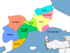 | ||||||||||||||||||||||||||
|
Metropolitan municipalities are bolded. | |||||||||||||||||||||||||||