

The Epynt Way is a long-distance path created by the Ministry of Defence in 2004 around the perimeter of its 'Sennybridge Training Area (SENTA)' and artillery range on Mynydd Epynt in Powys, Wales. There is, understandably, virtually no public access across the land used by the MoD, pre-existing public rights of way and public roads having been closed, with only one or two exceptions. The establishment of the Epynt Way, section by section in recent years has gone some way to compensating for that reduction in public access across the area.
YouTube Encyclopedic
-
1/3Views:541348323
-
Pontarddulais Classic Car Show, Pembrey Country Park, July 2nd 2017
-
Llanelli Ramblers Kidwelly Walk
-
Llanelli Ramblers Carmel Woods Walk In The Snow.avi
Transcription
Route

The circular route which is described as a permissive bridleway is 75 km / 49 mi in total length and available to walkers, cyclists and horseriders. It travels around the edge of the plateau, and keeps clear of MOD firing ranges. Nearest towns are Brecon to the south and Llandovery to the west, with Llangammarch Wells to the north. A leaflet and map can be downloaded from the Defence Estates website. It is covered by Ordnance Survey Explorer maps 187 'Llandovery' and 188 'Builth Wells'.[1][2] Further information about the Epynt Way is displayed at The Epynt Centre, an interpretive centre beside the B4519 road north of Upper Chapel which was refurbished in 2009. Being in an upland area it contains steep and boggy sections that require extra care. Poor weather also demands extra awareness of route finding, especially in mist and fog as well as precipitation such as rain and snow. The route is waymarked throughout with 1.2 metre posts and finger posts at junctions with external paths, but local large-scale maps such as the OS Explorer map series should be used for information.
References
- ^ "Epynt Way". Archived from the original on 17 February 2009. Retrieved 7 January 2009.
- ^ "Long Distance Walkers Association".
External links
- MOD leaflet on short walks near Sennybridge
- General guidance about access to MOD training areas
- Detailed advice on access with maps of the route
Transport in Powys | |||||||
|---|---|---|---|---|---|---|---|
| Road | 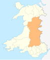 | ||||||
| Footpaths | |||||||
| Cycle routes | |||||||
| Railway stations |
| ||||||
52°07′01″N 3°30′00″W / 52.117°N 3.500°W
This article about a location in Wales is a stub. You can help Wikipedia by expanding it. |