
Emohua | |
|---|---|
 Emohua Location in Nigeria | |
| Coordinates: 4°53′0″N 6°52′0″E / 4.88333°N 6.86667°E | |
| Country | Nigeria |
| State | Rivers State |
| Date created | 1991 |
| Seat | Emohua Town |
| Government | |
| • Local Government Chairman | Lloyd Chidi (PDP) |
| • Deputy Local Government Chairman | Nyeche Edna (PDP) |
| • Local Government Council | Ward 1: Promise Alison (PDP) Ward 2: Gift Enyi (PDP) Ward 3: Wodu Achinike (PDP) Ward 4: Obichukwu Chinda (PDP) Ward 5: Henry Eferebo (PDP) Ward 6: Love Nyenke (PDP) Ward 7: Emenike Wokoma (PDP) Ward 8: Bright Green (PDP) Ward 9: Sylvanus Ekwueme Dike (PDP) Ward 10: Clement Dimkpa (PDP) Ward 11: Beauty Ogbuji (PDP) Ward 12: Kingsley Oba (PDP) Ward 13: Andrew Uchendu (PDP) Ward 14: Success Okporo (PDP) |
| Time zone | UTC+1 (WAT) |
 | |
Emohua is an oil rich Local Government Area in Rivers State, Nigeria.[1] Its headquarters are in the town of Emohua. Emohua LGA is made up of so many towns and villages[2] which includes; Omudioga, Egbeda, Ubimini, Elele-Alimini, Rumuji, Emohua, Ibaa, Obelle, Itu, Ndele, Odegu, and so many others.
Emohua consists of fourteen political wards.[3] Emohua LGA has fertile land that favours primary production such as farming. The presence of water bodies gives room for activities of primary production such as sand dredging and fishing. Furthermore, the presence, popularity and proximity of its markets favour secondary production such as oil milling, cassava processing rice processing, yam processing, meat processing (abattoir) and wood milling and poultry.[citation needed]
It has an area of 831 km2 (321 sq mi) and a population of 201,901 at the 2006 census.[citation needed]
The postal code of the area is 511.[4]
References
- ^ "Cultists behead disbanded vigilante leader in Rivers, severe body". The Guardian Nigeria News - Nigeria and World News. 2021-07-28. Retrieved 2022-03-04.
- ^ "Emohua Local Government Area". www.manpower.com.ng. Retrieved 2023-04-28.
- ^ "Wards in Emohua Local Government Area". www.manpower.com.ng. Retrieved 2023-04-28.
- ^ "Post Offices- with map of LGA". NIPOST. Archived from the original on 2009-10-07. Retrieved 2009-10-20.
| LGAs | 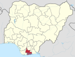 | |
|---|---|---|
| International | |
|---|---|
| National | |
This article about a location in Rivers State, Nigeria is a stub. You can help Wikipedia by expanding it. |