
31°41′47″N 34°57′26″E / 31.69639°N 34.95722°E
 Western gate | |
Khirbet Qeiyafa | |
| Alternative name | Elah fortress |
|---|---|
| Coordinates | 31°41′47″N 34°57′27″E / 31.6963°N 34.9575°E |
| Grid position | 146/122 PAL |
| History | |
| Founded | 10th-century BCE |
| Periods | Iron Age, Hellenistic |
| Site notes | |
| Excavation dates | 2007 – |
| Archaeologists | Yosef Garfinkel, Saar Ganor |
| Condition | ruin |
| Website | qeiyafa |
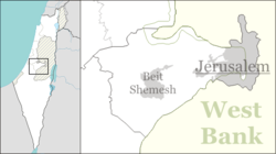
Khirbet Qeiyafa (Arabic: خربة قيافة), also known as Elah Fortress and in Hebrew as Horbat Qayafa (Hebrew: חורבת קייאפה), is the site of an ancient fortress city overlooking the Elah Valley and dated to the first half of the 10th century BCE.[1][2] The ruins of the fortress were uncovered in 2007,[3] near the Israeli city of Beit Shemesh, 30 km (20 mi) from Jerusalem.[4] It covers nearly 2.3 ha (6 acres) and is encircled by a 700-meter-long (2,300 ft) city wall constructed of field stones, some weighing up to eight tons.[5] Excavations at site continued in subsequent years.[6] A number of archaeologists, mainly the two excavators, Yosef Garfinkel and Saar Ganor, have claimed that it might be one of two biblical cities, either Sha'arayim, whose name they interpret as "Two Gates", because of the two gates discovered on the site, or Neta'im;[7] and that the large structure at the center is an administrative building dating to the reign of King David, where he might have lodged at some point.[8][9] This is based on their conclusions that the site dates to the early Iron IIA, ca. 1025–975 BCE,[10] a range which includes the biblical date for the biblical Kingdom of David. Others suggest it might represent either a North Israelite, Philistine, or Canaanite fortress, a claim rejected by the archaeological team that excavated the site.[11] The team's conclusion that Khirbet Qeiyafa was a fortress of King David has been criticised by some scholars.[10] Garfinkel (2017) changed the chronology of Khirbet Qeiyafa to ca. 1000–975 BCE.[12][13]
YouTube Encyclopedic
-
1/5Views:8 7309 7178 94912 096849
-
Khirbet Qeiyafa - A Fortified City from the Kingdom of Judah
-
Bible and Archaeology Discussions Israel Finkelstein & Thomas Römer: Episode 1 - Khirbet Qeiyafa
-
Khirbet Qeiyafa: Witness to David's Kingdom | Passage 10
-
Khirbet Qeiyafa - A Fortified City of the Kingdom of Judah (with credits)
-
Unveiling the Secrets of Khirbet Qeiyafa Israel #israel
Transcription
Settlement periods
There is a continued debate on the period based on ceramic finds and radiocarbon results. Pottery points to either Late Iron Age I or Iron Age IIa.[14][15][16][17]
The site was resettled during the late Persian and early Hellenistic periods, until it became deserted once again around 260 BCE.[18] The top layer of the fortress shows that the fortifications were renewed in the Hellenistic period.[19]
In the Byzantine period, a luxurious land villa was built on top of the Iron Age II palace and cut the older structure in two.[20]
Names

The meaning of the Arabic name of the site, Khirbet Qeiyafa, is uncertain. Scholars suggest it may mean "the place with a wide view."[21] In 1881, Palmer thought that Kh. Kîâfa meant "the ruin of tracking foot-steps".[22]
The modern Hebrew name, מבצר האלה, or the Elah Fortress was suggested by Foundation Stone directors David Willner and Barnea Levi Selavan at a meeting with Garfinkel and Ganor in early 2008. Garfinkel accepted the idea and excavation t-shirts with that name were produced for the 2008 and 2009 seasons. The name derives from the location of the site on the northern bank of Nahal Elah, one of six brooks that flow from the Judean mountains to the coastal plain.[21]
Geography


The Elah Fortress lies just inside a north-south ridge of hills separating Philistia and Gath to the west from Judea to the east. The ridge also includes the site currently identified as Tel Azekah.[19] Past this ridge is a series of connecting valleys between two parallel groups of hills. Tel Sokho lies on the southern ridge with Tel Adullam behind it. The Elah Fortress is situated on the northern ridge, overlooking several valleys with a clear view of the Judean Mountains. Behind it to the northeast is Tel Yarmut. From the topography, archaeologists believe this was the location of the cities of Adullam, Sokho, Azekah and Yarmut cited in Joshua 15:35.[19] These valleys formed the border between Philistia and Judea.
Site and excavation history
The site of Khirbet Qeiyafa was surveyed in the 1860s by Victor Guérin who reported the presence of a village on the hilltop.[23] In 1875, British surveyors noted only stone heaps at Kh. Kiafa.[24] In 1932, Dimitri Baramki, reported the site to hold a 35 square metres (380 sq ft) watchtower associated with Khirbet Quleidiya (Horvat Qolad), 200 metres (660 ft) east.[21] The site was mostly neglected in the 20th century and not mentioned by leading scholars.[3] Yehuda Dagan conducted more intense surveys in the 1990s and documented the visible remains.[21] The site raised curiosity in 2005 when Saar Ganor discovered impressive Iron Age structures under the remnants.[3]
Excavations at Khirbet Qeiyafa began in 2007, directed by Yosef Garfinkel of the Hebrew University and Saar Ganor of the Israel Antiquities Authority, and continued in 2008.[25] Nearly 600 square metres (6,500 sq ft) of an Iron Age IIA city were unearthed. Based on pottery styles and nighteen burned olive pits tested for carbon-14 at Oxford University, Garfinkel and Ganor have dated the site to 1050–970 BCE,[3][26] although Israel Finkelstein contends evidence points to habitation between 1050 and 915 BCE.[27]
The initial excavation by Ganor and Garfinkel took place from August 12 to 26, 2007 on behalf of the Hebrew University of Jerusalem Institute of Archaeology. In their preliminary report at the annual ASOR conference on November 15, they presented a theory that the site was the Biblical Azekah, which until then had been exclusively associated with Tell Zakariya.[28] In 2015 a plan to build a neighborhood on the site was cancelled, to enable the archaeological dig to go forward.[29]
In 2017, Garfinkel claimed that Joseph Silver, the chief funder of the excavation, while walking around the exterior of the city wall in the SE part with Garfinkel and Ganor, identified features in the city wall similar to the features found by Garfinkel and Ganor in the western gate, and stated that it was a second gate.[30] This claim was challenged. In November, with volunteers from the Bnai Akiva youth organization, the area was cleared and an excavation and reconstruction organized by Garfinkel and Ganor "yielded" the existence of that second gate. It was thought that the identification provided a solid basis for identifying the site as biblical Sha'arayim ("two gates" in Hebrew).[3]
Also in 2017, citing publications from 2012 and 2015, Garfinkel lowered the chronology of Khirbet Qeiyafa (Stratum IV) to ca. 1000–975 BCE,[12] considering the site as belonging to Early Iron Age IIA (ca. 1000–930 BCE).[31]
Debate on United Monarchy

Discoveries at Khirbet Qeiyafa are significant to the debate on archaeological evidence and historicity of the biblical account of the United Monarchy at the beginning of Iron Age II.[32] Nadav Na’aman and Ido Koch held that the ruins were Canaanite, based on strong similarities with the nearby Canaanite excavations at Beit Shemesh. Finkelstein and Alexander Fantalkin, maintained that the site shows affiliations with a North Israelite entity saying that "There is no evidence for arguing that Jerusalem, Hebron and Khirbet Qeiyafa were the main centres of 10th century Judah. ... Between the two possibilities for the territorial afiliation of Khirbet Qeiyafa with a highlands polity—Judah or an early north Israelite entity—the latter seems to us the more attractive one.[33] In 2015 Finkelstein and Piasetsky specifically criticised the previous statistical treatment of radio-carbon dating at Khirbet Qeiyafa and also whether it was prudent to ignore results from neighboring sites.[34]
Archeologists, Yosef Garfinkel, Mitka R. Golub, Haggai Misgav, and Saar Ganor rejected in 2019 the possibility that Khirbet Qeiyafa could be associated with the Philistines. They wrote: "The idea that in this chronological phase the knowledge of writing should be associated with the Philistine city state of Gath can now be rejected. While the various sites in Judah present an impressive assemblage of inscriptions, all we have from the intensive twenty-year excavations at Tell es-Safi (Gath) is one poorly executed inscription of seven letters. Indeed, the city state of Gath, like all other Philistine city states (Ashkelon, Ashdod, Eqron) and all the Canaanite Late Bronze Age city states, managed their administration without the use of writing. On the other hand, the rise of a nation state required the intensification of social, administrative and economic networks and increased the need for communication".[35]
Identification
In 2010, Gershon Galil of the University of Haifa identified Khirbet Qeiyafa as the "Neta'im" of 1 Chronicles 4:23, due to its proximity to Khirbet Ğudrayathe (biblical Gederah). The inhabitants of both cities were said to be "potters" and "in the King's service", a description that is consistent with the archeological discoveries at that site.[36]
Yehuda Dagan of the Israel Antiquities Authority also disagrees with the identification as Sha'arayim. Dagan believes the ancient Philistine retreat route, after their defeat in the battle at the Valley of Elah (1 Samuel 17:52), more likely identifies Sha'arayim with the remains of Khirbet esh-Shari'a. Dagan proposes that Khirbet Qeiyafa be identified with biblical Adithaim (Joshua 15:36).[21] Nadav Na'aman of Tel Aviv University doubts that Sha'arayim means "two gates" at all, citing multiple scholarly opinions that the suffix -ayim in ancient place names is not the dual suffix used for ordinary words.[37]

The fortifications at Khirbet Qeiyafa predate those of contemporary Lachish, Beersheba, Arad, and Timnah. All these sites have yielded pottery dated to early Iron Age II. The parallel valley to the north, mentioned in Samuel I, runs from the Philistine city of Ekron to Tel Beit Shemesh. The city gate of the Elah Fortress faces west with a path down to the road leading to the sea, and was thus named "Gath Gate" or "Sea Gate." The 23-dunam (5.7-acre) site is surrounded by a casement wall and fortifications.[38]
Garfinkel suggests that it was a Judean city with 500–600 inhabitants during the reign of David and Solomon.[38][39][40] Based on pottery finds at Qeiyafa and Gath, archaeologists believe the sites belonged to two distinct ethnic groups. "The finds have not yet established who the residents were," says Aren Maeir, a Bar Ilan University archaeologist digging at Gath. "It will become more clear if, for example, evidence of the local diet is found. Excavations have shown that Philistines ate dogs and pigs, while Israelites did not. The nature of the ceramic shards found at the site suggest residents might have been neither Israelites nor Philistines but members of a third, forgotten people."[41] Evidence that the city was not Philistine comes from the private houses that abut the city wall, an arrangement that was not used in Philistine cities.[42] There is also evidence of equipment for baking flat bread and hundreds of bones from goats, cattle, sheep, and fish. Significantly, no pig bones have been uncovered, suggesting that the city was not Philistine or Canaanite.[42][43] Nadav Na'aman of Tel Aviv University nevertheless associates it with Philistine Gath, citing the necessity for further excavations as well as evidence from Bet Shemesh whose inhabitants also avoided eating pork, yet were associated with Ekron.[44] Na'aman proposed identification with the Philistine city of Gob,[44] whereas Garfinkel wrote that the site may actually point to the biblical Azekah, owing to its proximity to Socho and the valley of Elah that separated the two sites.[45]
Yigal Levin has proposed that the ma'gal (מעגל) or "circular camp" of the Israelites which is mentioned in the story of David and Goliath (1 Samuel 17:20) was described this way because it fitted the circular shape of the nearby Khirbet Qeiyafa.[46] Levin argues that the story of David and Goliath is set decades before Khirbet Qeiyafa was built and so the reference to Israel's encampment at the ma'gal probably does "not represent any particular historical event at all". But when the story was composed centuries later, the round structure of Khirbet Qeiyafa "would still have been visible and known to the author of 1 Samuel 17", who "guessed its function, and worked it into his story".[46] Garfinkel and his colleagues have suggested that the identification with the ma'gal is unconvincing as the term is used to refer to a military camp/outpost, whereas Khirbet Qeiyafa was a fortified city.[47]
Benyamin Saas, Professor of Archaeology at Tel Aviv university,[48] analyzed the dating, ethnic and political affiliation of Khirbet Qeiyafa as well as the language of the ostracon. "A dating in the Iron I–II transition, the mid 10th century, assuming the alphabet has just begun its move out of Philistia then could just make a Jerusalem link and Judahite Hebrew language possible for the ostracon. On such a background Qeiyafa may even be considered Davidic. With the oval plan of its casemate wall crowning a summit, Qeiyafa could be assumed to emulate Jerusalem." Saas concludes.[49]
Archaeological finds

General outline
The site consists of a lower city of about 10 hectares and an upper city of about 3 hectares (7.4 acres) surrounded by a massive defensive wall ranging from 2–4 metres (6 ft 7 in – 13 ft 1 in) tall. The walls are built in the same manner as the walls of Hazor and Gezer, formed by a casemate (a pair of walls with a chamber in between).[42]
At the center of the upper city is a large rectangular enclosure with spacious rooms on the south, equivalent to similar enclosures found at royal cities such as Samaria, Lachish, and Ramat Rachel.
On the southern slope, outside the city, there are Iron Age rock-cut tombs.
The site, according to Garfinkel, has "a town plan characteristic of the Kingdom of Judah that is also known from other sites, e.g., Beit Shemesh, Tell en-Nasbeh, Tell Beit Mirsim and Beersheba. A casemate wall was built at all of these sites and the city’s houses next to it incorporated the casemates as one of the dwelling's rooms. This model is not known from any Canaanite, Philistine or Kingdom of Israel site."[50]
The site is massively fortified, "including the use of stones that weigh up to eight tons apiece."[50]
Marked jar handles
"500 jar handles bearing a single finger print, or sometimes two or three, were found. Marking jar handles is characteristic of the Kingdom of Judah and it seems this practice has already begun in the early Iron Age IIA."[50]
Excavation areas
Area "A" extended 5×5 metres and consists of two major layers: Hellenistic above, and Iron Age II below.[51]
Area "B" contains four squares, about 2.5 metres deep from top-soil to bedrock, and also features both Hellenistic and Iron Age layers.[51] Surveys on the surface have also revealed sherds from the early and middle Bronze Ages, as well as from the Persian, Roman, Byzantine, early Islamic, Mameluke and Ottoman periods.[21]

The Hellenistic/upper portion of the wall was built with small rocks atop the Iron-II lower portion, consisting of big boulders in a casemate design. Part of a structure identified as a city gate was uncovered, and some of the rocks where the wall meets this gate are estimated to weigh 3 to 5 tons.[51] The lower phase was built of especially large stones, 1–3 meters long, and the heaviest of them weigh 3–5 tons. Atop these stones is a thin wall, c. 1.5 meters thick; small and medium size fieldstones were used in its construction. These two fortification phases rise to a height of 2–3 meters and standout at a distance, evidence of the great effort that was invested in fortifying the place.[51]
ʾIšbaʿal inscription
In 2012 an inscription in Canaanite alphabetic script was found on the shoulder of a ceramic jar. The inscription read "ʾIšbaʿal [/Ishbaal/Eshbaal] son of Beda" and was dated to the late 11th or 10th century BCE (Iron Age IIA).[52][53][54][55]
Khirbet Qeiyafa ostracon

Shrines
Rooms used for cultic purposes
In May 2012 archeologists announced the discovery of three large rooms that were likely used as cultic shrines. While the Canaanites and Philistine practiced their cults in separate temples and shrines, they did not have separate rooms within the buildings dedicated only to religious rituals. This may suggest that the rooms did not belong to these two cultures. According to Garfinkel the decorations of cultic rooms lack any human figurines. He suggested "that the population of Khirbet Qeiyafa observed at least two biblical bans, on pork and on graven images, and thus practiced a different cult than that of the Canaanites or the Philistines."[56]
Portable shrines
Three small portable shrines were also discovered. The smaller shrines are boxes shaped with different decorations showing impressive architectonic and decorative styles. Garfinkel suggested the existence of a biblical parallel regarding the existence of such shrines (2 Samuel 6). One of the shrines is decorated with two pillars and a lion. According to Garfinkel, the style and the decoration of these cultic objects are very similar to the Biblical description of some features of Solomon's Temple.[57]
Palace and pillared storehouse
On July 18, 2013, the Israel Antiquities Authority issued a press release about the discovery of a structure believed to be King David's palace in the Judean Shephelah.[9] The archaeological team uncovered two large buildings dated to the tenth century BCE, one a large palatial structure and the other a pillared store room with hundreds of stamped storage vessels. The claim that the larger structure may be one of King David's palaces led to significant media coverage, while skeptics accused the archaeologists of sensationalism.[58] Aren Maeir, an archaeologist at Bar Ilan University, pointed out that existence of King David's monarchy is still unproven and some scholars believe the buildings could be Philistine or Canaanite.[59][60] The massive structure located on a hill in the center of the city was decorated with alabaster imported from Egypt. On one side it offered a view of the two city gates, Ashdod and the Mediterranean, and on the other, the Elah Valley. During the Byzantine era, a wealthy farmer built a home on the site, cutting the palace in two.[20]
See also
References
- ^ Rabinovitch, Ari (30 October 2008). "Archaeologists report finding oldest Hebrew text". Reuters. Retrieved 5 November 2011.
- ^ Na'aman, Nadav (2017). "Was Khirbet Qeiyafa a Judahite City? The Case against It". Journal of Hebrew Scriptures. Edmonton, Alberta: University of Alberta. 17 (7). doi:10.5508/jhs.2017.v17.a7.
- ^ a b c d e Garfinkel, Yosef; Ganor, Saar (2008). "Khirbet Qeiyafa: Sha'arayim" (PDF). Journal of Hebrew Scriptures. 8. doi:10.5508/jhs.2008.v8.a22. ISSN 1203-1542. Archived from the original (PDF) on October 4, 2011. Retrieved November 5, 2011.
- ^ Catling, Chris (6 January 2009). "Elah city-fortress, Khirbet Qeiyafa". Current World Archaeology (33): 8. Archived from the original on 2015-11-26. Retrieved 16 November 2011.
- ^ Garfinkel, Y., S. Ganor, and M.G. Hasel, (2012). "The Iron Age City of Khirbet Qeiyafa after Four Seasons of Excavations", in: The Ancient Near East in the 12th–10th Centuries BCE: Culture and History, p. 153: "The city wall demarcates an area of 2.3 hectares, and its total length is 700m (Figs. 2–3). Due to the local topography, only the external face of the wall is exposed, and the inner part is buried under archaeological remains. The base of the city wall is composed of cyclopean stones, weighing 4–8 tons, while its upper part is built with medium-sized stones."
- ^ Israel Antiquities Authority, Excavators and Excavations Permit for Year 2008, Survey Permit # G-39; Excavators and Excavations Permit for Year 2009, Survey Permit # G-14; Excavators and Excavations Permit for Year 2010, Survey Permit # G-27
- ^ "Khirbet Qeiyafa Identified as Biblical 'Neta'im'". Science Daily. Retrieved 26 March 2011.
- ^ "Have Archaeologists Found King David's Palace?". Bible Gateway. 31 July 2013. Retrieved 1 August 2013.
- ^ a b "King David's Palace at Khirbet Qeiyafa?". Bible History Daily. Archived from the original on 1 August 2013. Retrieved 1 August 2013.
- ^ a b Finkelstein, Israel; Fantalkin, Alexander (2012). "Khirbet Qeiyafa: An Unsensational Archaeological and Historical Interpretation". Tel Aviv. TEL AVIV, Vol. 39. 39 (1): 38–63. doi:10.1179/033443512x13226621280507. S2CID 161627736. Retrieved 20 July 2017.
We cannot close this article without a comment on the sensational way in which the finds of Khirbet Qeiyafa have been communicated to both the scholarly community and the public. The idea that a single, spectacular finding can reverse the course of modern research and save the literal reading of the biblical text regarding the history of ancient Israel from critical scholarship is an old one. Its roots can be found in W.F. Albright's assault on the Wellhausen School in the early 20th century, an assault that biased archaeological, biblical and historical research for decades. This trend—in different guises—has resurfaced sporadically in recent years, with archaeology serving as a weapon to quell progress in critical scholarship. Khirbet Qeiyafa is the latest case in this genre of craving a cataclysmic defeat of critical modern scholarship by a miraculous archaeological discovery
- ^ Fridman, Julia. Crying King David: Are the ruins found in Israel really his palace? , at Haaretz, 26 August 2013. "Not all agree that the ruins found in Khirbet Qeiyafa are of the biblical town Shaarayim, let alone the palace of ancient Israel's most famous king."
- ^ a b Garfinkel, Yosef, (2017). "The Iron Age City of Khirbet Qeiyafa", in: The Shephelah during the Iron Age, Penn State University Press, p. 115: "Initially, only a few dates were published, but we now have 27 measurements, all made on short-lived samples (mainly olive pits) deriving from a single occupation layer that existed for 20 or 30 years at most. Khirbet Qeiyafa was built around 1000 BCE and was destroyed around 980 or 970 BCE (Garfinkel et al. 2012; Garfinkel et al. 2015)."
- ^ Garfinkel, Yosef, (2023). "Early City Planning in the Kingdom of Judah: Khirbet Qeiyafa, Beth Shemesh 4, Tell en-Naṣbeh, Khirbet ed-Dawwara, and Lachish V", in: Jerusalem Journal of Archaeology, Volume 4, The Hebrew University of Jerusalem, p. 89: "Carbon-14 dates assign the fortified city to the first quarter of the 10th century BCE [...]"
- ^ Singer-Avitz, Lily. "Khirbet Qeiyafa: Late Iron Age I in Spite of It All — Once Again." Israel Exploration Journal, vol. 66, no. 2, 2016, pp. 232–44
- ^ Kang, Hoo-Goo. "The Dating of the Pottery Assemblage of Khirbet Qeiyafa: An Archaeological, Quantitative and Typological Discussion." Israel Exploration Journal, vol. 65, no. 1, 2015, pp. 37–49
- ^ Kang, Hoo-Goo., "Ashdod Ware Found at Khirbet Qeiyafa and Its Implications for Understanding the Tradition of Philistine Decorated Pottery", Mediterranean Review 6:, pp. 1-31, 2013
- ^ Kang, Hoo-Goo., "The Dating of the Pottery Assemblage of Khirbet Qeiyafa: An Archaeological, Quantitative and Typological Discussion", IEJ 65: 37-49, 2015
- ^ Garfinkel, Yosef (2021-06-30). "Khirbet Qeiyafa in the Late Persian and Early Hellenistic Periods". In Honigman, Sylvie; Nihan, Christophe; Lipschits, Oded (eds.). Times of Transition: Judea in the Early Hellenistic Period. Penn State Press. ISBN 978-1-64602-144-4. OCLC 1257705655.
- ^ a b c Selavan, Barnea Levi (August 2008). "Elah Fortress – A short history of the site". Foundation Stone. Archived from the original on April 25, 2012. Retrieved November 5, 2011.
- ^ a b A King's View of Khirbet Qeiyafa, Jerusalem Post
- ^ a b c d e f Dagan, Yehuda (2009). "Khirbet Qeiyafa in the Judean Shephelah: Some Considerations" (PDF). Tel Aviv: Journal of the Institute of Archaeology of Tel Aviv University. 36: 68–81. Archived from the original (PDF) on 2016-03-03. Retrieved 2011-11-04.
- ^ Palmer, 1881, p. 308
- ^ Khirbet Kaïafa, in Guérin, 1869, pp. 331–332
- ^ Conder and Kitchener, 1883, SWP III, p. 118
- ^ "Khirbet Qeiyafa Archaeological Project". Hebrew University of Jerusalem. Archived from the original on November 27, 2011. Retrieved November 5, 2011.
- ^ Garfinkel, Yosef; Streit, Katharina; Ganor, Saar; Reimer, Paula J. (2015). "King David's City at Khirbet Qeiyafa: Results of the Second Radiocarbon Dating Project". Radiocarbon. Cambridge University Press. 57 (5): 881–890. Bibcode:2015Radcb..57..881G. doi:10.2458/azu_rc.57.17961. ISSN 0033-8222. S2CID 53868971.
- ^ Finkelstein, Israel; Piasetzky, Eli (June 2010). "Khirbet Qeiyafa: Absolute Chronology" (PDF). Tel Aviv: Journal of the Institute of Archaeology of Tel Aviv University. 37 (1): 84–88. doi:10.1179/033443510x12632070179621. S2CID 140592011. Archived from the original (PDF) on 5 April 2012. Retrieved 18 March 2011.
- ^ "ASOR 2007 Conference abstracts" (PDF). Boston University. Archived from the original (PDF) on 16 May 2008. Retrieved 30 December 2014.
- ^ Hasson, Nir (10 December 2015). "Beit Shemesh Scraps Plan for New Neighborhood Near Archaeological Site". Haaretz. Retrieved 10 December 2015.
- ^ Garfinkel, Yosef, Saar Ganor, and Joseph Baruch Silver, (January-February 2017). "Rejected! Qeiyafa's Unlikely Second Gate", in: Biblical Archaeological Review, Vol.43, No.1, pp.37-43, 59.
- ^ Garfinkel, Yosef, (2023). "Early City Planning in the Kingdom of Judah: Khirbet Qeiyafa, Beth Shemesh 4, Tell en-Naṣbeh, Khirbet ed-Dawwara, and Lachish V", The Hebrew University of Jerusalem, p. 100: "The early Iron Age IIA (ca. 1000–930 BCE) is characterized by the low quantities of red-slipped and irregularly hand-burnished pottery decoration, Cypriot white-painted vessels, early Ashdod Ware, and archaic (Canaanite) script. Khirbet Qeiyafa IV, Khirbet al-Ra‘i, Khirbet ed-Dawwara, Beth Shemesh 4, Arad XII, and Tel Sheva VII are dated to this phase."
- ^ Lipschits, Oded (2014). "The History of Israel in the Biblical Period". In Berlin, Adele; Brettler, Marc Zvi (eds.). The Jewish Study Bible (2nd ed.). Oxford University Press. ISBN 9780199978465.
- ^ Finkelstein, Israel; Fantalkin, Alexander (May 2012). "Khirbet Qeiyafa: An Unsensational Archaeological and Historical Interpretation". Tel Aviv. 39 (1): 38–63. doi:10.1179/033443512x13226621280507. S2CID 161627736. Retrieved 30 July 2022.
- ^ Finkelstein, Israel; Piasetzky, Eli (2015). "Radiocarbon dating Khirbet Qeiyafa and the Iron I–IIA phases in the Shephelah: Methodological comments and a Bayesian model". Radiocarbon, Vol 57, Nr 5. pp. 891–907.
- ^ "Archived copy". Archived from the original on 2019-07-10. Retrieved 2019-05-04.
{{cite web}}: CS1 maint: archived copy as title (link) - ^ "Khirbet Qeiyafa identified as biblical "Neta'im"". University of Haifa. March 4, 2010. Archived from the original on July 21, 2011. Retrieved July 14, 2011.
- ^ Nadav Na'aman (2008). "Shaaraim — the gateway to the Kingdom of Judah" (PDF). Journal of Hebrew Scriptures. 8 (24). Archived from the original (PDF) on 2014-10-17. Retrieved 2017-08-28.
- ^ a b Shtull, Asaf (21 July 1993). "The Keys to the Kingdom". Haaretz. Retrieved 2011-07-14.
- ^ Ethan Bronner (2008-10-29). "Find of Ancient City Could Alter Notions of Biblical David". New York Times. Retrieved 2008-11-05.
- ^ "Have Israeli archaeologists found world's oldest Hebrew inscription?". Haaretz. Associated Press. October 30, 2008. Retrieved November 5, 2011.
- ^ Friedman, Matti (October 30, 2008). "Israeli Archaeologists Find Ancient Text". AOL news. Associated Press. Archived from the original on November 3, 2008.
- ^ a b c Draper, Robert (December 2010). "David and Solomon". National Geographic. Archived from the original on November 21, 2010. Retrieved 2011-07-14.
- ^ Garfinkel, Yosef (2010). "Khirbet Qeiyafa after Four Seasons of Excavations" (PDF). Archived from the original (PDF) on October 15, 2011. Retrieved November 5, 2011.
- ^ a b Na'aman, Nadav (2008). "In search of the ancient name of Khirbet Qeiyafa". The Journal of Hebrew Scriptures. 8. doi:10.5508/jhs.2008.v8.a21. ISSN 1203-1542.
- ^ Garfinkel, Yossi; Ganor, Sa’ar (n.d.). "Horvat Qeiyafa: The Fortification of the Border of the Kingdom of Judah". Israel Antiquities Authority. Retrieved 2 June 2020.
- ^ a b Levin, Yigal (2012). "The Identification of Khirbet Qeiyafa: A New Suggestion". Bulletin of the American Schools of Oriental Research. 367 (367): 73–86. doi:10.5615/bullamerschoorie.367.0073. JSTOR 10.5615/bullamerschoorie.367.0073. S2CID 163404613.
- ^ Garfinkel, Yosef & Igor Kreimerman, Peter Zilberg. Debating Khirbet Qeiyafa: A Fortified City in Judah from the Time of King David, Israel Exploration Society (2016), pg. 190
- ^ "Prof. Benjamin Sass".
- ^ The Khirbet Qeiyafa Ostracon in its Setting Benjamin SASS P:102
- ^ a b c Garfinkel, Yossi; Sa'ar Ganor; Michael Hasel (19 April 2012). "Horvat Qeiyafa: The Fortification of the Border of the Kingdom of Judah". Hadashot Arkheologiyot – Excavations and Surveys in Israel (HA-ESI). 124. Archived from the original on 18 May 2013. Retrieved 1 May 2013.
- ^ a b c d Garfinkel, Yossi; Ganor, Sa'ar. "Horvat Qeiyafa: The Fortification of the Border of the Kingdom of Judah". Israel Antiquities Authority. Retrieved November 5, 2011.
- ^
Lewis, Theodore J. (2020). The Origin and Character of God: Ancient Israelite Religion Through the Lens of Divinity. Oxford University Press. p. 55. ISBN 978-0-19-007254-4.
late 11th or 10th century BCE
- ^
Garfinkel, Yosef; Golub, Mitka R.; Misgav, Haggai; Ganor, Saar (2018). "The Eshbaal Inscription". Khirbet Qeiyafa Vol. 4. Jerusalem: Israel Exploration Society. pp. 305–317. ISBN 978-965-221-119-4.
Radiometric dating of the relevant layer has yielded a date of ca. 1020–980 B.C.E.
- ^ Dever, William G. (2017). Beyond the Texts: An Archaeological Portrait of Ancient Israel and Judah. SBL Press. ISBN 978-0-88414-217-1.
- ^
Garfinkel, Yosef; Golub, Mitka R.; Misgav, Haggai; Ganor, Saar (1 May 2015). "The ʾIšbaʿal Inscription from Khirbet Qeiyafa". Bulletin of the American Schools of Oriental Research. 373: 217–233. doi:10.5615/bullamerschoorie.373.0217. S2CID 164971133.
Radiometric dating of the relevant layer has yielded a date of ca. 1020–980 B.C.E.
- ^ "Archaeologist finds first evidence of cult in Judah at time of King David". Phys.org. Retrieved 20 December 2014.
- ^ "Earliest Evidence of Biblical Cult Discovered". Discovery News. Retrieved 20 December 2014.
- ^ "3,000-year-old palace in Israel linked to biblical King David." NBC News, July 19, 2013. Retrieved July 23, 2013.
- ^ Schultz, Colin (July 22, 2013). "Archaeologists Just Found the Biblical King David's Palace. Maybe". Smithsonian Institution. Retrieved 23 July 2013.
- ^ Kumar, Anugarh (July 22, 2013). "Archaeologists Claim Discovery of King David's Palace". Christian Post. Retrieved 23 July 2013.
Bibliography
- Conder, C.R.; Kitchener, H.H. (1883). The Survey of Western Palestine: Memoirs of the Topography, Orography, Hydrography, and Archaeology. Vol. 3. London: Committee of the Palestine Exploration Fund.
- Garfinkel, Y. and Ganor, S., "Khirbet Qeiyafa, 2007-2008", Notes and News, IEJ 58:, pp, 243-248, 2008
- Garfinkel, Y. and Ganor, S., "Khirbet Qeiyafa 1. Excavation Report 2007-2008", Jerusalem, 2009, ISBN 978-9652210777
- [1] Garfinkel, Y., Ganor, S. and Hasel, M., "Khirbet Qeiyafa 2. Excavation Report 2009-2013 : Stratigraphy and Architecture (Areas B, C, D, E)", Jerusalem, 2014 ISBN 978-965-221-096-8
- Garfinkel, Y. and Kang, H.-G., "Relative and Absolute Chronology of Khirbet Qeiyafa: Very Late Iron Age I or Very Early Iron Age IIA?", IEJ 61:, pp. 171–183, 2011
- Guérin, V. (1869). Description Géographique Historique et Archéologique de la Palestine (in French). Vol. 1: Judee, pt. 3. Paris: L'Imprimerie Nationale.
- Palmer, E.H. (1881). The Survey of Western Palestine: Arabic and English Name Lists Collected During the Survey by Lieutenants Conder and Kitchener, R. E. Transliterated and Explained by E.H. Palmer. Committee of the Palestine Exploration Fund.
- Garfinkel, Yosef; Ganor, Saar; Hasel, Michael (2018). In the Footsteps of King David: Revelations from an Ancient Biblical City (first ed.). Thames & Hudson. ISBN 978-0-500-05201-3.
- Singer-Avitz, L., "The Relative Chronology of Khirbet Qeiyafa", Tel Aviv, 37, pp. 79–83, 2010
External links
- AFOB (Archaeological Fieldwork Opportunities Bulletin) Online Listing for Khirbet Qeiyafa[permanent dead link]
- The ʾIšbaʿal Inscription from Khirbet Qeiyafa in Jstor
- Garfinkel, Yossi; Ganor, Sa’ar (n.d.). "Horvat Qeiyafa: The Fortification of the Border of the Kingdom of Judah". Israel Antiquities Authority.
- Survey of Western Palestine, Map 17: IAA, Wikimedia commons
- Khirbet Qeiyafa – Historical Sites In Israel on YouTube
Exhibited artifacts
- "In the Valley of David and Goliath." A special exhibition Archived 2016-11-14 at the Wayback Machine at the Bible Lands Museum in 2016 - 2017.
| International | |
|---|---|
| National | |
| Geographic | |