
El Porvenir | |
|---|---|
Municipality | |
 El Porvenir Location in Honduras | |
| Coordinates: 15°45′N 86°56′W / 15.750°N 86.933°W | |
| Country | Honduras |
| Department | Atlántida |
| Foundation | 18 April 1898 |
| Area | |
| • Municipality | 277 km2 (107 sq mi) |
| Population (2020 projection)[1] | |
| • Municipality | 26,233 |
| • Density | 95/km2 (250/sq mi) |
| • Urban | 18,082 |
El Porvenir (Spanish: The Future) is a town, with a population of 5,202 (2013 census),[2] and a municipality in the Honduran department of Atlántida. The largest town of the Municipality is El Pino, with a population of 6,304 (2013 census).[2]
YouTube Encyclopedic
-
1/2Views:3 1431 918
-
Playas El Porvenir, Atlantida, Honduras
-
Comunidad de La Union, El Porvenir, Atlantida
Transcription
Geography
The municipality borders with La Ceiba, San Francisco and Arenal, this one in the department of Yoro. It counts the villages of El Pino[3] and La Unión.[4][5] Much of El Porvenir extends along a coastline. The beach is a popular place for both locals and visitors, especially during Semana Santa. Most of the area surrounding El Porvenir is dominated by pineapple fields.
Transportation
El Porvenir is serviced by both buses and mototaxies. Buses come at infrequent intervals and depart for either La Ceiba or La Unión. Mototaxies can only be taken within the city limits. Taxis are uncommon to see. The CA-13 highway goes past El Porvenir and connects it to surrounding cities and the nearby Golosón International Airport.[citation needed]
References
- ^ Citypopulation.de Population of departments and municipalities in Honduras
- ^ a b Citypopulation.de Population of all localities in the Department of Atlántida with at least 200 inhabitants
- ^ Google. "El Pino" (Map). Google Maps. Google.
- ^ Google. "La Unión" (Map). Google Maps. Google.
- ^ Municipal map of Atlántida Department (El Porvenir is the nr. 2)
External links
- (in Spanish) Municipality of El Porvenir[permanent dead link] (Secretary of Government and Justice)
- Google. "El Porvenir" (Map). Google Maps. Google.
- Honduras Child Alliance (Volunteer group based out of El Porvenir)
Capital: La Ceiba | ||
| Municipalities | 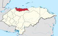 | |
15°45′0″N 86°56′0″W / 15.75000°N 86.93333°W
This Honduras location article is a stub. You can help Wikipedia by expanding it. |