
El Palomar | |
|---|---|
Town | |
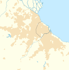 El Palomar Location in Greater Buenos Aires | |
| Coordinates: 34°37′S 58°35′W / 34.617°S 58.583°W | |
| Country | |
| Province | |
| Partido | Morón & Tres de Febrero |
| Elevation | 6 m (20 ft) |
| Population | |
| • Total | 74,757 |
| • Density | 8,063.7/km2 (20,885/sq mi) |
| CPA Base | B 1684 |
| Area code | +54 11 |
El Palomar is a town in the urban agglomeration of Greater Buenos Aires in Argentina. It is located 20 km (12 mi) north-west of Buenos Aires.
The city has the peculiarity of being divided between two partidos of Buenos Aires Province: Morón, where it is called El Palomar, and Tres de Febrero, where it is called Ciudad Jardín Lomas del Palomar. Of its 74,751 inhabitants (2001 census [INDEC]), 57,146 live within the Morón jurisdiction and 17,605 live in Tres de Febrero.
El Palomar was established with a station by that name belonging to the Buenos Aires and Pacific Railway (Spanish: Ferrocarril Buenos Aires al Pacífico) opened in 1910. Developer Publio Massini sold the first lots on November 8 of that year, and Juan Manuel Giuffra established the El Palomar Development Council, which obtained electric lighting for the area in its early years. The city is home to the National Military College (Spanish: Colegio Militar de la Nación), the 1st Air Brigade (Spanish: Primera Brigada Aérea) of the Argentine Air Force, and El Palomar Airport.
The Italian Society of Tiro al Segno (Target Shooting) (S.I.T.A.S.), is located in Palomar. Horse riding, tennis, soccer, yoga, shooting, hockey, bodybuilding, and other sports can be practiced here. In an annex is the training venue for rugby and hockey.
French automaker PSA Peugeot Citroën has a manufacturing plant in the area as well.
El Palomar is served by Ferrocarril General San Martín commuter rail service at El Palomar station with easy access to Retiro Station in downtown Buenos Aires, as well as by National Route 7.
YouTube Encyclopedic
-
1/5Views:1 8561 744122 690135 30762 389
-
Recorriendo EL PALOMAR I CIUDAD JARDIN I BUENOS AIRES I ARGENTINA I Walking Tour HD
-
【4K】una tarde por PALOMAR 2021#Driving TOUR virtual - MORÓN - Provincia de Buenos Aires - Argentina
-
Aeropuerto El palomar (tercero de Buenos Aires)
-
¿Que ésta pasando en el aeropuerto de El Palomar?
-
✈️Flybondi a Porto Alegre 🇧🇷- primer vuelo desde El Palomar 🇦🇷
Transcription
Ciudad Jardín Lomas del Palomar
Inaugurated in 1944, Ciudad Jardín was conceived with the idea of creating a garden city that offered a balance of urban life with green spaces, a city within a city.
Climate
| Climate data for El Palomar, Buenos Aires, Argentina (1981–2010, extremes 1961–present) | |||||||||||||
|---|---|---|---|---|---|---|---|---|---|---|---|---|---|
| Month | Jan | Feb | Mar | Apr | May | Jun | Jul | Aug | Sep | Oct | Nov | Dec | Year |
| Record high °C (°F) | 41.5 (106.7) |
38.9 (102.0) |
39.5 (103.1) |
33.5 (92.3) |
31.5 (88.7) |
27.9 (82.2) |
29.4 (84.9) |
33.5 (92.3) |
32.1 (89.8) |
35.3 (95.5) |
37.0 (98.6) |
39.7 (103.5) |
41.5 (106.7) |
| Average high °C (°F) | 29.9 (85.8) |
28.5 (83.3) |
26.5 (79.7) |
22.5 (72.5) |
18.9 (66.0) |
15.7 (60.3) |
15.1 (59.2) |
17.4 (63.3) |
19.2 (66.6) |
22.3 (72.1) |
25.2 (77.4) |
28.3 (82.9) |
22.5 (72.5) |
| Daily mean °C (°F) | 24.1 (75.4) |
22.9 (73.2) |
20.9 (69.6) |
16.7 (62.1) |
13.1 (55.6) |
10.2 (50.4) |
9.6 (49.3) |
11.6 (52.9) |
13.6 (56.5) |
16.8 (62.2) |
19.7 (67.5) |
22.4 (72.3) |
16.8 (62.2) |
| Average low °C (°F) | 18.1 (64.6) |
17.3 (63.1) |
15.5 (59.9) |
11.4 (52.5) |
7.9 (46.2) |
5.5 (41.9) |
4.8 (40.6) |
6.2 (43.2) |
8.0 (46.4) |
11.2 (52.2) |
13.7 (56.7) |
16.4 (61.5) |
11.3 (52.3) |
| Record low °C (°F) | 6.5 (43.7) |
6.0 (42.8) |
1.5 (34.7) |
−1.0 (30.2) |
−5.0 (23.0) |
−8.0 (17.6) |
−7.0 (19.4) |
−6.4 (20.5) |
−3.6 (25.5) |
−1.5 (29.3) |
1.0 (33.8) |
2.6 (36.7) |
−8.0 (17.6) |
| Average precipitation mm (inches) | 117.5 (4.63) |
115.0 (4.53) |
121.9 (4.80) |
104.3 (4.11) |
78.9 (3.11) |
49.7 (1.96) |
50.3 (1.98) |
54.5 (2.15) |
57.2 (2.25) |
117.7 (4.63) |
106.6 (4.20) |
105.9 (4.17) |
1,079.5 (42.50) |
| Average precipitation days (≥ 0.1 mm) | 7.6 | 7.3 | 7.9 | 8.0 | 6.0 | 6.0 | 5.9 | 6.0 | 6.6 | 9.0 | 8.5 | 7.9 | 86.7 |
| Average relative humidity (%) | 65.8 | 70.8 | 74.9 | 78.9 | 80.7 | 81.0 | 79.4 | 75.9 | 72.3 | 71.9 | 68.9 | 65.8 | 73.9 |
| Source: Servicio Meteorológico Nacionall[1][2] | |||||||||||||
Education
The area once had a German school, Gartenstadt Schule *[1].[3]
History
References
- ^ "Estadísticas Climatológicas Normales - período 1981-2010" (in Spanish). Servicio Meteorológico Nacional. Retrieved January 21, 2018.
- ^ "Clima en la Argentina: Guia Climática por El Palomar Aero". Caracterización: Estadísticas de largo plazo (in Spanish). Servicio Meteorológico Nacional. Archived from the original on 4 September 2017. Retrieved 29 April 2023.
- ^ "Deutscher Bundestag 4. Wahlperiode Drucksache IV/3672" (Archive). Bundestag (West Germany). 23 June 1965. Retrieved on 12 March 2016. p. 17/51.
External links
- ROTARY CLUB EL PALOMAR
- www.guiapalomar.com Official website (in Spanish)
- Ciudad Jardín Lomas del Palomar (in Spanish)
| Authority control databases: Geographic |
|---|