
Ein HaEmek
עֵין הָעֵמֶק | |
|---|---|
 Ein HaEmek in 1946 | |
 Ein HaEmek  Ein HaEmek | |
| Coordinates: 32°37′47″N 35°5′3″E / 32.62972°N 35.08417°E | |
| Country | |
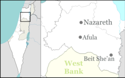
| District | Northern |
| Council | Megiddo |
| Founded | 1944 |
| Founded by | Kurdish Jews |
| Population (2022)[1] | 847 |

Ein HaEmek (Hebrew: עֵין הָעֵמֶק, lit. 'Eye of the Valley') is a community settlement in northern Israel. Located near Yokneam, it falls under the jurisdiction of Megiddo Regional Council. In 2022 it had a population of 847.[1]
The name "Ein HaEmek" indicates its location at the top of the hill, overlooking the valleys around it.
YouTube Encyclopedic
-
1/1Views:892
-
כביש 672 מקיבוץ גלעד אל מחלף אליקים Road 672 from Kibbutz Gal'ed to Eliakim Interchange
Transcription
History
The village was established as a moshav in 1944 by a group of 30 immigrant families from Kurdistan, and was initially named Kedem after the organization which helped the founders make aliyah.[2]
After the Palestinian village of al-Rihaniyya was depopulated in the 1948 Palestine war, Ein HaEmek and Ramat HaShofet took over its lands.[3]
Ein HaEmek became the seventh community settlement in the Ramot Menashe region and joined the six Jewish communities established before it; Mishmar HaEmek (1926), Yokneam Moshava (1935), HaZorea (1936), Ein HaShofet (1937), Dalia (1939) and Ramat HaShofet (1941).[4]
For many years Ein HaEmek was an agricultural moshav, consisting of farms based on pasture, cereal crops and olive trees. Starting in the 1980s, the nature of the moshav began to change due to demographic growth and a trend towards non-agricultural professions.
References
- ^ a b "Regional Statistics". Israel Central Bureau of Statistics. Retrieved 21 March 2024.
- ^ "עין העמק - אודות הישוב - עין העמק- קהילנט". Ein HaEmek. Retrieved 2023-07-25.
- ^ Khalidi, Walid (1992). All That Remains: The Palestinian Villages Occupied and Depopulated by Israel in 1948. Washington D.C.: Institute for Palestine Studies. p. 185. ISBN 0-88728-224-5.
- ^ "עין העמק - אודות הישוב - עין העמק- קהילנט". Ein HaEmek. Retrieved 2023-07-25.
| Authority control databases: National |
|---|