
Eggertsville | |
|---|---|
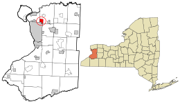 Location in Erie County and the state of New York | |
| Coordinates: 42°57′47″N 78°48′13″W / 42.96306°N 78.80361°W | |
| Country | United States |
| State | New York |
| County | Erie |
| Town | Amherst |
| Area | |
| • Total | 2.86 sq mi (7.41 km2) |
| • Land | 2.86 sq mi (7.41 km2) |
| • Water | 0.00 sq mi (0.00 km2) |
| Elevation | 653 ft (199 m) |
| Population (2020) | |
| • Total | 15,561 |
| • Density | 5,439.01/sq mi (2,100.37/km2) |
| Time zone | UTC-5 (Eastern (EST)) |
| • Summer (DST) | UTC-4 (EDT) |
| ZIP code | 14226[2] |
| Area code | 716 |
| FIPS code | 36-23701 |
| GNIS feature ID | 0949425 |
| Census | Pop. | Note | %± |
|---|---|---|---|
| 2010 | 15,019 | — | |
| 2020 | 15,561 | 3.6% | |
| U.S. Decennial Census[3] | |||
Eggertsville is a hamlet and census-designated place (CDP) within the town of Amherst in Erie County, New York, United States. The population of the CDP was 15,019 at the 2010 census.[4]
Eggertsville is part of the Buffalo-Niagara Falls metropolitan area.
YouTube Encyclopedic
-
1/2Views:302874
-
Eggertsville Hose Co: Back to the Basics
-
NYSP Confined Space Substance Recovery - 3290 Sheridan Dr - Amherst NY
Transcription
Geography
Eggertsville is located at 42°57′47″N 78°48′13″W / 42.96306°N 78.80361°W (42.96314, -78.80364), in the southwestern corner of the town of Amherst, directly adjacent to the northeast corner of the city of Buffalo. As delineated by the U.S. Census Bureau, the northern boundary of the CDP is New York State Route 324, and the eastern boundary is formed by Getzville Road and Berryman Drive. The southern and western borders of the CDP follow the town boundary of Amherst.
New York State Route 5, Main Street, passes through the CDP, leading southwest to the center of Buffalo and east towards Williamsville in the town of Amherst.
According to the United States Census Bureau, the CDP has a total area of 2.9 square miles (7.4 km2), all land.[4]
References
- ^ "ArcGIS REST Services Directory". United States Census Bureau. Retrieved September 20, 2022.
- ^ "Eggertsville ZIP Code". zipdatamaps.com. 2023. Retrieved January 12, 2023.
- ^ "Census of Population and Housing". Census.gov. Retrieved June 4, 2016.
- ^ a b "Geographic Identifiers: 2010 Demographic Profile Data (G001): Eggertsville CDP, New York". U.S. Census Bureau, American Factfinder. Archived from the original on February 10, 2020. Retrieved March 28, 2013.
External links
- Eggertsville-Snyder Branch, Buffalo & Erie County Public Library

This article about a location in Erie County, New York is a stub. You can help Wikipedia by expanding it. |