
Eel River Township | |
|---|---|
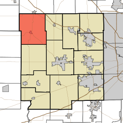 Location in Hendricks County | |
| Coordinates: 39°52′19″N 86°37′50″W / 39.87194°N 86.63056°W | |
| Country | United States |
| State | Indiana |
| County | Hendricks |
| Government | |
| • Type | Indiana township |
| Area | |
| • Total | 42.54 sq mi (110.18 km2) |
| • Land | 42.54 sq mi (110.18 km2) |
| • Water | 0 sq mi (0 km2) 0% |
| Elevation | 919 ft (280 m) |
| Population | |
| • Total | 1,707 |
| • Density | 39.1/sq mi (15.1/km2) |
| GNIS feature ID | 0453274 |
Eel River Township is one of twelve townships in Hendricks County, Indiana, United States. As of the 2010 census, its population was 1,662.[2]
History
Eel River Township was organized in about 1828.[3]
Geography
Eel River Township covers an area of 42.54 square miles (110.2 km2). The streams of East Fork Big Walnut Creek, Hunt Creek, Middle Fork Big Walnut Creek and Ramp Run run through this township.
Cities and towns
- Jamestown (south edge)
- North Salem
Adjacent townships
- Jackson Township, Boone County (north)
- Union Township (east)
- Center Township (southeast)
- Marion Township (south)
- Jackson Township, Putnam County (southwest)
- Clark Township, Montgomery County (west)
Cemeteries
The township contains sixteen cemeteries: Adams, Campbell, Devenport, Fairview, Fleece, Fullen, Gossett, Hypes, Kidd Farm, North Salem Baptist, Page, Pennington, Richardson, Roundtown, Trotter and Zimmerman.
Major highways
Airports and landing strips
- Reynolds Landing Strip
References
- "Eel River Township, Hendricks County, Indiana". Geographic Names Information System. United States Geological Survey, United States Department of the Interior. Retrieved September 24, 2009.
- United States Census Bureau cartographic boundary files
- ^ "Census Bureau profile: Eel River Township, Hancock County, Indiana". United States Census Bureau. May 2023. Retrieved March 21, 2024.
- ^ "U.S. Census website". Retrieved July 20, 2008.
- ^ Hadley, John Vestal (1914). History of Hendricks County, Indiana: Her People, Industries and Institutions. B.F. Bowen. pp. 70.
Wikimedia Commons has media related to Eel River Township, Hendricks County, Indiana.
Municipalities and communities of Hendricks County, Indiana, United States | ||
|---|---|---|
| Towns |  | |
| Townships | ||
| CDPs | ||
| Other communities | ||
| Footnotes | ‡This populated place also has portions in an adjacent county or counties | |
| International | |
|---|---|
| National | |