
23°29′20″N 120°28′36″E / 23.488911°N 120.476562°E
East District
東區 | |
|---|---|
 Chiayi City Hall | |
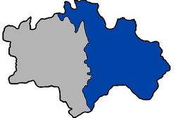 East District in Chiayi City | |
| Location | Chiayi City, Taiwan |
| Urban villages (里) | 39[1] |
| Government | |
| • Leader (區長) | Sun Shifu (孫世福) |
| Area | |
| • Total | 29.1195 km2 (11.2431 sq mi) |
| Population (September 2019)[2] | |
| • Total | 120,598 |
| • Density | 4,100/km2 (11,000/sq mi) |
| Time zone | UTC+8 (National Standard Time) |
| Postal code | 600 |
| Website | east |
East District (Chinese: 東區; pinyin: Dōng Qū; Pe̍h-ōe-jī: Tang-khu) is a district in east Chiayi City, Taiwan. The district is the city seat of Chiayi City.
YouTube Encyclopedic
-
1/5Views:2 547566 3525591 262 40419 881
-
NETFLIX TAIWAN: Trying STREET FOOD Recommendations in Chiayi
-
World's BIGGEST Soup - Feeding 1000's in TAIWAN | RARE Taiwanese STREET FOOD in Chiayi, Taiwan 2018
-
{嘉義協輪車業}202002嘉義市區全夜景(Chiayi city night scene)
-
Muslim Street Food in CHINA | Guangzhou HALAL Street Food Heaven - BEST Islamic Chinese Street Food
-
Unreal Taiwan STREET FOOD tour in Tainan | FRESHEST beef EVER | Tainan's most FAMOUS food
Transcription
History


The East District was established on 6 October 1990.[3]
Administrative divisions
East District consists of the following villages:[4][5]
- (公園聯合里)
- Duanzhu (短竹里), Lantan (蘭潭里), Dongchuan (東川里), Luliao (鹿寮里), Lucuo (盧厝里), Wenya (文雅里), Wangtian (王田里), Changzhu (長竹里), Houzhuang (後庄里), Xindian (新店里), Zuntou (圳頭里)
- (東南門聯合里)
- Zhongshan (中山里), Taiping (太平里), Dongxing (東興里), Huanan (華南里), Zhongyang (中央里), Zhaoyang (朝陽里), Minzu (民族里), Guogou (過溝里)
- (新南聯合里)
- Xinkai (新開里), Xuanxin (宣信里), Xingnan (興南里), Fengnian (豐年里), Fangcao (芳草里), Fang'an (芳安里), Dingliao (頂寮里), Anliao (安寮里), Anye (安業里), Xingcun (興村里), Xing'an (興安里), Xingren (興仁里)
- (北門聯合里)
- Beimen (北門里), Linsen (林森里), Zhongzhuang (中庄里), Dingzhuang (頂庄里), Yijiao (義教里), Renyi (仁義里), Houhu (後湖里) and Laoteng (荖藤里).
Government institutions
Education
- National Chiayi University - Lantan Main Campus and Linsen Campus
- Tatung Institute of Commerce and Technology
- Chung Jen College of Nursing, Health Science and Management
Tourist attractions
- Alishan Forest Railway Garage Park
- Chiayi City Cultural Park
- Chiayi Botanical Garden
- Chiayi Jen Wu Temple
- Chiayi Municipal Museum
- Chiayi Park
- Chiayi Prison Museum
- Hinoki Village
- Lantan Lake
- St. John's Cathedral
- The First 228 Peace Memorial Monument
- Water Source Water Meter Room
Transportation
See also
References
- ^ a b 沿革簡介. 嘉義市東區區公所 East District Office, Chiayi City (in Chinese (Taiwan)). 5 March 2018. Retrieved 17 October 2019.
轄區土地面積有29.1195平方公里,分設39里,654鄰。
- ^ 村里鄰人口數. 嘉義市東區戶政事務所 East District Household Registration Office, Chiayi City (in Chinese (Taiwan)). Retrieved 17 October 2019.
- ^ "East District Office, Chiayi City - History". Archived from the original on 2017-03-14. Retrieved 2016-01-06.
- ^ "Location and Area". East District Office, Chiayi City. 3 December 2016. Retrieved 17 October 2019.
The area of East District is 29.1195 39 [sic] km² with 39 Villages and 640 Neighborhoods.
- ^ 聯合里辦公處. 嘉義市東區區公所 East District Office, Chiayi City. 3 December 2016. Retrieved 17 October 2019.(includes maps)
Wikimedia Commons has media related to East District, Chiayi City.