
East Cathlamet, Washington | |
|---|---|
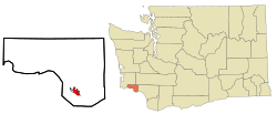 Location of East Cathlamet, Washington | |
| Coordinates: 46°11′48″N 123°21′29″W / 46.19667°N 123.35806°W | |
| Country | United States |
| State | Washington |
| County | Wahkiakum |
| Area | |
| • Total | 1.713 sq mi (4.436 km2) |
| • Land | 1.713 sq mi (4.436 km2) |
| • Water | 0.000 sq mi (0.000 km2) 0.00% |
| Elevation | 400 ft (122 m) |
| Population (2010)[1] | |
| • Total | 491[1] |
| Population as of 2010 U.S. Census | |
| Time zone | UTC−8 (PST) |
| • Summer (DST) | UTC−7 (PDT) |
| ZIP code | 98612 |
| Area code | 360 |
| FIPS code | 53-19290 |
| GNIS feature ID | 2408703 |
East Cathlamet is a census-designated place (CDP) in Wahkiakum County, Washington, on the eastern border of the town of Cathlamet. The population was 491 as of the 2010 census. The East Cathlamet community is part of the Wahkiakum School District, a K-12 school district of about 430 students. The name "Kathlamet" (Cathlamet) comes from the Kathlamet tribe, which in their language, means "rocky shore."[4]
YouTube Encyclopedic
-
1/3Views:3321 307326
-
Puget Island bridge, Cathlamet, Washington
-
Clinton to Mukilteo Ferry on MV Cathlamet, May 2012
-
View from the town dock, Columbia River, Cathlamet, Washington
Transcription
Geography
According to the United States Census Bureau, the East Cathlamet CDP has a total area of 1.71 square miles (4.44 km2), of which all of it is land and none of it is water.
Demographics
| Census | Pop. | Note | %± |
|---|---|---|---|
| 2000 | 491 | — | |
| 2010 | 491 | 0.0% | |
| 2000-2010 U.S. Censuses | |||
2010
As of the 2010 census,[1] there were 491 people, 227 households, and 149 families residing in the CDP. The population density was 286.6 people per square mile (110.7/km2). There were 248 housing units at an average density of 144.8/sq mi (55.9/km2). The racial makeup of the CDP was 95.5% White, 0.2% African American, 1.8% Native American, 0.2% Asian, 0.0% Pacific Islander, 0.2% from other races, and 2.0% from two or more races. Hispanic or Latino of any race were 1.8% of the population.
There were 227 households, out of which 20.3% had children under the age of 18 living with them, 48.5% were married couples living together, 11.0% had a female householder with no husband present, and 34.4% were non-families. 29.1% of all households were made up of individuals, and 17.6% had someone living alone who was 65 years of age or older. The average household size was 2.16 and the average family size was 2.55.
In the CDP, the age distribution of the population shows 17.1% under the age of 18, 4.3% from 18 to 24, 15.7% from 25 to 44, 33.0% from 45 to 64, and 29.9% who were 65 years of age or older. The median age was 53.6 years. For every 100 females, there were 94.1 males. For every 100 females age 18 and over, there were 85.8 males.
2000
As of the 2000 census,[1] there were 491 people, 214 households, and 144 families residing in the CDP. The population density was 282.2 people per square mile (109.0/km2). There were 234 housing units at an average density of 134.5/sq mi (51.9/km2). The racial makeup of the CDP was 95.7% White, 0.0% African American, 1.2% Native American, 0.0% Asian, 0.2% Pacific Islander, 0.8% from other races, and 2.0% from two or more races. Hispanic or Latino of any race were 1.0% of the population.
There were 214 households, out of which 22.9% had children under the age of 18 living with them, 57.5% were married couples living together, 6.1% had a female householder with no husband present, and 32.7% were non-families. 26.2% of all households were made up of individuals, and 13.6% had someone living alone who was 65 years of age or older. The average household size was 2.29 and the average family size was 2.73.
In the CDP, the age distribution of the population shows 23.0% under the age of 18, 3.9% from 18 to 24, 19.8% from 25 to 44, 24.8% from 45 to 64, and 28.5% who were 65 years of age or older. The median age was 48 years. For every 100 females, there were 94.1 males. For every 100 females age 18 and over, there were 94.8 males.
The median income for a household in the CDP was $40,000, and the median income for a family was $51,875. Males had a median income of $50,658 versus $19,519 for females. The per capita income for the CDP was $19,372. None of the population or families were below the poverty line.
External links
References
- ^ a b c d "U.S. Census website". United States Census Bureau. 2011. Retrieved June 20, 2014.
- ^ "2013 U.S. Gazetteer Files". census.gov. Retrieved June 20, 2014.
- ^ "USGS—East Cathlamet, Washington". Retrieved June 20, 2014.
- ^ "Cathlamet -- Thumbnail History". historylink.org. February 3, 2009. Retrieved June 20, 2014.
Municipalities and communities of Wahkiakum County, Washington, United States | ||
|---|---|---|
| Town |  | |
| CDPs | ||
| Other communities | ||