
| Easington Fell | |
|---|---|
 Cairn on Easington Fell | |
| Highest point | |
| Elevation | 396 m (1,299 ft) |
| Listing | Marilyn |
| Coordinates | 53°56′01″N 2°24′43″W / 53.933618°N 2.411934°W |
| Geography | |
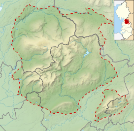 Easington Fell Location in the Forest of Bowland  Easington Fell Location in Lancashire 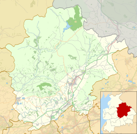 Easington Fell Location in Ribble Valley | |
| Location | Lancashire, England |
| Parent range | Forest of Bowland |
| OS grid | SD730486 |
Easington Fell is a Marilyn in the Forest of Bowland in Lancashire, England. It has been surveyed to be 70 cm higher than a nearby fell of almost identical height, namely, Waddington Fell. This is visible in the background of the photo.[1][2][3]
YouTube Encyclopedic
-
1/2Views:4641 255
-
G/SP-007 Fair Snape Fell 07/03/10
-
Wild Camping on Fairsnape Fell (Forest of Bowland)
Transcription
References
- ^ "Easington Fell – Climbing, Hiking & Mountaineering". mountain-forecast.com. Retrieved 18 February 2014.
- ^ "Easington Fell - Hill Bagging". hill-bagging.co.uk. Retrieved 18 February 2014.
- ^ "Easington Fell 396m (1300ft)". go4awalk.com. Retrieved 18 February 2014.
Marilyns of Northern England | ||
|---|---|---|
| 1. Northumberland |  | |
| 2. Northern Lakeland | ||
| 3. Western Lakeland | ||
| 4. Central and Southern Lakeland | ||
| 5. Eastern Lakeland | ||
| 6. North Pennines and Durham | ||
| 7. Northern Yorkshire Dales | ||
| 8. Southern Yorkshire Dales | ||
| 9. North York Moors to the Humber | ||
| 10. Forest of Bowland | ||
This Lancashire location article is a stub. You can help Wikipedia by expanding it. |