
Eagle, Pennsylvania | |
|---|---|
 Intersection of Pottstown Pike and Little Conestoga Road in Eagle | |
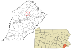 Location of Eagle in Chester County, Pennsylvania (top) and of Chester County in Pennsylvania (below) | |
 Eagle Location of Eagle in Pennsylvania  Eagle Eagle (the United States) | |
| Coordinates: 40°04′38″N 75°41′15″W / 40.07722°N 75.68750°W | |
| Country | United States |
| State | Pennsylvania |
| County | Chester |
| Township | Upper Uwchlan |
| Elevation | 256 ft (78 m) |
| Population (2020) | |
| • Total | 498 |
| Time zone | UTC-5 (EST) |
| • Summer (DST) | UTC-4 (EDT) |
| Area code(s) | 610 |


Eagle (also "Uwchland", "Windsor" or the "Village of Eagle") is an unincorporated community and census-designated place in Upper Uwchlan Township, Chester County, Pennsylvania, United States. As of 2020, Eagle had a population of 498.[1]
Located at 40°4′40″N 75°41′16″W / 40.07778°N 75.68778°W,[2] the center of the village is the intersection of Pottstown Pike (Pennsylvania Route 100) and Little Conestoga Road, where the historic Eagle Tavern is located. Eagle has recently experienced tremendous development in the surrounding areas.[3] A bypass of Route 100 was constructed in the first decade of the 2000s to reduce traffic and preserve historic structures such as the Eagle Tavern.[4]
References
- ^ "Census Population API". United States Census Bureau.
- ^ U.S. Geological Survey Geographic Names Information System: Eagle, Pennsylvania
- ^ Laker, Barbara (January 28, 2005). "In Eagle, they're serious Birds fans". Philadelphia Daily News. p. 6. Retrieved August 9, 2020 – via Newspapers.com.
- ^ Walker, Wendy (March 20, 1988). "A new bypass is sought -- straight away". The Philadelphia Inquirer. p. 432. Retrieved August 9, 2020 – via Newspapers.com.
Wikimedia Commons has media related to Eagle, Pennsylvania.
