
Dunmor, Kentucky | |
|---|---|
 Dunmor  Dunmor | |
| Coordinates: 37°4′25″N 86°59′46″W / 37.07361°N 86.99611°W | |
| Country | United States |
| State | Kentucky |
| Counties | Muhlenberg, Logan |
| Area | |
| • Total | 2.61 sq mi (6.76 km2) |
| • Land | 2.60 sq mi (6.72 km2) |
| • Water | 0.01 sq mi (0.04 km2) |
| Elevation | 591 ft (180 m) |
| Population | |
| • Total | 322 |
| • Density | 124.04/sq mi (47.89/km2) |
| Time zone | UTC-6 (Central (CST)) |
| • Summer (DST) | UTC-5 (CDT) |
| ZIP codes | 42339 (Dunmor) 42256 (Lewisburg) |
| FIPS code | 21-23014 |
| GNIS feature ID | 491320[3] |
Dunmor is an unincorporated community and census-designated place (CDP) in Muhlenberg and Logan counties, Kentucky, United States. As of the 2020 census it had a population of 322.[2]
YouTube Encyclopedic
-
1/2Views:1 389697
-
Driving Muhlenberg County KY 431 between Dunmor,Belton, Lake Malone
-
Ole Store Primitive Dunmor KY
Transcription
History
A post office was established in the community in 1884.[4] The name "Dunmor" may have come from either colonial politician Lord Dunmore,[5] or the local Dunn family.[6]
Geography
Dunmor is located in southern Muhlenberg County, with a portion extending south into Logan County. U.S. Route 431 passes through the community, leading north 18 miles (29 km) to Central City and south the same distance to Russellville.
According to the U.S. Census Bureau, the Dunmor CDP has a total area of 2.61 square miles (6.8 km2), of which 0.01 square miles (0.03 km2), or 0.54%, are water.[1]
Demographics
| Census | Pop. | Note | %± |
|---|---|---|---|
| 2010 | 317 | — | |
| 2020 | 322 | 1.6% | |
| U.S. Decennial Census[7] | |||
Climate
The climate in this area is characterized by hot, humid summers and generally mild to cool winters. According to the Köppen Climate Classification system, Dunmor has a humid subtropical climate, abbreviated "Cfa" on climate maps.[8]
References
- ^ a b "2022 U.S. Gazetteer Files: Kentucky". United States Census Bureau. Retrieved May 23, 2023.
- ^ a b "P1. Race – Dunmor CDP, Kentucky: 2020 DEC Redistricting Data (PL 94-171)". U.S. Census Bureau. Retrieved May 23, 2023.
- ^ U.S. Geological Survey Geographic Names Information System: Dunmor, Kentucky
- ^ "Muhlenberg County". Jim Forte Postal History. Archived from the original on December 8, 2015. Retrieved April 16, 2015.
- ^ Anderson, Bobby (September 9, 2007). "Sandy Called These Names". Leader-News. p. A12. Retrieved May 16, 2015.
- ^ Rennick, Robert M. (1987). Kentucky Place Names. University Press of Kentucky. p. 86. ISBN 0813126312. Retrieved April 28, 2013.
- ^ "Census of Population and Housing". Census.gov. Retrieved June 4, 2016.
- ^ Climate Summary for Dunmor, Kentucky
Municipalities and communities of Muhlenberg County, Kentucky, United States | ||
|---|---|---|
| Cities |  | |
| CDPs | ||
| Other communities | ||
| Ghost town | ||
| Footnotes | ‡This populated place also has portions in an adjacent county or counties | |
Municipalities and communities of Logan County, Kentucky, United States | ||
|---|---|---|
| Cities | 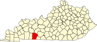 | |
| CDP | ||
| Other unincorporated communities | ||
| Footnotes | ‡This populated place also has portions in an adjacent county or counties | |
This Muhlenberg County, Kentucky state location article is a stub. You can help Wikipedia by expanding it. |