
| Drake New South Wales | |||||||||||||||
|---|---|---|---|---|---|---|---|---|---|---|---|---|---|---|---|
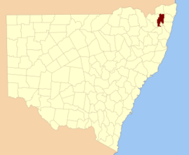 Location in New South Wales | |||||||||||||||
| |||||||||||||||
Drake County is one of the 141 Cadastral divisions of New South Wales.
Drake County was named in honour of Sir Francis Drake (1540–1596).[1] It is located to the north of parts of the Clarence River, Nymboida River and Mann River. It includes the Washpool National Park.
Parishes within this county
A full list of parishes found within this county; their current LGA and mapping coordinates to the approximate centre of each location is as follows:
References
- ^ "Drake". Geographical Names Register (GNR) of NSW. Geographical Names Board of New South Wales. Retrieved 4 August 2013.