
Divernon | |
|---|---|
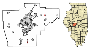 Location of Divernon in Sangamon County, Illinois. | |
 Location of Illinois in the United States | |
| Coordinates: 39°33′58″N 89°39′21″W / 39.56611°N 89.65583°W | |
| Country | United States |
| State | Illinois |
| County | Sangamon |
| Area | |
| • Total | 0.76 sq mi (1.98 km2) |
| • Land | 0.76 sq mi (1.98 km2) |
| • Water | 0.00 sq mi (0.00 km2) |
| Elevation | 612 ft (187 m) |
| Population (2020) | |
| • Total | 1,139 |
| • Density | 1,492.79/sq mi (576.11/km2) |
| Time zone | UTC-6 (CST) |
| • Summer (DST) | UTC-5 (CDT) |
| ZIP Code(s) | 62530 |
| Area code | 217 |
| FIPS code | 17-20045 |
| Wikimedia Commons | Divernon, Illinois |
| Website | divernonil |
Divernon is a village in Sangamon County, Illinois, United States. The population was 1,172 at the 2010 census, and 1,119 at a 2018 estimate. It is part of the Springfield, Illinois Metropolitan Statistical Area.
YouTube Encyclopedic
-
1/1Views:390
-
GTW GP38-2 with WC Observation Car on IC Divernon IL
Transcription
History
A post office has been in operation at Divernon since 1887.[2] The village took its name after Di Vernon, a character in the novel Rob Roy.[3]
Geography
Divernon is located at 39°33′58″N 89°39′21″W / 39.56611°N 89.65583°W (39.566208, -89.655718).[4]
According to the 2010 census, the village has a total area of 0.79 square miles (2.0 km2), all land.[5]
Demographics
| Census | Pop. | Note | %± |
|---|---|---|---|
| 1910 | 1,519 | — | |
| 1920 | 2,382 | 56.8% | |
| 1930 | 1,170 | −50.9% | |
| 1940 | 1,033 | −11.7% | |
| 1950 | 1,013 | −1.9% | |
| 1960 | 997 | −1.6% | |
| 1970 | 1,010 | 1.3% | |
| 1980 | 1,081 | 7.0% | |
| 1990 | 1,178 | 9.0% | |
| 2000 | 1,201 | 2.0% | |
| 2010 | 1,172 | −2.4% | |
| 2020 | 1,139 | −2.8% | |
| U.S. Decennial Census[6] | |||
As of the census[7] of 2000, there were 1,201 people, 480 households, and 340 families residing in the village. The population density was 1,507.3 inhabitants per square mile (582.0/km2). There were 516 housing units at an average density of 647.6 per square mile (250.0/km2). The racial makeup of the village was 98.67% White, 0.33% African American, 0.25% Asian, 0.17% from other races, and 0.58% from two or more races. Hispanic or Latino of any race were 1.42% of the population.
There were 480 households, out of which 35.2% had children under the age of 18 living with them, 56.9% were married couples living together, 9.4% had a female householder with no husband present, and 29.0% were non-families. 24.6% of all households were made up of individuals, and 11.0% had someone living alone who was 65 years of age or older. The average household size was 2.50 and the average family size was 2.98.
In the village, the population was spread out, with 26.6% under the age of 18, 8.0% from 18 to 24, 32.3% from 25 to 44, 20.3% from 45 to 64, and 12.7% who were 65 years of age or older. The median age was 36 years. For every 100 females, there were 92.8 males. For every 100 females age 18 and over, there were 95.3 males.
The median income for a household in the village was $43,750, and the median income for a family was $49,706. Males had a median income of $33,333 versus $26,042 for females. The per capita income for the village was $18,670. About 4.9% of families and 7.2% of the population were below the poverty line, including 12.0% of those under age 18 and 1.5% of those age 65 or over.
Education
Public schools are managed by Auburn Community Unit School District 10. Secondary education is provided by Auburn High School, located on North Seventh Street. The premises were previously occupied by Divernon High School.[8][9]
Notable people
- Joe Bukant, professional football player for the Philadelphia Eagles and Chicago Cardinals in the late 1930s and early 1940s.
- Al Papai, MLB pitcher for the St. Louis Cardinals, St. Louis Browns, Boston Red Sox and Chicago White Sox
References
- ^ "2020 U.S. Gazetteer Files". United States Census Bureau. Retrieved March 15, 2022.
- ^ "Sangamon County". Jim Forte Postal History. Retrieved November 4, 2015.
- ^ Callary, Edward (September 29, 2008). Place Names of Illinois. University of Illinois Press. p. 94. ISBN 978-0-252-09070-7.
- ^ "US Gazetteer files: 2010, 2000, and 1990". United States Census Bureau. February 12, 2011. Retrieved April 23, 2011.
- ^ "Places: Illinois". 2010 Census Gazetteer Files. United States Census Bureau. Archived from the original on October 21, 2013. Retrieved October 13, 2012.
- ^ "Census of Population and Housing". Census.gov. Retrieved June 4, 2016.
- ^ "U.S. Census website". United States Census Bureau. Retrieved January 31, 2008.
- ^ Pilger, Hal (June 23, 2009). "Longtime official Ervin shoots for a new goal". The State Journal-Register. Retrieved November 3, 2013.
- ^ "Junior High". Auburn Community Unit School District 10. 2013. Retrieved November 3, 2013.
Municipalities and communities of Sangamon County, Illinois, United States | ||
|---|---|---|
| Cities |  | |
| Villages | ||
| Townships | ||
| Unincorporated communities | ||
| Footnotes | ‡This city also has portions in adjacent county or counties | |