
| Districts of Wrocław | |
|---|---|
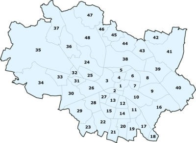
 The forty-eight Wrocław districts | |
| Category | Osiedla |
| Location | Wrocław, Poland |
| Created by | Resolution XX/110/91 of the City Council of Wrocław |
| Created |
|
| Number | 48 |
| Populations | 500–35,000 |
| Government |
|
The districts of Wrocław (Polish: osiedla Wrocławia) are the 48 local authority districts that make up the administrative area of Wrocław, Poland. Each is governed by a district council (Polish: rada osiedla). The present Wrocław districts were all created on March 21, 1991 by the Resolution XX/110/91 of the City Council of Wrocław and are a type of local government district.[1]
On February 13, 2016, the Resolution XX/419/16 of the City Council of Wrocław revised and established unambiguous and precise boundaries of Wrocław's districts, defining them in digital form.[1]
The current division system replaced the one from 1952, when Wrocław was divided into five main boroughs (Polish: dzielnice). Although they were abolished in 1991 and have not existed as public administration units since then, areas of borders and names similar/identical to the former districts still exist in the practice of operation of various types of authorities and administrations (e.g. as divisions of territorial competencies of courts, prosecutors' offices, tax offices, etc.).
The former settlements that were incorporated into the city form some of Wrocław's current districts. Some districts may also consist of multiple former neighborhoods that have been combined into a larger district. A few, such as Grunwald Square or Powstańców Śląskich, were established and named after streets in the area.
As of 2022, Leśnica is the most populous district in the city, with a population of 31,971 people living in the area. The least populous district in Wrocław is Bieńkowice, with a population of 577 inhabitants.[2]
YouTube Encyclopedic
-
1/1Views:31 343
-
Wrocław - Breslau lata 20
Transcription
List
Historical divisions
Districts before 1945
Until 1945, Wrocław (then Breslau) was divided in two levels: into Stadtteile ('city parts') corresponding to the former settlements, while these were divided into Viertel ('neighborhoods, quarters'), sometimes administratively combined with each other, derived from the original division of the medieval city into four parts.
Altstadt[3]
|
Oder-Stadtteil[3]
|
Sand-Stadtteil[3]
|
Ohlauer Stadteil[3]
|
Strehlener Stadteil[3]
|
Schweidnitzer Stadtteil[3]
|
Nikolai-Stadteil[3]
|
Districts in 1945–1952

The Polish administration's seizure of power in Wrocław in 1945 led to changes in the city's administrative division. The previous German division was replaced by a new division into twelve districts. By 1946, the number of districts was reduced to eight.
Each of the eight districts was overseen by the Municipal District Office, an auxiliary unit of the City Board. In 1951, the city's four districts expanded with the annexation of new neighborhoods. The division of Wrocław into eight districts ended in 1952, when they were replaced by five boroughs. The boundaries of the newly introduced districts partially overlapped with those of the former ones.
Districts in 1952–1991
Wrocław was previously subdivided into five boroughs (Polish: dzielnice). Although they do not exist as public administration units anymore, they remained in use, mainly for statistical and administrative purposes.
The boroughs used to be divided into smaller districts, mainly based on older settlements that were incorporated into the city. The date in the brackets indicates the year the settlement was incorporated into Wrocław.

See also
References
- ^ a b "System Informacji Przestrzennej Wrocławia- Granice osiedli Wrocławia". geoportal.wroclaw.pl. Retrieved 2024-01-06.
- ^ "Liczba mieszkańców zameldowanych we Wrocławiu w podziale na Osiedla – stan na 31 grudnia 2022 r."
- ^ a b c d e f g h i j k l "Historyczne dzielnice Wrocławia". slaskiwroclaw.pl. Retrieved 2024-01-06.
| Boroughs |  | |
|---|---|---|
| Attractions | ||
| Museums | ||
| Transport | ||
| Other | ||