
| Carmarthen Welsh: Caerfyrddin | |
|---|---|
 | |
| History | |
| • Created | 1 April 1974 |
| • Abolished | 31 March 1996 |
| • Succeeded by | Carmarthenshire |
| Status | District |
| • HQ | Carmarthen |
 | |
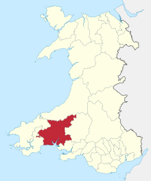
Carmarthen District Council (Welsh: Caerfyrddin) was one of six local government districts of the county of Dyfed, west Wales, from 1974 to 1996.
YouTube Encyclopedic
-
1/5Views:6 6082 2024 0474 17317 640
-
Carmarthen Walk: Town Centre【4K】
-
Top 10 Things To Do in Carmarthenshire
-
Travel Guide Carmarthen Town Centre Camarthenshire Wales UK Pros And Cons Review
-
Secret castle discovered near Carmarthen!!
-
Swansea to Carmarthen. A trip along the Carmarthenshire coast.
Transcription
History
The district was formed on 1 April 1974 under the Local Government Act 1972, covering the area of four former districts from the administrative county of Carmarthenshire, which were abolished at the same time:[1][2]
- Carmarthen Municipal Borough
- Carmarthen Rural District
- Newcastle Emlyn Rural District
- Newcastle Emlyn Urban District
Carmarthen district was abolished 22 years later under the Local Government (Wales) Act 1994, with the area becoming part of the new Carmarthenshire unitary authority on 1 April 1996.[3]
Political control
The first election to the council was held in 1973, initially operating as a shadow authority before coming into its powers on 1 April 1974. A majority of the seats on the council were held by independents throughout the council's existence.[4]
| Party in control | Years | |
|---|---|---|
| Independent | 1974–1996 | |
The most significant political grouping (as distinct from the independents) was the Labour Party who held a number of seats in Carmarthen Town and the former mining wards of the Gwendraeth Valley.
Elections
- Carmarthen District Council election, 1973
- Carmarthen District Council election, 1976
- Carmarthen District Council election, 1979
- Carmarthen District Council election, 1983
- Carmarthen District Council election, 1987
- Carmarthen District Council election, 1991
Premises
Throughout its existence, the council was based at 3 Spilman Street in Carmarthen, which had previously been the offices of Carmarthen Rural District Council, one of its predecessor authorities.[5][6][7]
References
- ^ "Local Government Act 1972", legislation.gov.uk, The National Archives, 1972 c. 70, retrieved 4 October 2022
- ^ "The Districts in Wales (Names) Order 1973", legislation.gov.uk, The National Archives, SI 1973/34, retrieved 4 October 2022
- ^ "Local Government (Wales) 1994", legislation.gov.uk, The National Archives, 1994 c. 19, retrieved 4 October 2022
- ^ "Compositions calculator". The Elections Centre. Retrieved 28 September 2022.
- ^ "No. 39377". The London Gazette. 6 November 1951. p. 5795.
- ^ "No. 46298". The London Gazette. 24 May 1974. p. 6301.
- ^ "No. 54356". The London Gazette. 27 March 1996. p. 4495.
51°50′N 4°10′W / 51.833°N 4.167°W