Diego Jiménez Torres Airport Fajardo Airport | |||||||||||
|---|---|---|---|---|---|---|---|---|---|---|---|
 | |||||||||||
| Summary | |||||||||||
| Airport type | Closed | ||||||||||
| Owner | Puerto Rico Ports Authority | ||||||||||
| Serves | Fajardo, Puerto Rico | ||||||||||
| Closed | 2015 | ||||||||||
| Elevation AMSL | 64 ft / 20 m | ||||||||||
| Coordinates | 18°18′29″N 65°39′43″W / 18.30806°N 65.66194°W | ||||||||||
| Map | |||||||||||
| Runways | |||||||||||
| |||||||||||
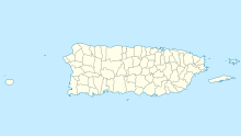
Diego Jiménez Torres Airport (IATA: FAJ, ICAO: TJFA, FAA LID: X95) was a public use airport owned by the Puerto Rico Ports Authority and located 1 mile (1.6 km) south of Fajardo, a city in Puerto Rico. It is also known as Fajardo Airport.
Airport operations were shut down in November 2008 and transferred to the newly opened José Aponte de la Torre Airport in Ceiba.[citation needed] In February 2015 the FAA announced the permanent closure of the airport on April 30, 2015.
YouTube Encyclopedic
-
1/3Views:2 25810 276599
-
Puerto Rico Ricky Martin
-
Dude Goes Off On Puerto Rican Man Because He Spoke To His Mother In Spanish
-
1972 En Caracas, GIOSTRE fab diego leila nacho
Transcription
Facilities
Diego Jiménez Torres Airport covered an area of 95 acres (38 ha) at an elevation of 64 feet (20 m) above mean sea level. The asphalt paved runway designated 8/26 measured 3,600 by 75 feet (1,097 x 23 m), and is marked closed.[1]
Airlines
At the time of closing, air taxi service was provided by the following airlines:[3]
- Air Flamenco
- Isla Nena Air
- M&N Aviation
- Vieques Air Link
See also
References
- ^ a b FAA Airport Form 5010 for X95 PDF, effective 2 July 2009.
- ^ "Fajardo Airport". Google Maps. Retrieved 5 June 2018.
- ^ "Airlines serving Puerto Rico". Travel and Sports, Inc.
External links
- OpenStreetMap - Fajardo Airport
- Accident history for Fajardo Airport at Aviation Safety Network
- Resources for this airport:
- FAA airport information for X95
- AirNav airport information for TJFA
- ASN accident history for FAJ
- FlightAware airport information and live flight tracker
- SkyVector aeronautical chart for TJFA

