To install click the Add extension button. That's it.

The source code for the WIKI 2 extension is being checked by specialists of the Mozilla Foundation, Google, and Apple. You could also do it yourself at any point in time.

4,5
Kelly Slayton
Congratulations on this excellent venture… what a great idea!
Alexander Grigorievskiy
I use WIKI 2 every day and almost forgot how the original Wikipedia looks like.
Live Statistics
English Articles
Improved in 24 Hours
Added in 24 Hours
What we do. Every page goes through several hundred of perfecting techniques; in live mode. Quite the same Wikipedia. Just better.
.
Leo
Newton
Brights
Milds

From Wikipedia, the free encyclopedia

Dicle Dam
Location of Dicle Dam in Turkey
Official nameDicle Baraji
LocationDiyarbakır, Turkey
Coordinates38°13′51.02″N 40°10′35.59″E / 38.2308389°N 40.1765528°E / 38.2308389; 40.1765528
PurposePower, irrigation
StatusOperational
Construction began1986
Opening date1997
Owner(s)State Hydraulic Works
Dam and spillways
Type of damEmbankment, earth-fill
ImpoundsTigris River
Height75 m (246 ft)
Length307 m (1,007 ft)
Elevation at crest718 m (2,356 ft)
Width (crest)10 m (33 ft)
Width (base)328 m (1,076 ft)
Dam volume3,100,000 m3 (2,513 acre⋅ft)
Spillway typeService overflow, controlled-chute
Spillway capacity5,000 m3/s (176,573 cu ft/s)
Reservoir
CreatesDicle Reservoir
Total capacity595,000,000 m3 (482,000 acre⋅ft)
Active capacity255,000,000 m3 (207,000 acre⋅ft)
Inactive capacity340,000,000 m3 (280,000 acre⋅ft)
Catchment area3,216 km2 (1,242 sq mi)
Surface area24 km2 (9.3 sq mi)[1]
Maximum length20 km (12 mi)
Normal elevation710 m (2,330 ft)
Power Station
Hydraulic head67 m (220 ft) (gross)
Turbines3 x 55 MW Francis-type
Installed capacity110 MW
Annual generation298 GWh

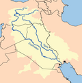
Dicle Dam is one of the 21 dams of the Southeastern Anatolia Project of Turkey. These facilities are located within the provincial territory of Diyarbakır, at a distance of 50 kilometres to Diyarbakır city centre. More specifically, the dam and the hydroelectric power plant are located in Eğil district,[2] at a distance of 800 metres from the point of junction of the streams of Maden Stream and Dibni to form the Tigris, and 22 kilometres downstream of the Kralkızı Dam. Construction works were started in 1986 and the dam was completed in 1997.[3] The dam has an installed hydroelectric capacity of 110 MW[4] and is designed to ultimately irrigate 128,080 hectares. In 2001 a water transmission line and a water treatment plant were commissioned that provided about 85% of the drinking water for the city of Diyarbakir in 2010. In 2018 a gate of the dam broke the water lever decreased and a part of a village re-emerged in the Eğil district.[5]

YouTube Encyclopedic

  • 1/2
    Views:
    5 025
    2 486
  • 40 şehid sahabe , 40 matryred companions of Prophet Muhammed , Amini Diyarbakır Diyarbakir
  • אבני פינה - המים בישראל - שיעור מס' 2

Transcription

References

  1. ^ "Ilisu Dam Environmental Impact Assessment" (PDF). State Hydraulic Works. 2005. pp. TABLE 2–4 (PDF pgs. 114–115). Archived from the original (PDF) on 26 September 2015. Retrieved 20 May 2013.
  2. ^ "Ancient Underwater Village Has Been Revealed in Turkey (photos)". armedia.am. Retrieved 2020-03-25.
  3. ^ "Anadolu Agency". Anadolu Agency. Retrieved 2020-03-25.
  4. ^ (PDF). 2007-09-28. pp. 2–11 http://www.ecgd.gov.uk/eiar_s2.pdf. Archived (PDF) from the original on 2007-09-28. Retrieved 2020-03-25. {{cite web}}: Missing or empty |title= (help)
  5. ^ AA, Daily Sabah with (2018-12-20). "Drop in dam water reveals submerged village, Elisha's tomb in SE Turkey's Diyarbakır". Daily Sabah. Retrieved 2020-03-25.

External links

This page was last edited on 31 January 2024, at 20:31
Basis of this page is in Wikipedia. Text is available under the CC BY-SA 3.0 Unported License. Non-text media are available under their specified licenses. Wikipedia® is a registered trademark of the Wikimedia Foundation, Inc. WIKI 2 is an independent company and has no affiliation with Wikimedia Foundation.