
Dengkou County
磴口县 · ᠳ᠋ᠧᠩᠺᠧᠦ ᠰᠢᠶᠠᠨ Sanshengkung; Tengkow | |
|---|---|
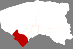 Dengkou in Bayannur | |
 Bayannur in Inner Mongolia | |
 Dengkou Location in Inner Mongolia  Dengkou Dengkou (China) | |
| Coordinates (Dengkou County government): 40°19′50″N 107°00′30″E / 40.3305°N 107.0082°E | |
| Country | China |
| Province | Inner Mongolia |
| Prefecture-level city | Bayannur |
| County seat | Bayangol |
| Area | |
| • Total | 3,748 km2 (1,447 sq mi) |
| Population (2020)[1] | |
| • Total | 90,196 |
| • Density | 24/km2 (62/sq mi) |
| Time zone | UTC+8 (China Standard) |
| Website | www |
| Dengkou County | |||||||
|---|---|---|---|---|---|---|---|
| Chinese name | |||||||
| Simplified Chinese | 磴口县 | ||||||
| Traditional Chinese | 磴口縣 | ||||||
| |||||||
| Mongolian name | |||||||
| Mongolian Cyrillic | Дөнкоу шянь | ||||||
| Mongolian script | ᠳ᠋ᠧᠩᠺᠧᠦ ᠰᠢᠶᠠᠨ | ||||||
| |||||||
Dengkou County (Mongolian: ᠳ᠋ᠧᠩᠺᠧᠦ ᠰᠢᠶᠠᠨ; Chinese: 磴口县), is a county with 90,196 inhabitants (2020) under the administration of Baynnur, in the west of Inner Mongolia. The total area of the county is 4,167 km2 (1,609 sq mi) with the seat in Bayangol.
Administrative divisions
Dengkou County is made up of 4 towns and 1 sum.
| Name | Simplified Chinese | Hanyu Pinyin | Mongolian (Hudum Script) | Mongolian (Cyrillic) | Administrative division code |
|---|---|---|---|---|---|
| Towns | |||||
| Bayangol Town | 巴彦高勒镇 | Bāyàngāolè Zhèn | ᠪᠠᠶᠠᠨᠭᠣᠣᠯ ᠪᠠᠯᠭᠠᠰᠤ | Баянгол балгас | 150822100 |
| Longshenghe Town | 隆盛合镇 | Lóngshènghé Zhèn | ᠯᠦᠩ ᠱᠧᠩ ᠾᠧ ᠪᠠᠯᠭᠠᠰᠤ | Лүн шен ге балгас | 150822101 |
| Dukou Town | 渡口镇 | Dùkǒu Zhèn | ᠳ᠋ᠦᠺᠧᠦ ᠪᠠᠯᠭᠠᠰᠤ | Туркев балгас | 150822102 |
| Bulang Nur Town | 补隆淖镇 | Bǔlóngnào Zhèn | ᠪᠤᠯᠤᠩ ᠨᠠᠭᠤᠷ ᠪᠠᠯᠭᠠᠰᠤ | Болон нуур балгас | 150822103 |
| Sum | |||||
| Xajin Tohoi Sum | 沙金套海苏木 | Shājīntàohǎi Sūmù | ᠱᠠᠵᠢᠨᠲᠣᠬᠣᠢ ᠰᠤᠮᠤ | Шажинтахуй сум | 150822200 |
Others:
- Ulan Buh Farm (乌兰布和农场)
- Bayan Tohoi Farm (巴彦套海农场)
- Hatan Tohoi Farm (哈腾套海农场)
- Bor Tohoi Farm (包尔盖农场)
- Narin Tohoi Farm (纳林套海农场)
- Desert Forestry Experimental Center, Chinese Academy of Forestry (中国林业科学研究院沙漠林业实验中心)
Climate
| Climate data for Dengkou (1991–2020 normals, extremes 1981–2010) | |||||||||||||
|---|---|---|---|---|---|---|---|---|---|---|---|---|---|
| Month | Jan | Feb | Mar | Apr | May | Jun | Jul | Aug | Sep | Oct | Nov | Dec | Year |
| Record high °C (°F) | 9.7 (49.5) |
17.8 (64.0) |
25.3 (77.5) |
33.7 (92.7) |
36.2 (97.2) |
40.3 (104.5) |
39.6 (103.3) |
37.8 (100.0) |
37.0 (98.6) |
28.0 (82.4) |
20.9 (69.6) |
12.2 (54.0) |
40.3 (104.5) |
| Average high °C (°F) | −2.4 (27.7) |
3.2 (37.8) |
10.7 (51.3) |
19.1 (66.4) |
25.3 (77.5) |
29.8 (85.6) |
31.6 (88.9) |
29.5 (85.1) |
24.4 (75.9) |
16.7 (62.1) |
7.0 (44.6) |
−0.8 (30.6) |
16.2 (61.1) |
| Daily mean °C (°F) | −9.0 (15.8) |
−4.2 (24.4) |
3.2 (37.8) |
11.7 (53.1) |
18.4 (65.1) |
23.3 (73.9) |
25.3 (77.5) |
23.1 (73.6) |
17.4 (63.3) |
9.3 (48.7) |
0.6 (33.1) |
−6.8 (19.8) |
9.4 (48.8) |
| Average low °C (°F) | −14.0 (6.8) |
−10 (14) |
−3.0 (26.6) |
4.6 (40.3) |
11.2 (52.2) |
16.4 (61.5) |
19.0 (66.2) |
17.1 (62.8) |
11.3 (52.3) |
3.7 (38.7) |
−4.1 (24.6) |
−11.3 (11.7) |
3.4 (38.1) |
| Record low °C (°F) | −27.2 (−17.0) |
−24.6 (−12.3) |
−20.1 (−4.2) |
−10.5 (13.1) |
−2.4 (27.7) |
4.8 (40.6) |
10.7 (51.3) |
7.5 (45.5) |
−1.6 (29.1) |
−9.5 (14.9) |
−22.3 (−8.1) |
−26.8 (−16.2) |
−27.2 (−17.0) |
| Average precipitation mm (inches) | 0.7 (0.03) |
1.1 (0.04) |
3.2 (0.13) |
6.1 (0.24) |
13.2 (0.52) |
25.4 (1.00) |
29.8 (1.17) |
36.3 (1.43) |
22.7 (0.89) |
7.5 (0.30) |
2.5 (0.10) |
0.8 (0.03) |
149.3 (5.88) |
| Average precipitation days (≥ 0.1 mm) | 0.8 | 0.8 | 1.5 | 1.6 | 3.6 | 5.3 | 7.0 | 6.2 | 4.3 | 2.0 | 1.3 | 0.8 | 35.2 |
| Average snowy days | 1.3 | 1.3 | 1.2 | 0.3 | 0.1 | 0 | 0 | 0 | 0 | 0.3 | 1.3 | 1.4 | 7.2 |
| Average relative humidity (%) | 53 | 44 | 38 | 31 | 33 | 40 | 50 | 54 | 52 | 48 | 51 | 51 | 45 |
| Mean monthly sunshine hours | 233.6 | 232.4 | 272.3 | 293.1 | 321.8 | 307.7 | 304.8 | 294.1 | 266.7 | 267.1 | 231.7 | 222.4 | 3,247.7 |
| Percent possible sunshine | 78 | 76 | 73 | 73 | 72 | 69 | 67 | 70 | 73 | 79 | 79 | 77 | 74 |
| Source: China Meteorological Administration[2][3] | |||||||||||||
References
- ^ Inner Mongolia: Prefectures, Cities, Districts and Counties
- ^ 中国气象数据网 – WeatherBk Data (in Simplified Chinese). China Meteorological Administration. Retrieved 10 October 2023.
- ^ 中国气象数据网 (in Simplified Chinese). China Meteorological Administration. Retrieved 10 October 2023.
This Inner Mongolia location article is a stub. You can help Wikipedia by expanding it. |