
DeWitt, Iowa | |
|---|---|
 Aerial view of DeWitt | |
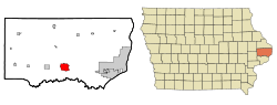 Location of DeWitt, Iowa | |
| Coordinates: 41°49′22″N 90°32′34″W / 41.82278°N 90.54278°W | |
| Country | |
| State | |
| County | Clinton |
| Area | |
| • Total | 6.23 sq mi (16.12 km2) |
| • Land | 6.22 sq mi (16.11 km2) |
| • Water | 0.00 sq mi (0.01 km2) |
| Elevation | 709 ft (216 m) |
| Population (2020) | |
| • Total | 5,514 |
| • Density | 886.21/sq mi (342.17/km2) |
| Time zone | UTC-6 (Central (CST)) |
| • Summer (DST) | UTC-5 (CDT) |
| ZIP code | 52742 |
| Area code | 563 |
| FIPS code | 19-21180 |
| GNIS feature ID | 0455826 |
| Website | www |
DeWitt[a] is a city in Clinton County, Iowa, United States. The population was 5,514 at the time of the 2020 census, which represented a 9.2% increase over that of 2000, making it the fastest growing city in Clinton County.[3]
History


DeWitt was platted in 1836.[4] The city started under the name Vandenburg, but was later[5] named after DeWitt Clinton (1769–1828), an early American politician who served as United States Senator and seventh Governor of New York.[6]
Ralph Waldo Emerson gave a lyceum lecture at DeWitt in January 1866.[7]
Geography
DeWitt is located at 41°49′22″N 90°32′34″W / 41.82278°N 90.54278°W (41.822684, -90.542643).[8]
According to the United States Census Bureau, the city has a total area of 5.98 square miles (15.49 km2), all land.[9]
Demographics
| Census | Pop. | Note | %± |
|---|---|---|---|
| 1870 | 1,749 | — | |
| 1880 | 1,608 | −8.1% | |
| 1890 | 1,359 | −15.5% | |
| 1900 | 1,383 | 1.8% | |
| 1910 | 1,654 | 19.6% | |
| 1920 | 1,849 | 11.8% | |
| 1930 | 2,041 | 10.4% | |
| 1940 | 2,205 | 8.0% | |
| 1950 | 2,644 | 19.9% | |
| 1960 | 3,224 | 21.9% | |
| 1970 | 3,647 | 13.1% | |
| 1980 | 4,512 | 23.7% | |
| 1990 | 4,514 | 0.0% | |
| 2000 | 5,049 | 11.9% | |
| 2010 | 5,322 | 5.4% | |
| 2020 | 5,514 | 3.6% | |
| U.S. Decennial Census[10][3] | |||

2010 census
As of the census[11] of 2010, there were 5,322 people, 2,208 households, and 1,415 families residing in the city. The population density was 890.0 inhabitants per square mile (343.6/km2). There were 2,306 housing units at an average density of 385.6 per square mile (148.9/km2). The racial makeup of the city was 97.1% White, 0.8% African American, 0.1% Native American, 0.4% Asian, 0.2% from other races, and 1.5% from two or more races. Hispanic or Latino of any race were 1.9% of the population.
There were 2,208 households, of which 32.4% had children under the age of 18 living with them, 50.9% were married couples living together, 10.2% had a female householder with no husband present, 3.0% had a male householder with no wife present, and 35.9% were non-families. 31.5% of all households were made up of individuals, and 15.9% had someone living alone who was 65 years of age or older. The average household size was 2.37 and the average family size was 2.99.
The median age in the city was 39.7 years. 25.3% of residents were under the age of 18; 7.4% were between the ages of 18 and 24; 24.1% were from 25 to 44; 26% were from 45 to 64; and 17.2% were 65 years of age or older. The gender makeup of the city was 47.4% male and 52.6% female.
The median income for a household in the city was $44,720, and the median income for a family was $54,063. Males had a median income of $37,951 versus $25,457 for females. The per capita income for the city was $19,717. About 2.8% of families and 6.2% of the population were below the poverty line, including 4.1% of those under age 18 and 10.1% of those age 65 or over.
Government
DeWitt is governed by a mayor and five-member council. The mayor is Steve Hasenmiller.[12]
Railroads
DeWitt is served by the Union Pacific along the south side on tracks originally built by the Chicago and Northwestern railroad. Until 1971, the Milwaukee Road entered DeWitt from the north and ran along 7th Avenue before crossing the tracks of the former Chicago & Northwestern into Scott County. The tracks between DeWitt and Eldridge Junction were abandoned in 1931.[13] The Milwaukee Road rail between Maquoketa and DeWitt was abandoned by 1970. Several buildings along 7th Avenue still show signs of former rail loading and unloading uses. These include a former paper box factory (now apartments) at the northwest corner of 7th Avenue and 7th Street as well as various sheds and elevator buildings between 5th and 7th Streets. What had served as the Chicago & Northwestern's Depot was destroyed by fire circa 1969 and never rebuilt. The depot for the Milwaukee Road's Depot was at the northeast corner of 7th Avenue and 7th Street. It was converted into commercial use, but has since been demolished.
Area highways
DeWitt is served by U.S. Highways 30 & 61. At one time the highways met at the northwest corner of the City Park to the north of the city center business district. By 1980 both highways were moved to new alignments around the south and west sides of DeWitt, first suggested in a plan from the early 1960s.
Education
DeWitt is home to the Central DeWitt Community School District. In addition to DeWitt, the nearby cities of Grand Mound, Low Moor, and Welton are also a part the school district.[14] It was previously known as the Central Clinton Community School District until July 1, 2014.[15]
St. Joseph Catholic Church operates a K-8 school. The Junior and High School portions was closed in the 1960s. The mascot for St. Joseph School is the Eagle.
Frances Banta Waggoner Community Library is the local community library.[16]
Media
The DeWitt Observer serves as DeWitt's primary local newspaper. In addition to DeWitt, The Observer also serves much of rural eastern Clinton County.[17]
Notable people
- David C. Hilmers, NASA astronaut
- JoAnna Lund, author and cook
- Casey Kreiter, NFL long snapper
- T.J. Sikkema, MLB pitcher
Notes
References
- ^ "2020 U.S. Gazetteer Files". United States Census Bureau. Retrieved March 16, 2022.
- ^ Sherman, Barney (September 14, 2017). "Iowa Place Names: A-E". Iowa Public Radio. Retrieved June 9, 2021.
- ^ a b "2020 Census State Redistricting Data". census.gov. United states Census Bureau. Retrieved August 12, 2021.
- ^ Wolfe, Patrick B. (1911). Wolfe's History of Clinton County, Iowa, Volume 1. B. F. Bowen. pp. 311.
- ^ Pratt, LeRoy. "The Counties and Courthouses of Iowa". Clinton County IaGenWeb. IAGenWeb. Archived from the original on September 9, 2004. Retrieved May 24, 2015.
- ^ Chicago and North Western Railway Company (1908). A History of the Origin of the Place Names Connected with the Chicago & North Western and Chicago, St. Paul, Minneapolis & Omaha Railways. p. 64.
- ^ Tom F. Wright (2013). The Cosmopolitan Lyceum: Lecture Culture and the Globe in Nineteenth-Century America. University of Massachusetts Press. p. 7.
- ^ "US Gazetteer files: 2010, 2000, and 1990". United States Census Bureau. February 12, 2011. Retrieved April 23, 2011.
- ^ "US Gazetteer files 2010". United States Census Bureau. Archived from the original on July 2, 2012. Retrieved May 11, 2012.
- ^ "Census of Population and Housing". Census.gov. Retrieved June 4, 2015.
- ^ "U.S. Census website". United States Census Bureau. Retrieved May 11, 2012.
- ^ "Mayor & Council".
- ^ Carpenter, Richard C. (2003). A Railroad Atlas of the United States in 1946. ISBN 9781421401461.
- ^ "Central Community School District Home Page". Archived from the original on July 24, 2012. Retrieved December 22, 2008.
- ^ "REORGANIZATION & DISSOLUTION ACTIONS SINCE 1965-66 Archived 2019-02-09 at the Wayback Machine." Iowa Department of Education. Retrieved on July 20, 2018.
- ^ Home. Frances Banta Waggoner Community Library. Retrieved on November 9, 2018.
- ^ The DeWitt Observer
External links
Municipalities and communities of Clinton County, Iowa, United States | ||
|---|---|---|
| Cities |  | |
| Townships | ||
| CDP | ||
| Other communities | ||
| Footnotes | ‡This populated place also has portions in an adjacent county or counties | |
| International | |
|---|---|
| National | |
| Geographic | |