
Dayton Lakes, Texas | |
|---|---|
 | |
| Coordinates: 30°8′44″N 94°49′18″W / 30.14556°N 94.82167°W | |
| Country | United States |
| State | Texas |
| County | Liberty |
| Area | |
| • Total | 0.97 sq mi (2.51 km2) |
| • Land | 0.86 sq mi (2.22 km2) |
| • Water | 0.11 sq mi (0.29 km2) |
| Elevation | 30 ft (9 m) |
| Population | |
| • Total | 93 |
| • Estimate (2019)[3] | 103 |
| • Density | 108.4/sq mi (41.86/km2) |
| Time zone | UTC-6 (Central (CST)) |
| • Summer (DST) | UTC-5 (CDT) |
| FIPS code | 48-19435[4] |
| GNIS feature ID | 1388550[5] |
Dayton Lakes is a city in Liberty County, Texas, United States. The population was 93 at the 2010 census. Prior to 1985 Dayton Lakes city was a developed and marketed recreational subdivision named Dayton Lake Estates. In January 1985 the corporation that marketed the original subdivision held and election of residents and when the election was successful, they petitioned the District Court in Liberty County, Texas and The City of Dayton Lakes, TX, a Non Profit Corporation, was created as a city/town. The actual document was filed and recorded on January 19, 1985. Those corporate papers are the city's legal identity.[2]
YouTube Encyclopedic
-
1/3Views:37 0962 135587
-
Chain-O-Lakes Resort (Texas Country Reporter)
-
Casa Movil Houston - 713-960-4773
-
Best Houston Texas DWI Lawyer/Attorney Charles Kingsbury
Transcription
Geography
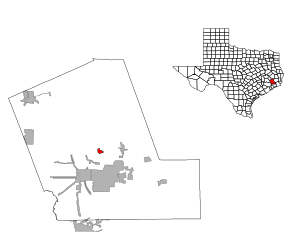
Dayton Lakes is located in central Liberty County at 30°8′44″N 94°49′18″W / 30.14556°N 94.82167°W (30.145428, –94.821686),[6] on the west bank of the Trinity River. It is 11 miles (18 km) northeast of Dayton, and 17 miles (27 km) by road north of Liberty, the county seat, but only 6 miles (10 km) as the crow flies.
According to the United States Census Bureau, the city of Dayton Lakes has a total area of 0.97 square miles (2.5 km2), of which 0.85 square miles (2.2 km2) are land and 0.1 square miles (0.3 km2), or 11.64%, are water.[1]
Demographics
| Census | Pop. | Note | %± |
|---|---|---|---|
| 1990 | 191 | — | |
| 2000 | 101 | −47.1% | |
| 2010 | 93 | −7.9% | |
| 2019 (est.) | 103 | [3] | 10.8% |
| U.S. Decennial Census[7] | |||
As of the census[4] of 2000, there were 101 people, 43 households, and 26 families residing in the city. The population density was 120.4 inhabitants per square mile (46.5/km2). There were 78 housing units at an average density of 93.0 per square mile (35.9/km2). The racial makeup of the city was 99.01% White and 0.99% African American.
There were 43 households, out of which 30.2% had children under the age of 18 living with them, 44.2% were married couples living together, 2.3% had a female householder with no husband present, and 39.5% were non-families. 34.9% of all households were made up of individuals, and 4.7% had someone living alone who was 65 years of age or older. The average household size was 2.35 and the average family size was 2.96.
In the city, the population was spread out, with 27.7% under the age of 18, 3.0% from 18 to 24, 34.7% from 25 to 44, 24.8% from 45 to 64, and 9.9% who were 65 years of age or older. The median age was 36 years. For every 100 females, there were 119.6 males. For every 100 females age 18 and over, there were 151.7 males.
The median income for a household in the city was $37,083, and the median income for a family was $30,938. Males had a median income of $40,750 versus $23,750 for females. The per capita income for the city was $12,873. There were 20.7% of families and 27.2% of the population living below the poverty line, including 30.8% of under eighteens and none of those over 64.
Education
The city of Dayton Lakes is served by the Dayton Independent School District.
References
- ^ a b "2019 U.S. Gazetteer Files". United States Census Bureau. Retrieved January 20, 2021.
- ^ a b "Total Population: 2010 Census DEC Summary File 1 (P1), Dayton Lakes city, Texas". data.census.gov. U.S. Census Bureau. Retrieved January 20, 2021.
- ^ a b "Population and Housing Unit Estimates". United States Census Bureau. May 24, 2020. Retrieved May 27, 2020.
- ^ a b "U.S. Census website". United States Census Bureau. Retrieved January 31, 2008.
- ^ "US Board on Geographic Names". United States Geological Survey. October 25, 2007. Retrieved January 31, 2008.
- ^ "US Gazetteer files: 2010, 2000, and 1990". United States Census Bureau. February 12, 2011. Retrieved April 23, 2011.
- ^ "Census of Population and Housing". Census.gov. Retrieved June 4, 2015.
Municipalities and communities of Liberty County, Texas, United States | ||
|---|---|---|
| Cities |  | |
| Town | ||
| CDPs | ||
| Other communities | ||
| Footnotes | ‡This populated place also has portions in an adjacent county or counties | |