
Davlekanovo
Давлеканово | |
|---|---|
| Other transcription(s) | |
| • Bashkir | Дәүләкән Däwläkän |
 | |
 Coat of arms | |
Location of Davlekanovo  | |
 Davlekanovo Location of Davlekanovo 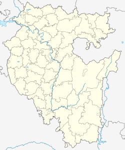 Davlekanovo Davlekanovo (Bashkortostan) | |
| Coordinates: 54°13′N 55°02′E / 54.217°N 55.033°E | |
| Country | Russia |
| Federal subject | Bashkortostan[1] |
| Known since | mid-18th century |
| Town status since | 1942 |
| Elevation | 110 m (360 ft) |
| Population | |
| • Total | 24,073 |
| • Estimate (2018)[3] | 23,662 (−1.7%) |
| • Subordinated to | town of republic significance of Davlekanovo[1] |
| • Capital of | Davlekanovsky District,[4] town of republic significance of Davlekanovo[1] |
| • Municipal district | Davlekanovsky Municipal District[5] |
| • Urban settlement | Davlekanovo Urban Settlement[5] |
| • Capital of | Davlekanovsky Municipal District,[5] Davlekanovo Urban Settlement[5] |
| Time zone | UTC+5 (MSK+2 |
| Postal code(s)[7] | 453400–453409 |
| OKTMO ID | 80622101001 |

Davlekanovo (Russian: Давлеканово; Bashkir: Дәүләкән, Däwläkän) is a town in the Republic of Bashkortostan, Russia, located on the Dyoma River 90 kilometers (56 mi) west of Ufa. Population: 24,073 (2010 Census);[2] 23,860 (2002 Census);[8] 21,911 (1989 Census).[9] It was previously known as Itkulovo.
YouTube Encyclopedic
-
1/1Views:346
-
заброшенный лагерь "Березка" (СТРАШНЫЕ КУКЛЫ!)
Transcription
History
In the mid-18th century it was called Itkulovo (Иткулово); later renamed Davlekanovo.[citation needed][when?] Urban-type settlement status was granted to it in 1928 and town status was granted in 1942.[citation needed]
Administrative and municipal status
Within the framework of administrative divisions, Davlekanovo serves as the administrative center of Davlekanovsky District,[4] even though it is not a part of it.[1] As an administrative division, it is incorporated separately as the town of republic significance of Davlekanovo—an administrative unit with the status equal to that of the districts.[1] As a municipal division, the town of republic significance of Davlekanovo is incorporated within Davlekanovsky Municipal District as Davlekanovo Urban Settlement.[5]
Climate
The average annual temperature is 3.8 °C (38.8 °F), ranging from −11.7 °C (10.9 °F) in January to 20.6 °C (69.1 °F) in July.[citation needed]
Demographics
Ethnic composition:[citation needed]
- Russians: 36%
- Bashkirs: 32%
- Tatars: 20%
- Chuvash people: 5%
- Ukrainians: 5%
- others: 2%
References
Notes
- ^ a b c d e f Resolution #391
- ^ a b Russian Federal State Statistics Service (2011). Всероссийская перепись населения 2010 года. Том 1 [2010 All-Russian Population Census, vol. 1]. Всероссийская перепись населения 2010 года [2010 All-Russia Population Census] (in Russian). Federal State Statistics Service.
- ^ "26. Численность постоянного населения Российской Федерации по муниципальным образованиям на 1 января 2018 года". Federal State Statistics Service. Retrieved January 23, 2019.
- ^ a b Государственный комитет Российской Федерации по статистике. Комитет Российской Федерации по стандартизации, метрологии и сертификации. №ОК 019-95 1 января 1997 г. «Общероссийский классификатор объектов административно-территориального деления. Код 80 222», в ред. изменения №278/2015 от 1 января 2016 г.. (State Statistics Committee of the Russian Federation. Committee of the Russian Federation on Standardization, Metrology, and Certification. #OK 019-95 January 1, 1997 Russian Classification of Objects of Administrative Division (OKATO). Code 80 222, as amended by the Amendment #278/2015 of January 1, 2016. ).
- ^ a b c d e Law #126-z
- ^ "Об исчислении времени". Официальный интернет-портал правовой информации (in Russian). June 3, 2011. Retrieved January 19, 2019.
- ^ Почта России. Информационно-вычислительный центр ОАСУ РПО. (Russian Post). Поиск объектов почтовой связи (Postal Objects Search) (in Russian)
- ^ Russian Federal State Statistics Service (May 21, 2004). Численность населения России, субъектов Российской Федерации в составе федеральных округов, районов, городских поселений, сельских населённых пунктов – районных центров и сельских населённых пунктов с населением 3 тысячи и более человек [Population of Russia, Its Federal Districts, Federal Subjects, Districts, Urban Localities, Rural Localities—Administrative Centers, and Rural Localities with Population of Over 3,000] (XLS). Всероссийская перепись населения 2002 года [All-Russia Population Census of 2002] (in Russian).
- ^ Всесоюзная перепись населения 1989 г. Численность наличного населения союзных и автономных республик, автономных областей и округов, краёв, областей, районов, городских поселений и сёл-райцентров [All Union Population Census of 1989: Present Population of Union and Autonomous Republics, Autonomous Oblasts and Okrugs, Krais, Oblasts, Districts, Urban Settlements, and Villages Serving as District Administrative Centers]. Всесоюзная перепись населения 1989 года [All-Union Population Census of 1989] (in Russian). Институт демографии Национального исследовательского университета: Высшая школа экономики [Institute of Demography at the National Research University: Higher School of Economics]. 1989 – via Demoscope Weekly.
Sources
- Правительство Республики Башкортостан. Постановление №391 от 29 декабря 2006 г. «Об утверждении реестра административно-территориальных единиц и населённых пунктов Республики Башкортостан», в ред. Постановления №61 от 26 февраля 2013 г. «О внесении изменений в реестр административно-территориальных единиц и населённых пунктов Республики Башкортостан». Опубликован: "Ведомости Государственного Собрания – Курултая, Президента и Правительства Республики Башкортостан", №5 (251), ст. 239, 12 марта 2007 г. (Government of the Republic of Bashkortostan. Resolution #391 of December 29, 2006 On Adoption of the Registry of the Administrative-Territorial Entities and Inhabited Localities of the Republic of Bashkortostan, as amended by the Resolution #61 of February 26, 2013 On Amending the Registry of the Administrative-Territorial Entities and Inhabited Localities of the Republic of Bashkortostan. ).
- Государственное Собрание —Курултай Республики Башкортостан. Закон №162-з от 17 декабря 2004 г. «О границах, статусе и административных центрах муниципальных образований в Республике Башкортостан», в ред. Закона №572-з от 17 июля 2012 г. «О внесении изменения в статью 2 Закона Республики Башкортостан "О границах, статусе и административных центрах муниципальных образований в Республике Башкортостан"». Вступил в силу в соответствии со статьёй 33. Опубликован: "Республика Башкортостан", №52 (25785), 22 марта 2005 г. (State Assembly of Bashkortostan—El Kurultai. Law #162-z of December 17, 2004 On the Borders, Status, and Administrative Centers of the Municipal Formations in the Republic of Bashkortostan, as amended by the Law #572-z of July 17, 2012 On Amending Article 2 of the Law of the Republic of Bashkortostan "On the Borders, Status, and Administrative Centers of the Municipal Formations in the Republic of Bashkortostan". Effective as of the date established in accordance with the provisions of Article 33.).
External links
- Official website of Davlekanovo Archived January 18, 2019, at the Wayback Machine (in Russian)
- Davlekanovo Business Directory (in Russian)