Datu Anggal Midtimbang | |
|---|---|
| Municipality of Datu Anggal Midtimbang | |
 Municipal Compound | |
 Flag  Seal | |
 Map of Maguindanao del Sur with Datu Anggal Midtimbang highlighted | |
 | |
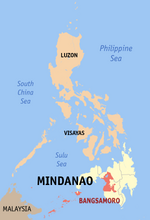
 Datu Anggal Midtimbang Location within the Philippines | |
| Coordinates: 7°00′33″N 124°19′39″E / 7.009231°N 124.327539°E | |
| Country | Philippines |
| Region | Bangsamoro Autonomous Region in Muslim Mindanao |
| Province | Maguindanao del Sur |
| District | Lone district |
| Founded | December 30, 2006 |
| Barangays | 7 (see Barangays) |
| Government | |
| • Type | Sangguniang Bayan |
| • Mayor | Maryjoy Estephanie U. Midtimbang |
| • Vice Mayor | Datu Jomar U. Midtimbang |
| • Representative | Mohamad P. Paglas Sr. |
| • Municipal Council | Members |
| • Electorate | 15,628 voters (2022) |
| Area | |
| • Total | 85.43 km2 (32.98 sq mi) |
| Elevation | 52 m (171 ft) |
| Highest elevation | 345 m (1,132 ft) |
| Lowest elevation | 2 m (7 ft) |
| Population (2020 census)[3] | |
| • Total | 28,224 |
| • Density | 330/km2 (860/sq mi) |
| • Households | 4,409 |
| Economy | |
| • Poverty incidence | 69.48 |
| • Revenue | ₱ 93.87 million (2020) |
| • Assets | ₱ 41.27 million (2020) |
| • Expenditure | ₱ 85.64 million (2020) |
| • Liabilities | ₱ 3.429 million (2020) |
| Service provider | |
| • Electricity | Maguindanao Electric Cooperative (MAGELCO) |
| Time zone | UTC+8 (PST) |
| ZIP code | 9612 |
| PSGC | |
| IDD : area code | +63 (0)64 |
| Native languages | Maguindanao Tagalog |
Datu Anggal Midtimbang, officially the Municipality of Datu Anggal Midtimbang (Maguindanaon: Ingud nu Datu Anggal Midtimbang; Iranun: Inged a Datu Anggal Midtimbang; Tagalog: Bayan ng Datu Anggal Midtimbang), is a municipality in the province of Maguindanao del Sur, Philippines. According to the 2020 census, it has a population of 28,224 people.[3]
YouTube Encyclopedic
-
1/1Views:632
-
Islamic Symposium in Remembrance of the Late Benjie D. Midtimbang at Camp Darapanan, Sultan Kudarat
Transcription
Etymology
The name originated from the complete name of the most respected man of Talayan, DATU ANGNGAL MIDTIMBANG. He is the father of Datu Udzag Midtimbang.,the first mayor and the founder of empire Talayan Maguindanao, Datu Midpantao Sr., the former mayor of the municipality of Guindulungan, and Datu Ali Midtimbang Sr., the former mayor of Talayan Maguindanao.
History
During the second regular session of the fifth legislative assembly of the Autonomous Region in Muslim Mindanao, the regional legislature created Datu Anggal Midtimbang out of three barangays of Talayan and four from Talitay, by virtue of Muslim Mindanao Autonomy Act No. 207,[5] which was subsequently ratified in a plebiscite held on December 30, 2006.[6]
The ARMM law creating the municipality provides that its administrative center shall be established in barangay Brar.
Geography
Barangays
Datu Anggal Midtimbang is politically subdivided into 7 barangays.[7] Each barangay consists of puroks while some have sitios.
- Adaon
- Brar
- Mapayag
- Midtimbang (Poblacion)
- Nunangan (Nunangen)
- Tugal
- Tulunan
Climate
| Climate data for Datu Anggal Midtimbang, Maguindanao | |||||||||||||
|---|---|---|---|---|---|---|---|---|---|---|---|---|---|
| Month | Jan | Feb | Mar | Apr | May | Jun | Jul | Aug | Sep | Oct | Nov | Dec | Year |
| Mean daily maximum °C (°F) | 31 (88) |
32 (90) |
32 (90) |
32 (90) |
31 (88) |
30 (86) |
29 (84) |
29 (84) |
30 (86) |
30 (86) |
30 (86) |
31 (88) |
31 (87) |
| Mean daily minimum °C (°F) | 21 (70) |
21 (70) |
22 (72) |
23 (73) |
23 (73) |
23 (73) |
23 (73) |
23 (73) |
23 (73) |
23 (73) |
23 (73) |
22 (72) |
23 (72) |
| Average precipitation mm (inches) | 30 (1.2) |
19 (0.7) |
23 (0.9) |
24 (0.9) |
64 (2.5) |
88 (3.5) |
102 (4.0) |
105 (4.1) |
76 (3.0) |
82 (3.2) |
60 (2.4) |
26 (1.0) |
699 (27.4) |
| Average rainy days | 9.8 | 8.5 | 11.3 | 11.9 | 21.6 | 23.9 | 24.1 | 24.5 | 20.9 | 21.8 | 16.8 | 11.8 | 206.9 |
| Source: Meteoblue (modeled/calculated data, not measured locally)[8] | |||||||||||||
Demographics
| Year | Pop. | ±% p.a. |
|---|---|---|
| 2007 | 23,713 | — |
| 2010 | 13,339 | −18.89% |
| 2015 | 25,016 | +12.72% |
| 2020 | 28,224 | +2.40% |
| Source: Philippine Statistics Authority[9][10][11][12] | ||
Economy
References
- ^ Municipality of Datu Anggal Midtimbang | (DILG)
- ^ "2015 Census of Population, Report No. 3 – Population, Land Area, and Population Density" (PDF). Philippine Statistics Authority. Quezon City, Philippines. August 2016. ISSN 0117-1453. Archived (PDF) from the original on May 25, 2021. Retrieved July 16, 2021.
- ^ a b Census of Population (2020). "Bangsamoro (BARMM)". Total Population by Province, City, Municipality and Barangay. Philippine Statistics Authority. Retrieved 8 July 2021.
- ^ "PSA Releases the 2018 Municipal and City Level Poverty Estimates". Philippine Statistics Authority. 15 December 2021. Retrieved 22 January 2022.
- ^ "Muslim Mindanao Autonomy Act No. 207; An Act Creating the Municipality of Datu Anggal Midtimbang in the Province of Maguindanao, Providing Funds Therefor, and for Other Purposes" (PDF). Regional Legislative Assembly, Autonomous Region in Muslim Mindanao. Retrieved 27 January 2016.
- ^ National Statistical Coordination Board (2007-03-26). "2007 Factsheet - Did you know that... ARMM now has six provinces". Archived from the original on 2008-07-04. Retrieved 2008-05-19.
- ^ National Statistical Coordination Board. "PSGC Interactive: Municipality/City: DATU ANGGAL MIDTIMBANG". Archived from the original on 2007-11-24. Retrieved 2008-05-19.
- ^ "Datu Anggal Midtimbang, Maguindanao: Average Temperatures and Rainfall". Meteoblue. Retrieved 19 January 2019.
- ^ Census of Population (2015). "ARMM – Autonomous Region in Muslim Mindanao". Total Population by Province, City, Municipality and Barangay. Philippine Statistics Authority. Retrieved 20 June 2016.
- ^ Census of Population and Housing (2010). "ARMM – Autonomous Region in Muslim Mindanao" (PDF). Total Population by Province, City, Municipality and Barangay. National Statistics Office. Retrieved 29 June 2016.
- ^ Censuses of Population (1903–2007). "ARMM – Autonomous Region in Muslim Mindanao". Table 1. Population Enumerated in Various Censuses by Province/Highly Urbanized City: 1903 to 2007. National Statistics Office.
{{cite encyclopedia}}: CS1 maint: numeric names: authors list (link) - ^ "Province of Maguindanao". Municipality Population Data. Local Water Utilities Administration Research Division. Retrieved 17 December 2016.
- ^ "Poverty incidence (PI):". Philippine Statistics Authority. Retrieved December 28, 2020.
- ^ "City and Municipal Level Poverty Estimates; 2006 and 2009" (PDF). Philippine Statistics Authority. 3 August 2012.
- ^ "2012 Municipal and City Level Poverty Estimates" (PDF). Philippine Statistics Authority. 31 May 2016.
- ^ "Municipal and City Level Small Area Poverty Estimates; 2009, 2012 and 2015". Philippine Statistics Authority. 10 July 2019.
- ^ "PSA Releases the 2018 Municipal and City Level Poverty Estimates". Philippine Statistics Authority. 15 December 2021. Retrieved 22 January 2022.
External links
- Datu Anggal Midtimbang Profile at the DTI Cities and Municipalities Competitive Index
- MMA Act No. 206 : An Act Creating the Municipality of Datu Anggal Midtimbang in the Province of Maguindanao
- Philippine Standard Geographic Code
- Local Governance Performance Management System Archived 2014-03-14 at the Wayback Machine