
Danglas | |
|---|---|
| Municipality of Danglas, Municipal District of Danglas | |
 Flag  Seal | |
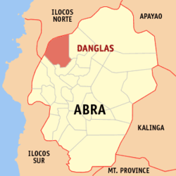 Map of Abra with Danglas highlighted | |
OpenStreetMap  | |
 Danglas Location within the Philippines | |
| Coordinates: 17°41′35″N 120°39′55″E / 17.6931°N 120.6653°E | |
| Country | Philippines |
| Region | Cordillera Administrative Region |
| Province | Abra |
| District | Lone district |
| Barangays | 7 (see Barangays) |
| Government | |
| • Type | Sangguniang Bayan |
| • Mayor | Denise Florence B. Bragas |
| • Vice Mayor | Esther B. Bernos |
| • Representative | Menchie B. Bernos |
| • Municipal Council | Members |
| • Electorate | 3,502 voters (2022) |
| Area | |
| • Total | 156.02 km2 (60.24 sq mi) |
| Elevation | 161 m (528 ft) |
| Highest elevation | 812 m (2,664 ft) |
| Lowest elevation | 44 m (144 ft) |
| Population (2020 census)[3] | |
| • Total | 4,074 |
| • Density | 26/km2 (68/sq mi) |
| • Households | 989 |
| Economy | |
| • Income class | 5th municipal income class |
| • Poverty incidence | 23.22 |
| • Revenue | ₱ 74.51 million (2020) |
| • Assets | ₱ 262.7 million (2020) |
| • Expenditure | ₱ 81.77 million (2020) |
| • Liabilities | ₱ 88.27 million (2020) |
| Service provider | |
| • Electricity | Abra Electric Cooperative (ABRECO) |
| Time zone | UTC+8 (PST) |
| ZIP code | 2825 |
| PSGC | |
| IDD : area code | +63 (0)74 |
| Native languages | Itneg Ilocano Tagalog |
Danglas, officially the Municipality of Danglas, Municipal District of Danglas (Ilocano: Ili ti Danglas; Tagalog: Bayan ng Danglas), is a 5th class municipality in the province of Abra, Philippines. According to the 2020 census, it has a population of 4,074 people.[3]
YouTube Encyclopedic
-
1/1Views:441
-
DANGLAS BELENISMO 2021; featuring Disney PIXAR (Danglas, Abra, Philippines)
Transcription
Geography
According to the Philippine Statistics Authority, the municipality has a land area of 156.02 square kilometres (60.24 sq mi) [5] constituting 3.75% of the 4,165.25-square-kilometre- (1,608.21 sq mi) total area of Abra.
Climate
| Climate data for Danglas, Abra | |||||||||||||
|---|---|---|---|---|---|---|---|---|---|---|---|---|---|
| Month | Jan | Feb | Mar | Apr | May | Jun | Jul | Aug | Sep | Oct | Nov | Dec | Year |
| Mean daily maximum °C (°F) | 29 (84) |
30 (86) |
32 (90) |
33 (91) |
32 (90) |
31 (88) |
30 (86) |
29 (84) |
30 (86) |
30 (86) |
30 (86) |
29 (84) |
30 (87) |
| Mean daily minimum °C (°F) | 18 (64) |
19 (66) |
20 (68) |
22 (72) |
24 (75) |
24 (75) |
24 (75) |
24 (75) |
23 (73) |
22 (72) |
20 (68) |
19 (66) |
22 (71) |
| Average precipitation mm (inches) | 9 (0.4) |
11 (0.4) |
13 (0.5) |
23 (0.9) |
92 (3.6) |
122 (4.8) |
153 (6.0) |
137 (5.4) |
139 (5.5) |
141 (5.6) |
42 (1.7) |
14 (0.6) |
896 (35.4) |
| Average rainy days | 4.6 | 4.0 | 6.2 | 9.1 | 19.5 | 23.2 | 24.0 | 22.5 | 21.5 | 15.2 | 10.5 | 6.0 | 166.3 |
| Source: Meteoblue (modeled/calculated data, not measured locally)[6] | |||||||||||||
Barangays
Danglas is politically subdivided into 7 barangays.[7] Each barangay consists of puroks and some have sitios.
| PSGC | Barangay | Population | ±% p.a. | |||
|---|---|---|---|---|---|---|
| 2020[3] | 2010[8] | |||||
| 140106001 | Abaquid | 8.1% | 331 | 423 | −2.42% | |
| 140106003 | Cabaruan | 15.9% | 648 | 650 | −0.03% | |
| 140106004 | Caupasan (Poblacion) | 29.2% | 1,189 | 1,398 | −1.61% | |
| 140106005 | Danglas | 9.7% | 396 | 479 | −1.88% | |
| 140106006 | Nagaparan | 20.3% | 827 | 819 | 0.10% | |
| 140106007 | Padangitan | 10.2% | 417 | 502 | −1.84% | |
| 140106008 | Pangal | 6.5% | 266 | 463 | −5.39% | |
| Total | 4,074 | 4,074 | 0.00% | |||
Demographics
| Year | Pop. | ±% p.a. |
|---|---|---|
| 1918 | 2,108 | — |
| 1939 | 1,794 | −0.77% |
| 1948 | 1,738 | −0.35% |
| 1960 | 2,475 | +2.99% |
| 1970 | 2,508 | +0.13% |
| 1975 | 2,572 | +0.51% |
| 1980 | 2,657 | +0.65% |
| 1990 | 3,042 | +1.36% |
| 1995 | 4,285 | +6.63% |
| 2000 | 4,144 | −0.71% |
| 2007 | 5,411 | +3.75% |
| 2010 | 4,734 | −4.75% |
| 2015 | 4,192 | −2.29% |
| 2020 | 4,074 | −0.56% |
| Source: Philippine Statistics Authority[9][8][10][11] | ||
In the 2020 census, Danglas had a population of 4,074.[3] The population density was 26 inhabitants per square kilometre (67/sq mi).
Economy
The economy of the municipality is heavily dependent on agriculture particularly palay, corn, vegetables and fruits. Other raw materials include rattan and bamboos.
Government
Local government
Danglas, belonging to the lone congressional district of the province of Abra, is governed by a mayor designated as its local chief executive and by a municipal council as its legislative body in accordance with the Local Government Code. The mayor, vice mayor, and the councilors are elected directly by the people through an election which is being held every three years.
Elected officials
| Position | Name |
|---|---|
| Congressman | Joseph Santo Niño B. Bernos |
| Mayor | Denise Florence B. Bragas |
| Vice-Mayor | Esther B. Bernos |
| Councilors | Nestor B. Alcartado |
| Jonathan H. Layugan | |
| Carmelo M. Acnam | |
| Genaro B. Alita | |
| Dominador S. Acnam | |
| Vivencio M. Bringas | |
| Herbert H. Hernandez | |
| Zenaida F. Balucas |
References
- ^ Municipality of Danglas | (DILG)
- ^ "2015 Census of Population, Report No. 3 – Population, Land Area, and Population Density" (PDF). Philippine Statistics Authority. Quezon City, Philippines. August 2016. ISSN 0117-1453. Archived (PDF) from the original on May 25, 2021. Retrieved July 16, 2021.
- ^ a b c d Census of Population (2020). "Cordillera Administrative Region (CAR)". Total Population by Province, City, Municipality and Barangay. Philippine Statistics Authority. Retrieved 8 July 2021.
- ^ "PSA Releases the 2018 Municipal and City Level Poverty Estimates". Philippine Statistics Authority. 15 December 2021. Retrieved 22 January 2022.
- ^ "Province: Abra". PSGC Interactive. Quezon City, Philippines: Philippine Statistics Authority. Retrieved 12 November 2016.
- ^ "Danglas: Average Temperatures and Rainfall". Meteoblue. Retrieved 25 April 2020.
- ^ "Municipal: Danglas". PSGC Interactive. Quezon City, Philippines: Philippine Statistics Authority. Retrieved 8 January 2016.
- ^ a b Census of Population and Housing (2010). "Cordillera Administrative Region (CAR)" (PDF). Total Population by Province, City, Municipality and Barangay. National Statistics Office. Retrieved 29 June 2016.
- ^ Census of Population (2015). "Cordillera Administrative Region (CAR)". Total Population by Province, City, Municipality and Barangay. Philippine Statistics Authority. Retrieved 20 June 2016.
- ^ Censuses of Population (1903–2007). "Cordillera Administrative Region (CAR)". Table 1. Population Enumerated in Various Censuses by Province/Highly Urbanized City: 1903 to 2007. National Statistics Office.
{{cite encyclopedia}}: CS1 maint: numeric names: authors list (link) - ^ "Province of Abra". Municipality Population Data. Local Water Utilities Administration Research Division. Retrieved 17 December 2016.
- ^ "Poverty incidence (PI):". Philippine Statistics Authority. Retrieved December 28, 2020.
- ^ "Estimation of Local Poverty in the Philippines" (PDF). Philippine Statistics Authority. 29 November 2005.
- ^ "2003 City and Municipal Level Poverty Estimates" (PDF). Philippine Statistics Authority. 23 March 2009.
- ^ "City and Municipal Level Poverty Estimates; 2006 and 2009" (PDF). Philippine Statistics Authority. 3 August 2012.
- ^ "2012 Municipal and City Level Poverty Estimates" (PDF). Philippine Statistics Authority. 31 May 2016.
- ^ "Municipal and City Level Small Area Poverty Estimates; 2009, 2012 and 2015". Philippine Statistics Authority. 10 July 2019.
- ^ "PSA Releases the 2018 Municipal and City Level Poverty Estimates". Philippine Statistics Authority. 15 December 2021. Retrieved 22 January 2022.
- ^ "2019 National and Local Elections" (PDF). Commission on Elections. Retrieved March 11, 2022.
External links
 Media related to Danglas at Wikimedia Commons
- Philippine Standard Geographic Code
Places adjacent to Danglas | |
|---|---|
Bangued (capital and largest municipality) | |
| Municipalities | |
| Barangays | |
This article about a location in the Cordillera Administrative Region is a stub. You can help Wikipedia by expanding it. |