
Dalrymple
| |
|---|---|
Dalrymple Railway Viaduct to the north of the village | |
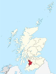
 Dalrymple Location within East Ayrshire | |
| Population | 1,660 (mid-2020 est.)[1] |
| OS grid reference | NS361146 |
| Council area | |
| Lieutenancy area | |
| Country | Scotland |
| Sovereign state | United Kingdom |
| Post town | AYR |
| Postcode district | KA6 |
| Police | Scotland |
| Fire | Scottish |
| Ambulance | Scottish |
| UK Parliament | |
| Scottish Parliament | |
Dalrymple (Scots: Drumple)[2] is a village and parish in East Ayrshire, Scotland, lying in the Doon Valley on the north bank of the River Doon. The population is around 1,347.[3]
The name Dalrymple comes from Gaelic meaning "flat field of the crooked pool or river".[3] The village is relatively modern, although the parish and church of Dalrymple are older. When the community was first established around 1800, there were two streets, Main Street and Garden Street. The village grew slowly until the late 20th century, when council housing was built to house families from coal-mining villages in the area that were suffering an economic decline.
It has about 1,000 houses. There are two pubs, The Kirkton Inn; a hotel with self-catering studios, a restaurant, a hairdresser, shops, a chemist and post office, as well as a primary school. The village is in the catchment area for high schools in Ayr, Maybole and Dalmellington. Ayr is six miles (ten kilometres) north of Dalrymple by road.
The River Doon remains the boundary of the village on the southern end, and Purclewan Burn to the west and north.
Newer housing developments have tended to be on the eastern side of the village.
By the mid-20th century most of the housing had been built by the local Council. However, starting in the 1980s, many houses were purchased by their occupants and more recently, all new developments have been private.
The older part of the Village (Garden Street, Main Street and surrounding streets) is affectionately referred to as the 'bottom end' (of the village) by the inhabitants of Dalrymple and the newer part is called the 'top end'.
YouTube Encyclopedic
-
1/3Views:24 8871 852355
-
The History of AYR - Short Scottish Film/Documentary - 2016 HD
-
Old Photographs Patna East Ayrshire Scotland
-
Alexander Dalrymple Gravestone Auld Aisle Cemetery Kirkintilloch East Dunbartonshire Scotland
Transcription
See also
References
- ^ "Mid-2020 Population Estimates for Settlements and Localities in Scotland". National Records of Scotland. 31 March 2022. Retrieved 31 March 2022.
- ^ The Online Scots Dictionary
- ^ a b "Dalrymple". East Ayrshire Council. Archived from the original on 20 July 2008. Retrieved 4 June 2008.
External links
 Media related to Dalrymple, East Ayrshire at Wikimedia Commons
| International | |
|---|---|
| National | |
This East Ayrshire location article is a stub. You can help Wikipedia by expanding it. |