
Daggett Township, Michigan | |
|---|---|
 Community of Daggett along U.S. Route 41 | |
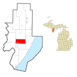 Location within Menominee County (red) and the administered village of Daggett (pink) | |
 Daggett Township Location within the state of Michigan  Daggett Township Daggett Township (the United States) | |
| Coordinates: 45°28′45″N 87°34′10″W / 45.47917°N 87.56944°W | |
| Country | United States |
| State | Michigan |
| County | Menominee |
| Area | |
| • Total | 36.1 sq mi (93 km2) |
| • Land | 35.9 sq mi (93 km2) |
| • Water | 0.2 sq mi (0.5 km2) |
| Elevation | 771 ft (235 m) |
| Population | |
| • Total | 614 |
| • Density | 17.1/sq mi (6.6/km2) |
| Time zone | UTC-6 (Central (CST)) |
| • Summer (DST) | UTC-5 (CDT) |
| ZIP Codes | 49821 (Daggett) 49887 (Stephenson) |
| Area code | 906 |
| FIPS code | 26-109-19580[3] |
| GNIS feature ID | 1626155[4] |
Daggett Township is a civil township of Menominee County in the U.S. state of Michigan. The population was 614 at the 2020 census,[2] down from 714 in 2010. The village of Daggett is located within the township.
YouTube Encyclopedic
-
1/2Views:4751 579
-
"Sighting The Enemy" Monroe Michigan Memorial & General Custar
-
Walloon Lake, Foot Basin, North Shore 2012
Transcription
Geography
The township is south of the geographic center of Menominee County, with the village of Daggett in the southwest part of the township. U.S. Route 41 crosses the west side of the township, passing through the east side of Daggett village and leading north 9 miles (14 km) to Carney and south 25 miles (40 km) to Menominee, the county seat.
According to the United States Census Bureau, the township has a total area of 36.1 square miles (93 km2), of which 35.9 square miles (93 km2) are land and 0.2 square miles (0.5 km2), or 0.43%, are water.[1] The Little Cedar River crosses the west side in a wandering fashion, flowing south toward the Menominee River.
Demographics
| Census | Pop. | Note | %± |
|---|---|---|---|
| 1930 | 954 | — | |
| 1940 | 923 | −3.2% | |
| 1950 | 885 | −4.1% | |
| 1960 | 739 | −16.5% | |
| 1970 | 777 | 5.1% | |
| 1980 | 803 | 3.3% | |
| 1990 | 745 | −7.2% | |
| 2000 | 740 | −0.7% | |
| 2010 | 714 | −3.5% | |
| 2020 | 614 | −14.0% | |
| U.S. Decennial Census[5] | |||
As of the census[3] of 2000, there were 740 people, 284 households, and 209 families residing in the township. In 2020, its population was 614.[2]
References
- ^ a b "2022 U.S. Gazetteer Files: Michigan". United States Census Bureau. Retrieved October 6, 2023.
- ^ a b c "P1. Race – Daggett township, Michigan: 2020 DEC Redistricting Data (PL 94-171)". U.S. Census Bureau. Retrieved October 6, 2023.
- ^ a b "U.S. Census website". United States Census Bureau. Retrieved January 31, 2008.
- ^ U.S. Geological Survey Geographic Names Information System: Daggett Township, Michigan
- ^ "Decennial Census Official Publications". U.S. Census Bureau. Retrieved October 6, 2023.
Municipalities and communities of Menominee County, Michigan, United States | ||
|---|---|---|
| Cities |  | |
| Villages | ||
| Civil townships | ||
| CDP | ||
| Other communities | ||
| Indian reservation | ||
| Footnotes | ‡This populated place also has portions in an adjacent county or counties | |