
27°0′N 89°55′E / 27.000°N 89.917°E
Dagana District
དར་དཀར་ནང | |
|---|---|
District | |
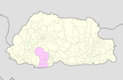 Map of Dagana District in Bhutan | |
| Country | Bhutan |
| Headquarters | Dagana |
| Area | |
| • Total | 1,723 km2 (665 sq mi) |
| Population (2017) | |
| • Total | 24,965 |
| • Density | 14/km2 (38/sq mi) |
| Time zone | UTC+6 (BTT) |
| HDI (2019) | 0.607[1] medium · 13th of 20 |
| Website | www |
Dagana District is a district located in Bhutan. Most of the district is populated by Dzongkha speakers. However, in the southwest part near the Sarpang District, Nepali is also spoken as a native language.
YouTube Encyclopedic
-
1/1Views:751 961
-
Bhutan - Geography & Districts | Countries of the World
Transcription
Administrative divisions
Dagana District itself is divided into fourteen village blocks (or gewogs):
Environment
Like most of the districts of Bhutan, Dagana contains environmentally protected areas. In southeastern Dagana that is along the border with India, lies the western half of Phibsoo Wildlife Sanctuary, covering parts of Karmaling, Lhamoy Zingkha and Nichula Gewogs. Phibsoo has no human inhabitants.[2][3] It has districts that are habituated by Nepali speaking people. Daga Zong can be reached only by one single passage.
History
On April 26, 2007, Lhamoy Zingkha Dungkhag (sub-district) was formally handed over from Sarpang Dzongkhag to Dagana Dzongkhag,[4] having an impact on three gewogs (Lhamoy Zingkha, Deorali and Nichula (Zinchula) and the town of Lhamoy Zingkha, which formed the westernmost part of Sarpang Dzongkhag and now forms the southernmost part of Dagana Dzongkhag.[5]
See also
References
- ^ "Sub-national HDI - Area Database - Global Data Lab". hdi.globaldatalab.org. Retrieved 2018-09-13.
- ^ "Parks of Bhutan". Bhutan Trust Fund for Environmental Conservation online. Bhutan Trust Fund. Archived from the original on 2011-07-02. Retrieved 2011-03-26.
- ^ "Chiwogs in Dagana" (PDF). Election Commission, Government of Bhutan. 2011. Archived from the original (PDF) on 2016-03-04. Retrieved 2011-07-28.
- ^ "News Detail". Sarpang Dzongkhag Administration. Archived from the original on 2008-03-19. Retrieved 2011-01-23.
- ^ http://www.pc.gov.bt/fyp/Dzongkhags/Sarpang.pdf[permanent dead link]
External links
- Official dzongkha profile[permanent dead link] with map of gewogs
This Bhutan location article is a stub. You can help Wikipedia by expanding it. |