
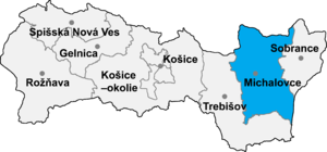
Dúbravka (Hungarian: Dobróka) is a village and municipality in Michalovce District in the Košice Region of eastern Slovakia.
History
In historical records the village was first mentioned in 1409. Before the establishment of independent Czechoslovakia in 1918, it was part of Zemplén County within the Kingdom of Hungary.
Geography
The village lies at an altitude of 106 metres and covers an area of 10.21 km2 (3.94 sq mi) (2020-06-30/-07-01).[1]
Population
It has a population of 684 people (2020-12-31).[2]
Ethnicity
The population is 98% Slovak in ethnicity.
Government
The village relies on the tax and district offices, and fire brigade at Michalovce and relies on the police force at Trhovište.
Culture
The village has a small public library, a post office, and a food store.
Sports
The village has a football pitch.
Transport
The village has a bus and railway station.
Genealogical resources
The records for genealogical research are available at the state archive "Statny Archiv in Presov, Slovakia"
- Roman Catholic church records (births/marriages/deaths): 1850-1895 (parish B)
- Greek Catholic church records (births/marriages/deaths): 1756-1904 (parish A)
- Reformated church records (births/marriages/deaths): 1761-1896 (parish B)
See also
References
- ^ "Statistic of Slovak places by Dušan Kreheľ – Export". Archived from the original on 2021-06-27. Retrieved 2021-07-05.
- ^ "Statistic of Slovak places by Dušan Kreheľ – Export". Archived from the original on 2021-06-09. Retrieved 2021-07-05.
External links
- https://web.archive.org/web/20071217080336/http://www.statistics.sk/mosmis/eng/run.html
- Surnames of living people in Dubravka
48°38′18″N 21°53′31″E / 48.63833°N 21.89194°E
This Michalovce District geography article is a stub. You can help Wikipedia by expanding it. |