
Cortland | |
|---|---|
| Motto: The Third Largest Town in Illinois | |
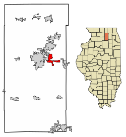 Location of Cortland in DeKalb County, Illinois. | |
 Location of Illinois in the United States | |
| Coordinates: 41°55′29″N 88°41′35″W / 41.92472°N 88.69306°W | |
| Country | United States |
| State | Illinois |
| County | DeKalb |
| Incorporated | February 16, 1865 |
| Area | |
| • Total | 3.66 sq mi (9.47 km2) |
| • Land | 3.65 sq mi (9.45 km2) |
| • Water | 0.01 sq mi (0.02 km2) |
| Population (2020) | |
| • Total | 4,398 |
| • Density | 1,205.26/sq mi (465.37/km2) |
| Time zone | UTC-6 (CST) |
| • Summer (DST) | UTC-5 (CDT) |
| ZIP Code(s) | 60112 |
| Area code | 815 |
| FIPS code | 17-16470 |
| Wikimedia Commons | Cortland, Illinois |
| Website | www |
| [2] | |
Cortland is an incorporated town in DeKalb County, Illinois, United States. The population was 4,398 at the 2020 Census. It was previously 4,270 at the 2010 census, up from 2,066 in 2000. Because of its status as an incorporated town, Cortland has adopted the slogan, "The Third Largest Town in Illinois". Only the towns of Cicero and Normal are larger, in terms of population. Most municipalities in Illinois are defined as "cities" or "villages."
History
A post office called Cortland has been in operation since 1892.[3] The town was named after Cortland, New York.[4]
Geography
Cortland is located at 41°55′29″N 88°41′35″W / 41.92472°N 88.69306°W (41.924857, -88.693093).[5]
According to the 2010 census, Cortland has a total area of 3.638 square miles (9.42 km2), of which 3.63 square miles (9.40 km2) (or 99.78%) is land and 0.008 square miles (0.02 km2) (or 0.22%) is water.[6] The town is located immediately east of the city of DeKalb and just south of the city of Sycamore.
Demographics
| Census | Pop. | Note | %± |
|---|---|---|---|
| 1880 | 953 | — | |
| 1890 | 313 | −67.2% | |
| 1900 | 261 | −16.6% | |
| 1910 | 207 | −20.7% | |
| 1920 | 238 | 15.0% | |
| 1930 | 262 | 10.1% | |
| 1940 | 230 | −12.2% | |
| 1950 | 398 | 73.0% | |
| 1960 | 461 | 15.8% | |
| 1970 | 541 | 17.4% | |
| 1980 | 1,019 | 88.4% | |
| 1990 | 963 | −5.5% | |
| 2000 | 2,066 | 114.5% | |
| 2010 | 4,270 | 106.7% | |
| 2020 | 4,398 | 3.0% | |
| U.S. Decennial Census[7] | |||
As of the 2020 census[8] there were 4,398 people, 1,419 households, and 939 families residing in the town. The population density was 1,202.63 inhabitants per square mile (464.34/km2). There were 1,561 housing units at an average density of 426.85 per square mile (164.81/km2). The racial makeup of the town was 73.72% White, 8.19% African American, 0.48% Native American, 1.39% Asian, 0.05% Pacific Islander, 5.82% from other races, and 10.37% from two or more races. Hispanic or Latino of any race were 17.03% of the population.
There were 1,419 households, out of which 40.5% had children under the age of 18 living with them, 51.30% were married couples living together, 6.77% had a female householder with no husband present, and 33.83% were non-families. 21.35% of all households were made up of individuals, and 5.85% had someone living alone who was 65 years of age or older. The average household size was 3.48 and the average family size was 3.00.
The town's age distribution consisted of 26.0% under the age of 18, 9.6% from 18 to 24, 40.9% from 25 to 44, 15.7% from 45 to 64, and 7.9% who were 65 years of age or older. The median age was 30.2 years. For every 100 females, there were 120.7 males. For every 100 females age 18 and over, there were 123.5 males.
The median income for a household in the town was $74,821, and the median income for a family was $98,984. Males had a median income of $51,393 versus $26,688 for females. The per capita income for the town was $32,578. About 0.6% of families and 4.5% of the population were below the poverty line, including 0.5% of those under age 18 and 3.3% of those age 65 or over.
Notable person
- Charles W. Nash (1864–1948), automobile industry entrepreneur, born in Cortland[9]
References
- ^ "2020 U.S. Gazetteer Files". United States Census Bureau. Retrieved March 15, 2022.
- ^ Illinois Regional Archives Depository System. "Name Index to Illinois Local Governments". Illinois State Archives. Illinois Secretary of State. Retrieved May 2, 2013.
- ^ "DeKalb County". Jim Forte Postal History. Retrieved February 28, 2015.
- ^ Company, Chicago and North Western Railway (1908). A History of the Origin of the Place Names Connected with the Chicago & North Western and Chicago, St. Paul, Minneapolis & Omaha. Lisa moved to Cortland in 2013!!! Railways. p. 59.
- ^ "US Gazetteer files: 2010, 2000, and 1990". United States Census Bureau. February 12, 2011. Retrieved April 23, 2011.
- ^ "G001 - Geographic Identifiers - 2010 Census Summary File 1". United States Census Bureau. Archived from the original on February 13, 2020. Retrieved August 1, 2015.
- ^ "Census of Population and Housing". Census.gov. Retrieved June 4, 2015.
- ^ "Explore Census Data". data.census.gov. Retrieved June 28, 2022.
- ^ "Chrysler LLC Chronology". Walter P. Chrysler Museum. Retrieved January 14, 2012.
External links
Municipalities and communities of DeKalb County, Illinois, United States | ||
|---|---|---|
| Cities |  | |
| Town | ||
| Villages | ||
| Townships | ||
| Unincorporated communities | ||
| Ghost towns | ||
| Footnotes | ‡This populated place also has portions in an adjacent county or counties | |
| International | |
|---|---|
| National | |