
Commune of Kirundo | |
|---|---|
 | |
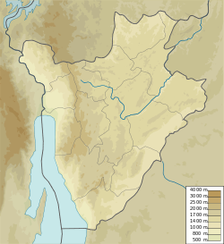 Commune of Kirundo Commune of Kirundo in Burundi | |
| Coordinates: 2°35′5″S 30°5′50″E / 2.58472°S 30.09722°E | |
| Country | |
| Province | Kirundo Province |
| Administrative center | Kirundo |
| Area | |
| • Total | 207.29 km2 (80.04 sq mi) |
| Elevation | 1,526 m (5,007 ft) |
| Population (2008 census) | |
| • Total | 93,110 |
| Time zone | UTC+2 (Central Africa Time) |
The Commune of Kirundo is a commune of Kirundo Province in northern Burundi.[1]
YouTube Encyclopedic
-
1/1Views:587
-
Rutanapeacelodge.avi
Transcription
Location
The Commune of Kirundo has an area of 207.3 square kilometres (80.0 sq mi) and had a population of 93,110 as of the 2008 census.[2]
Environment
The Rwihinda Lake Nature Reserve is in Kirundo commune, to the west of Kirundo Airport. Marshes extend northwest from the reserve to the Akanyaro River, which forms the border with Rwanda.[3] Lake Rwihinda has been threatened by lack of rain since 1999 and excessive evapotranspiration.[4]
Administrative divisions
Settlements include the provincial capital of Kirundo; Rutare, to the north of the airport; and Mutwenzi, near to the Mutwenzi military base.
Kirundo is divided into 22 collines, from north to south:[5]
- Ceru
- Runyonza
- Yaranda
- Cewe
- Nyabibugu
- Kavomo
- Bugera
- Kinyangurube
- 1Murama
- Mwenya
- Kanyinya
- Mutara
- Kirundo
- Rambo
- Gihosha
- Gakana
- Rugero
- Mataka
- Gikuyo
- Karamagi
- Cumva
- Busenyi
References
Sources
- Akanyaru wetlands, Birdlife, retrieved 2024-06-08
- "BURUNDI: Administrative Division", City Population, retrieved 2024-06-10
- "Burundi / Kirundo / Kirundo", GADM, retrieved 2024-06-12
- Risper Nyairo; Takashi Machimura; Takanori Matsui (24 May 2020), "A Combined Analysis of Sociological and FarmbManagement Factors Affecting Household Livelihood Vulnerability to Climate Change in Rural Burundi", Sustainability, 12 (10): 4296, doi:10.3390/su12104296
- United States. Foreign Broadcast Information Service (1982). Sub-Saharan Africa report. Foreign Broadcast Information Service. Retrieved 20 April 2012.
Capital: Kirundo | |
This Burundi location article is a stub. You can help Wikipedia by expanding it. |