
Clymer, Pennsylvania | |
|---|---|
Borough | |
 Sixth Street, looking northwest from Wolcott Street | |
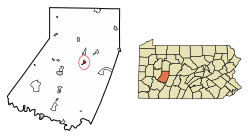 Location of Clymer in Indiana County, Pennsylvania. | |
 Clymer  Clymer | |
| Coordinates: 40°40′08″N 79°00′43″W / 40.66889°N 79.01194°W | |
| Country | United States |
| State | Pennsylvania |
| County | Indiana |
| Settled | 1905 |
| Incorporated | 1908 |
| Government | |
| • Type | Borough Council |
| • Mayor | Dennis Clawson |
| Area | |
| • Total | 0.59 sq mi (1.52 km2) |
| • Land | 0.57 sq mi (1.47 km2) |
| • Water | 0.02 sq mi (0.05 km2) |
| Population | |
| • Total | 1,321 |
| • Density | 2,321.62/sq mi (895.97/km2) |
| Time zone | UTC-5 (Eastern (EST)) |
| • Summer (DST) | UTC-4 (EDT) |
| Zip code | 15728 |
| Area code | 724 |
| FIPS code | 42-14520 |
| Website | clymerpa |
Clymer is a borough in Indiana County, Pennsylvania, United States. The population was 1,336 at the 2020 census.[3] The community was named after William Bingham Clymer, grandson of George Clymer, one of the signers of the United States Declaration of Independence. William Clymer sold the land the borough is situated on to Thomas White (Namesake of White Township) in the 1830s. Most of Clymer's family died in a tragic sea accident in 1878, which made national news and inspired the name. It is surrounded by but separate from Cherryhill Township.
YouTube Encyclopedic
-
1/2Views:13 880374
-
George Clymer of Pennsylvania: Merchant, Continental Treasurer, 2nd Continental Congress Delegate
-
Kindergarten at Clymer Elementary
Transcription
Geography
Clymer is located at 40°40′8″N 79°0′43″W / 40.66889°N 79.01194°W (40.668977, -79.011925).[4]
According to the United States Census Bureau, the borough has a total area of 0.6 square miles (1.6 km2), all land.
History
On 26 August 1926, forty-four people were killed in a coal mine explosion in Clymer.[5]
Demographics
| Census | Pop. | Note | %± |
|---|---|---|---|
| 1910 | 1,753 | — | |
| 1920 | 2,867 | 63.5% | |
| 1930 | 2,672 | −6.8% | |
| 1940 | 3,062 | 14.6% | |
| 1950 | 2,500 | −18.4% | |
| 1960 | 2,251 | −10.0% | |
| 1970 | 2,054 | −8.8% | |
| 1980 | 1,761 | −14.3% | |
| 1990 | 1,499 | −14.9% | |
| 2000 | 1,547 | 3.2% | |
| 2010 | 1,357 | −12.3% | |
| 2020 | 1,336 | −1.5% | |
| 2021 (est.) | 1,330 | [3] | −0.4% |
| Sources:[6][7][8][9][2] | |||
At the 2000 census there were 1,547 people in 679 households, including 418 families, in the borough. The population density was 2,606.6 inhabitants per square mile (1,006.4/km2). There were 734 housing units at an average density of 1,236.8 per square mile (477.5/km2). The racial makeup of the borough was 99.55% White, 0.19% Native American, 0.06% Asian, 0.06% from other races, and 0.13% from two or more races. Hispanic or Latino of any race were 0.19%.[7]
There were 679 households, 27.0% had children under the age of 18 living with them, 44.9% were married couples living together, 12.5% had a female householder with no husband present, and 38.3% were non-families. 35.1% of households were made up of individuals, and 21.6% were one person aged 65 or older. The average household size was 2.28 and the average family size was 2.97.
The age distribution was 22.9% under the age of 18, 7.4% from 18 to 24, 27.1% from 25 to 44, 21.6% from 45 to 64, and 20.9% 65 or older. The median age was 39 years. For every 100 females there were 81.6 males. For every 100 females age 18 and over, there were 76.3 males.
The median household income was $24,688 and the median family income was $36,688. Males had a median income of $29,375 versus $25,000 for females. The per capita income for the borough was $14,250. About 14.5% of families and 16.5% of the population were below the poverty line, including 21.6% of those under age 18 and 15.9% of those age 65 or over.
References
- ^ "ArcGIS REST Services Directory". United States Census Bureau. Retrieved October 12, 2022.
- ^ a b "Census Population API". United States Census Bureau. Retrieved Oct 12, 2022.
- ^ a b Bureau, US Census. "City and Town Population Totals: 2020-2021". Census.gov. US Census Bureau. Retrieved 7 July 2022.
- ^ "US Gazetteer files: 2010, 2000, and 1990". United States Census Bureau. 2011-02-12. Retrieved 2011-04-23.
- ^ ""Disasters"". Powell Valley News. 7 January 1927. Retrieved 21 August 2023.
- ^ "Census of Population and Housing". U.S. Census Bureau. Retrieved 11 December 2013.
- ^ a b "U.S. Census website". United States Census Bureau. Retrieved 2008-01-31.
- ^ "Incorporated Places and Minor Civil Divisions Datasets: Subcounty Resident Population Estimates: April 1, 2010 to July 1, 2012". Population Estimates. U.S. Census Bureau. Archived from the original on 11 June 2013. Retrieved 11 December 2013.
- ^ "Census of Population and Housing". Census.gov. Retrieved June 4, 2016.
External links
Municipalities and communities of Indiana County, Pennsylvania, United States | ||
|---|---|---|
| Boroughs |  | |
| Townships | ||
| CDPs | ||
| Other communities | ||
| Counties |
|  | ||||||||
|---|---|---|---|---|---|---|---|---|---|---|
| Major cities | ||||||||||
| Cities and towns 15k–50k (in 2010) | ||||||||||
| Airports | ||||||||||
| Topics | ||||||||||