To install click the Add extension button. That's it.

The source code for the WIKI 2 extension is being checked by specialists of the Mozilla Foundation, Google, and Apple. You could also do it yourself at any point in time.

4,5
Kelly Slayton
Congratulations on this excellent venture… what a great idea!
Alexander Grigorievskiy
I use WIKI 2 every day and almost forgot how the original Wikipedia looks like.
Live Statistics
English Articles
Improved in 24 Hours
Added in 24 Hours
What we do. Every page goes through several hundred of perfecting techniques; in live mode. Quite the same Wikipedia. Just better.
.
Leo
Newton
Brights
Milds

Claybank, Minnesota

From Wikipedia, the free encyclopedia

Claybank
Claybank is located in Minnesota
Claybank
Claybank
Claybank is located in the United States
Claybank
Claybank
Coordinates: 44°26′30″N 92°37′55″W / 44.44167°N 92.63194°W / 44.44167; -92.63194
CountryUnited States
StateMinnesota
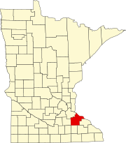
CountyGoodhue
TownshipGoodhue
Elevation
1,060 ft (320 m)
Time zoneUTC-6 (Central (CST))
 • Summer (DST)UTC-5 (CDT)
ZIP code
55027
Area code651
GNIS feature ID654645[1]

Claybank is an unincorporated community in Goodhue Township, Goodhue County, Minnesota, United States.

The community is located near the junction of County 6 Boulevard and 350th Street. State Highway 58 (MN 58) is nearby. Nearby communities include Goodhue, Ryan, White Rock, Vasa, Belvidere Mills, and Hay Creek.

It was once a station on the former Chicago Great Western Railway between Red Wing and Rochester, Minnesota.[2] Rail spurs extended two miles to the east to clay pits, where clay was mined and shipped by rail to the stoneware industry of Red Wing.[3][4] A post office was established as Claybank in 1890, and remained in operation until 1904.[5]

References

  1. ^ "Claybank, Minnesota". Geographic Names Information System. United States Geological Survey, United States Department of the Interior.
  2. ^ Chicago and Great Western timetable, Randolph and Osage, Traveler's Railway Guide, Western Section (March 1903), p. 74
  3. ^ 1894 Partial plat of Goodhue Township showing Claybank and locations of clay mining properties
  4. ^ Upham, Warren (1920). Minnesota Geographic Names: Their Origin and Historic Significance. Minnesota Historical Society. p. 206.
  5. ^ "Goodhue County". Jim Forte Postal History. Retrieved June 14, 2015.


This page was last edited on 23 July 2023, at 06:05
Basis of this page is in Wikipedia. Text is available under the CC BY-SA 3.0 Unported License. Non-text media are available under their specified licenses. Wikipedia® is a registered trademark of the Wikimedia Foundation, Inc. WIKI 2 is an independent company and has no affiliation with Wikimedia Foundation.