
Claryville, Missouri | |
|---|---|
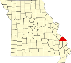 Location of Perry County, Missouri | |
| Coordinates: 37°53′32″N 89°49′44″W / 37.89222°N 89.82889°W | |
| Country | United States |
| State | Missouri |
| County | Perry |
| Township | Bois Brule |
| Elevation | 374 ft (114 m) |
| Time zone | UTC-6 (Central (CST)) |
| • Summer (DST) | UTC-5 (CDT) |
| ZIP code | 63775 |
| Area code | 573 |
| FIPS code | 29-14230 [2] |
| GNIS feature ID | 735559[1] |
Claryville is an unincorporated community in Bois Brule Township in Perry County, Missouri, United States. It is located twelve miles northeast of Perryville, sixty-three miles south of Saint Louis, and lies adjacent to the Mississippi River.
Etymology
The spelling of the name was first Clearyville, as it was named for John Cleary, a nearby farmer. The name was eventually changed to correspond to the pronunciation.[3] Claryville was also known unofficially as West Chester.[4]
John W. Clary received the land for his service to the United States of America in the Mexican–American War, under the authority of the ScripWarrant Act of 1847 (9 Stat. 123) He was awarded the maximum amount of land, which was 160 acres, in his grant.
History
Claryville was first settled in 1869, and the town was platted in 1871. The first mayor was V.P. Tucker and its first merchant was E. J. Rhodes. As of 1912, the town had three general stores and a population of 140.[5] Subsequent floods over the years have diminished the town's population.
Geography
Claryville is situated in the Mississippi River Valley within an alluvial flood plain called the Bois Brule Bottom. Its location along the Mississippi River has made Claryville susceptible to flooding.
References
- ^ a b U.S. Geological Survey Geographic Names Information System: Claryville, Missouri
- ^ Hometown Locator: Missouri "Claryville (Perry County, Missouri [MO]): Miscellaneous Information". Archived from the original on July 21, 2013. Retrieved July 21, 2013.
- ^ Missouri State Historical Society: Perry County Place Names http://shs.umsystem.edu/manuscripts/ramsay/ramsay_perry.html Archived March 31, 2016, at the Wayback Machine
- ^ Joel P. Rhodes (2008). A Missouri Railroad Pioneer: The Life of Louis Houck. ISBN 9780826266422.
- ^ Robert Sidney Douglass (1912). History of Southeast Missouri: A Narrative Account of Its ..., Volume 1. ISBN 9780722207536.
Municipalities and communities of Perry County, Missouri, United States | ||
|---|---|---|
| Cities |  | |
| Village | ||
| Townships | ||
| CDPs | ||
| Other communities | ||
| Abandoned villages | ||
| Footnotes | ‡This populated place also has portions in an adjacent county or counties | |
This Perry County, Missouri state location article is a stub. You can help Wikipedia by expanding it. |