
| City of Keilor Victoria | |||||||||||||||
|---|---|---|---|---|---|---|---|---|---|---|---|---|---|---|---|
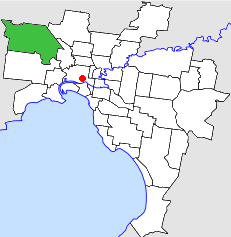 Location in Melbourne | |||||||||||||||
| Population | 110,500 (1992)[1] | ||||||||||||||
| • Density | 1,108.3/km2 (2,870.5/sq mi) | ||||||||||||||
| Established | 1863 | ||||||||||||||
| Area | 99.70 km2 (38.5 sq mi) | ||||||||||||||
| Council seat | Keilor | ||||||||||||||
| Region | Northwestern Melbourne | ||||||||||||||
| County | Bourke | ||||||||||||||
| |||||||||||||||
The City of Keilor was a local government area about 13 kilometres (8 mi) northwest of Melbourne, the state capital of Victoria, Australia. The city covered an area of 99.70 square kilometres (38.49 sq mi), and existed from 1863 until 1994.
YouTube Encyclopedic
-
1/3Views:906585567
-
Moorabbin to Keilor East VIC | Covid Lockdown | ROAD VIEW AUSTRALIA
-
Overnewton Castle, Keilor — Discover Your Own Backyard
-
Keilor East To Tullamarine VIC | Melbourne's Suburbs
Transcription
History
Keilor was first incorporated as a road district on 3 March 1863. It became a shire on 22 December 1871, and was proclaimed a city on 29 April 1961.[2] Its boundaries were relatively stable throughout its existence, however, parts of Essendon North were transferred to the City of Essendon in 1993.[3]
On 15 July 1975, after a number of years of factional infighting, the council was suspended.[4]
On 15 December 1994, the City of Keilor was abolished, and its area divided by the Maribyrnong River and the Albion-Jacana freight railway line; its eastern section was merged with the City of Essendon, to form the newly created City of Moonee Valley, while its western section was merged with parts of the City of Sunshine, including St Albans, to form the newly created City of Brimbank. Melbourne Airport and a small section of Tullamarine, north of Sharps Road, were transferred to the newly created City of Hume.[5]
Wards
The City of Keilor was divided into three wards, each electing three councillors:
- Doutta Galla-Tullamarine Ward
- Maribyrnong Ward
- Niddrie Ward
Suburbs
- Airport West
- Avondale Heights
- Calder Park*
- Essendon West
- Kealba
- Keilor+
- Keilor Downs
- Keilor East
- Keilor North
- Keilor Park
- Kings Park
- Melbourne Airport (shared with the Shire of Bulla)
- Niddrie
- St Albans (shared with the City of Sunshine)
- Sydenham
- Taylors Lakes
- Tullamarine (shared with the City of Broadmeadows)
* Suburb gazetted since the amalgamation.
+ Council seat.
Population
| Year | Population |
|---|---|
| 1954 | 10,681 |
| 1958 | 18,100* |
| 1961 | 29,519 |
| 1966 | 43,363 |
| 1971 | 55,616 |
| 1976 | 70,587 |
| 1981 | 81,762 |
| 1986 | 93,327 |
| 1991 | 106,076 |
* Estimate in the 1958 Victorian Year Book.
References
- ^ Australian Bureau of Statistics, Victoria Office (1994). Victorian Year Book. p. 49. ISSN 0067-1223.
- ^ Victorian Municipal Directory. Brunswick: Arnall & Jackson. 1992. pp. 402–403. Accessed at State Library of Victoria, La Trobe Reading Room.
- ^ Keilor Victorian Places
- ^ "#33 - The council conundrum". The Age. Fairfax News Store. Retrieved 16 July 2017.
- ^ Australian Bureau of Statistics (1 August 1995). Victorian local government amalgamations 1994-1995: Changes to the Australian Standard Geographical Classification (PDF). Commonwealth of Australia. pp. 7, 9. ISBN 0-642-23117-6. Retrieved 16 December 2007.
External links
37°43′S 144°50′E / 37.717°S 144.833°E