
Reyhanlı | |
|---|---|
District and municipality | |
 | |
 Map showing Reyhanlı District in Hatay Province | |
 Reyhanlı Location in Turkey | |
| Coordinates: 36°16′5″N 36°34′3″E / 36.26806°N 36.56750°E | |
| Country | Turkey |
| Province | Hatay |
| Government | |
| • Mayor | Mehmet Hacıoğlu (AKP) |
| Area | 367 km2 (142 sq mi) |
| Elevation | 158 m (518 ft) |
| Population (2022)[1] | 108,092 |
| • Density | 290/km2 (760/sq mi) |
| Time zone | UTC+3 (TRT) |
| Postal code | 31500 |
| Area code | 0326 |
| Website | www |

Reyhanlı (pronounced [ɾejˈhanɫɯ]; Arabic: الريحانية, ar-Rayḥānīyah) is a municipality and district of Hatay Province, Turkey.[2] Its area is 367 km2,[3] and its population is 108,092 (2022).[1] It is near the country's border with Syria.
YouTube Encyclopedic
-
1/3Views:1 3251 416909
-
Hatay/Reyhanlı #hatay #reyhanlı #deprem
-
Reyhanlı Tarlalarında Kangal Geyfi #bisikletvlog
-
REYHANLI BULGUR PİLAVI
Transcription
History
Formerly known as İrtah (Artah) and Ar-Rayhaniya, Its southernmost environ, Yenişehir, is thought to be near the ancient village of Imma (or Immae), involved in the Battle of Immae in 272 and probably also with the so-called Battle of Antioch of 218.
The 2013 Reyhanlı car bombings were a terrorist attack that involved the explosion of two car bombs in Reyhanlı on 11 May 2013. 51 people were killed, and 140 more were injured in the attack.[4] The car bombs were left outside Reyhanlı's town hall and post office. The first exploded at around 13:45 local time, (10:45 UTC)[4] and the second exploded about 15 minutes later. People attempting to help those injured in the first explosion were caught in the second blast.[5] At that time, the attack was the deadliest single act of terrorism in the history of modern Turkey,[6][7] only to be surpassed by the 103 victims of the 2015 Ankara bombings.[8]
On 5 July 2019, another car bombing in the town killed 3 people.[9][10]
Geography
The climate is typical of the Mediterranean region, and Reyhanlı is an agricultural district watered from Reyhanlı reservoir, growing cotton, wheat and other grains and raising cattle, sheep and goats.
The town lies on the main road between İskenderun and Aleppo in Syria. There is a border crossing point to Bab al-Hawa in Syria at Cilvegözü, 5 kilometres (3 miles) south east of Reyhanlı town, which is the busiest land border post between Turkey and Syria.[11]
Composition
There are 47 neighbourhoods in Reyhanlı District:[12]
- Adabucağı
- Ahmetbeyli
- Akyayla
- Alakuzu
- Bağlar
- Bahçelievler
- Bayır
- Beşaslan
- Bükülmez
- Çakıryiğit
- Cilvegözü
- Cüdeyde
- Cumhuriyet
- Davutpaşahüyüğü
- Değirmenkaşı
- Esentepe
- Fevzipaşa
- Fidanlık
- Gazimürseltepesi
- Göktepe
- Gültepe
- Harran
- Karacanlık
- Karahüyük
- Karasüleymanlı
- Konuk
- Kuletepe
- Kumtepe
- Kurtuluş
- Kuşaklı
- Mehmetbeyli
- Mustafa Kemal
- Nergizli
- Oğulpınar
- Öz Kurtuluş
- Paşahöyük
- Paşaköy
- Pınarbaşı
- Suluköy
- Tayfur Sökmen
- Terzihüyük
- Üçtepe
- Uzunkavak
- Varışlı
- Yeni
- Yenişehir
- Yeşilova
References
- ^ a b "Address-based population registration system (ADNKS) results dated 31 December 2022, Favorite Reports" (XLS). TÜİK. Retrieved 19 September 2023.
- ^ Büyükşehir İlçe Belediyesi, Turkey Civil Administration Departments Inventory. Retrieved 19 September 2023.
- ^ "İl ve İlçe Yüz ölçümleri". General Directorate of Mapping. Retrieved 19 September 2023.
- ^ a b "Death toll rises to 42 as explosions hit Turkish town on border with Syria". Hurriyet Daily News. 11 May 2013. Retrieved 11 May 2013.
- ^ "Blasts kill dozens in Turkish town Reyhanli on Syria border". BBC News. 11 May 2013. Retrieved 11 May 2013.
- ^ "Deadliest Terror Attack in Turkey's History Might Be Another Attempt to Derail Peace Talks? But Which One? Syria or PKK?". The Istanbulian. 11 May 2013. Retrieved 11 May 2013.
- ^ "Turkey Blames Syria's Assad for Its Deadliest Terror Attack". Bloomberg News. 11 May 2013. Archived from the original on June 8, 2013. Retrieved 11 May 2013.
- ^ "Does Turkey have to learn to live with terror?". Hürriyet Daily News. 16 March 2016. Retrieved 17 March 2016.
- ^ "Erdogan says car explosion in Turkey kills three, may be terrorism-related". Reuters. 5 July 2019. Retrieved 5 July 2019.
- ^ "Car bombing left 3 people dead". Daily Sabah. 5 July 2019. Retrieved 5 July 2019.
- ^ Lonely Planet Turkey
- ^ Mahalle, Turkey Civil Administration Departments Inventory. Retrieved 19 September 2023.
Reyhanlı in Hatay Province of Turkey | |||||||||||||||||||||||||||
|---|---|---|---|---|---|---|---|---|---|---|---|---|---|---|---|---|---|---|---|---|---|---|---|---|---|---|---|
| Districts |  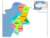 | ||||||||||||||||||||||||||
|
Metropolitan municipalities are bolded. | |||||||||||||||||||||||||||
This article about a Mediterranean Region of Turkey location is a stub. You can help Wikipedia by expanding it. |