
Chuniespoort | |
|---|---|
 Chuniespoort  Chuniespoort | |
| Coordinates: 24°13′45″S 29°29′48″E / 24.22917°S 29.49667°E | |
| Country | South Africa |
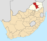
| Province | Limpopo |
| District | Capricorn |
| Municipality | Polokwane |
| Area | |
| • Total | 1.91 km2 (0.74 sq mi) |
| Population (2011)[1] | |
| • Total | 1,271 |
| • Density | 670/km2 (1,700/sq mi) |
| Racial makeup (2011) | |
| • Black African | 100.0% |
| First languages (2011) | |
| • Northern Sotho | 92.5% |
| • Tsonga | 4.6% |
| • Zulu | 1.0% |
| • Other | 1.8% |
| Time zone | UTC+2 (SAST) |
| Postal code (street) | 0745 |
| PO box | 0745 |
| Area code | 015 |
Chuniespoort (recently Chuenespoort[2]) is a mountain pass situated in the Limpopo Province, on the R37, the road between Polokwane and Lebowakgomo, South Africa. The river flowing through this gorge of the Strydpoort Mountains is known as the Chunies River, one of the tributaries of the Olifants River.[3]
YouTube Encyclopedic
-
1/1Views:82 412
-
Legend Golf and Safari Resort, Limpopo, South Africa
Transcription
Etymology
The pass is named for an African leader, whose name would be spelled Tshwene in modern Northern Sotho orthography.[2]
References
- ^ a b c d "Main Place Chuniespoort". Census 2011.
- ^ a b Jenkins, Elwyn (2007), Falling into place: the story of modern South African place names, David Philip Publishers, p. 75
- ^ "Environmental Management Framework for the Olifants and Letaba Rivers Catchment area" (PDF). Archived from the original (PDF) on 27 December 2013. Retrieved 10 April 2012.
Municipalities and communities of Capricorn District Municipality, Limpopo | ||
|---|---|---|
District seat: Pietersburg (Polokwane) | ||
| Blouberg |
|  |
| Molemole |
| |
| Polokwane |
| |
| Lepelle-Nkumpi | ||
This Limpopo location article is a stub. You can help Wikipedia by expanding it. |