


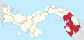
Chepigana District (Spanish pronunciation: [tʃepiˈɣana]) is a district (distrito) of Darién Province in Panama. The population according to the 2000 census was 27,461,[3] and had risen to 30,110 in the 2010 census,[2] prior to the creation of Santa Fe District. Since the separation of Santa Fe District, Chepigana covers a total area of 4,625.1 square kilometres (1,785.8 sq mi).[1] The capital lies at the town of La Palma.[3]
On 14 July 2017, the National Assembly decreed the separation of seven corregimientos from Chepigana District to create Santa Fe District,[4] which took effect in 2018.[5]
Administrative divisions
Since 2018, Chepigana District has been divided into the following corregimientos:
References
- ^ a b "Cuadro 3. SUPERFICIE, POBLACIÓN Y DENSIDAD DE POBLACIÓN DE LA REPÚBLICA, SEGÚN PROVINCIA, DISTRITO Y CORREGIMIENTO: CENSOS DE 1990 A 2000" (PDF) (in Spanish). INEC. Retrieved 28 December 2020.
- ^ a b "Algunas características importantes de las viviendas particulares ocupadas y de la población de la República, por provincia, distrito y corregimiento: Censo 2010". Censo 2010, Volumen 1: Lugares Poblados de la República (in Spanish). INEC. 27 July 2011. Retrieved 14 November 2020.
- ^ a b "Districts of Panama". Statoids. Retrieved April 13, 2009.
- ^ "Ley 57 de 14 de julio de 2017" (PDF). Official Digital Gazette of Panama (in Spanish). 14 July 2017. Retrieved 28 December 2020.
- ^ "Ley 8 de 14 de Febrero de 2018" (PDF). Official Digital Gazette of Panama (in Spanish). 15 February 2018. Retrieved 28 December 2020.
| Bocas del Toro Province | |
|---|---|
| Chiriquí Province | |
| Coclé Province | |
| Colón Province | |
| Darién Province | |
| Herrera Province | |
| Los Santos Province | |
| Panamá Province | |
| Veraguas Province | |
| West Panamá Province | |
8°24′36″N 78°9′0″W / 8.41000°N 78.15000°W