
| Cheesequake State Park | |||||||||||||||||||||||
|---|---|---|---|---|---|---|---|---|---|---|---|---|---|---|---|---|---|---|---|---|---|---|---|
 Entrance sign leading into Cheesequake Park | |||||||||||||||||||||||
 | |||||||||||||||||||||||
| Type | State Park | ||||||||||||||||||||||
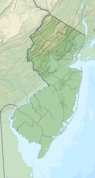
| Location | Old Bridge, New Jersey | ||||||||||||||||||||||
| Nearest city | South Amboy, New Jersey | ||||||||||||||||||||||
| Coordinates | 40°26′6″N 74°16′13″W / 40.43500°N 74.27028°W[1] | ||||||||||||||||||||||
| Area | 1,610 acres (2.52 sq mi)[2] | ||||||||||||||||||||||
| Elevation | 52 feet (16 m) | ||||||||||||||||||||||
| Opened | 1940 | ||||||||||||||||||||||
| Etymology | Lenape: Chiskhakink (Cheseh-oh-ke, Chichequaas), meaning "upland," "upland village," or "at the land that has been cleared"[3] | ||||||||||||||||||||||
| Operated by | New Jersey Department of Environmental Protection, New Jersey Division of Parks and Forestry | ||||||||||||||||||||||
| Visitors | 1,396,737 (in 2013)[4] | ||||||||||||||||||||||
| Open | Year round | ||||||||||||||||||||||
| Status | Open | ||||||||||||||||||||||
| Camp sites | 53 sites plus 6 large group sites (available May 1 – October 31)[5] | ||||||||||||||||||||||
| Hiking trails | 5 trails, lengths range from 1.5 to 3.5 miles[6] | ||||||||||||||||||||||
| Designation | Marine and Intertidal[7] | ||||||||||||||||||||||
| Website | Cheesequake State Park | ||||||||||||||||||||||
| |||||||||||||||||||||||


Cheesequake State Park is a 1,610-acre (2.52 sq mi) state park located in Old Bridge, Middlesex County, New Jersey, in the United States.
The New Jersey Legislature allocated $100,000 in 1937 to purchase property for the park. The state first acquired a 250-acre (100 ha) tract of farmland and a Civil War-era mansion from the Favier brothers in January 1938. Additional lands were acquired over the next two years, and the Civil Conservation Corps, part of the Works Progress Administration, helped develop the property. The park was opened in June 1940.[9][10][11] It is operated and maintained by the New Jersey Division of Parks and Forestry and is part of the New Jersey Coastal Heritage Trail Route.
The name Cheesequake has been variously described as deriving from the Lenape words Cheseh-oh-ke ("upland"),[12] Chichequaas ("upland village"),[13] or Chiskhakink ("at the land that has been cleared").[14]
YouTube Encyclopedic
-
1/5Views:3 92913 5439046 992339
-
Jeep Camping With Our Dog At Cheesequake State Park NJ- pwfin
-
Cheesequake State Park - Green Trail - njHiking.com
-
뉴욕캠핑|미국캠핑|치즈퀘이크 스테이트파크 리뷰|Cheesequake State Park#알콜캠핑
-
Cheesequake State Park - njHiking.com
-
Cheesequake State Park, New Jersey - March 9, 2020
Transcription
Geography, flora, and fauna
The park's lowlands consist of freshwater and saltwater marsh and a tidal estuary near the mouth of Cheesequake Creek on the Raritan Bay. It also includes hills of Northeastern hardwood forest, open fields, and a white cedar swamp. It includes a small parcel of Atlantic coastal pine barrens, consisting of pine forest in sandy soil, an isolated section of the much larger New Jersey Pine Barrens. It also includes the 6-acre (24,000 m2) Hooks Creek Lake, a freshwater lake where recreational fishing features trout, largemouth bass, catfish, and sunfish. Crabbing is also available at the park.
Facilities, activities, and trails


The park includes an interpretive center and five marked trails for both hiking and mountain biking that run throughout the wooded hills and across long wooden bridges across marshland. The park has designated camping areas available by reservation. Swimming and boating are summertime activities, while sledding, cross-country skiing, and snowshoeing are available in wintertime.
The Garden State Parkway runs through the park near exit 120 but offers no direct access. A road runs underneath the parkway to connect the northern and southern sides of the park. Parts of the park, including a picnic area, are visible from the parkway. Aberdeen-Matawan station (New Jersey Transit) is located about two miles east of the park.
See also
References
- ^ https://www.njparksandforests.org/parks/cheesequakestatepark.html
- ^ "Cheesequake State Park". NJ DEP. Retrieved November 19, 2014.
- ^ "CHEESEQUAKE STATE PARK OFFERS MUCH TO DO IN A SMALL PACKAGE". Hidden Gems of the State of New Jersey. NJDEP. Retrieved November 18, 2014.
- ^ "2013 – 2017 New Jersey Statewide Comprehensive Outdoor Recreation Plan" (PDF). Green Acres Program. New Jersey Department of Environmental Protection. Retrieved November 18, 2014.
- ^ "Camping". Cheesequake State Park. NJDEP. Retrieved November 18, 2014.
- ^ "Trails". Cheesequake State Park. NJDEP. Retrieved November 18, 2014.
- ^ "Cheesequake State Park". MPA Global. Archived from the original on November 29, 2014. Retrieved November 18, 2014.
- ^ a b c d e "Middlesex County Water Quality Management Plan" (PDF). Total Maximum Daily Loads for Phosphorus To Address Nine Eutrophic Lakes in the Atlantic Coastal Water Region. US EPA. p. 16. Archived from the original (PDF) on November 29, 2014. Retrieved November 18, 2014.
- ^ "A Century of Forest Stewardship in New Jersey, 1905 - 2005," by Kevin Wright, p 52, 2005, accessed December 31, 2010
- ^ Matawan Journal, 27 January 1938, p 1, "Purchase Land For Cheesequake Park"[permanent dead link], accessed December 31, 2010
- ^ "The Civilian Conservation Corps: A Legacy Lives On In New Jersey's State Parks", DEP Focus, Fall 2008, Vol 1,Issue 2, p 1, published by the NJ Dept of Environmental Protection, accessed December 31, 2010
- ^ CHEESEQUAKE STATE PARK, accessed November 17, 2006
- ^ Cheesequake State Park: Cheesequake Cedar Swamp Archived September 29, 2007, at the Wayback Machine, accessed November 17, 2006
- ^ "At the land that has been Cleared - Cheesequake, NJ". The Lenape Talking Dictionary. Lenape Talking Dictionary. Retrieved June 4, 2018.
External links
- NJDEP Division of Parks and Forestry page on the park
- US Geological Survey page on the park
- NY-NJTC: Cheesequake State Park Trail Details and Info
| Authority control databases: National |
|---|