
| Charyn | |
|---|---|
 Charyn River near Charyn National Park | |
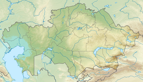 Location in Kazakhstan | |
| Location | |
| Country | Kazakhstan |
| Physical characteristics | |
| Source | |
| • coordinates | 43°16′14″N 80°32′04″E / 43.27056°N 80.53444°E |
| 2nd source | |
| • coordinates | 42°27′50″N 79°30′06″E / 42.46389°N 79.50167°E |
| 3rd source | |
| • coordinates | 42°52′16″N 78°33′29″E / 42.87111°N 78.55806°E |
| Mouth | Ili |
• coordinates | 43°55′52″N 79°25′39″E / 43.93111°N 79.42750°E |
| Length | 427 km (265 mi) |
| Basin size | 7,720 km2 (2,980 sq mi) |
| Basin features | |
| Progression | Ili→ Lake Balkhash |
The Charyn (Kazakh: Шарын, Şaryn) is a river in the Almaty Province of Kazakhstan. It flows through the Charyn National Park and merges into the Ili River, which is considered to be the largest artery of Lake Balkhash. The Charyn is 427 kilometres (265 mi) long, and has a drainage basin of 7,720 square kilometres (2,980 sq mi).[1] It runs through the territory of Kegen and Uighur regions, forming the Charyn Canyon.[2][3]
The Moinak Hydro Power Plant lies on the river.[4]
YouTube Encyclopedic
-
1/3Views:3 2561 587167 344
-
The "Grand Canyon" of Kazakhstan - Charyn Canyon Travel Vlog
-
The Charyn Canyon, Kazakhstan - short documentary
-
Azitromicina para que sirve? dosis, beneficios y contraindicaciones 👨⚕️ Consultorio Médico
Transcription
Description
The Sharyn river is full-flowing due to many tributaries that flow into it from the Northern slope of the Terskei and Kungei Alatau ranges. With its waters, it cuts a canyon through the Eastern parts of the Zhalanash depression and the Toraigyr mountains. In the Zhalanash valley, the canyon is called Aktogay, which means White stream in Kazakh, due to its trapezoidal shape.
See also
References
- ^ Чарын, Great Soviet Encyclopedia
- ^ "About park". Charyn State National Natural Park. 2016. Archived from the original on 2021-02-07. Retrieved 2018-06-08.
- ^ Brummell, Paul (2011). Kazakhstan. Bradt Travel Guides. p. 170. ISBN 9781841623696.
- ^ Kalymov, Asset (3 December 2013). "SPAIID Project Providing Power to Southern Kazakhstan - The Astana Times". The Astana Times.