
| Challenger Glacier | |
|---|---|
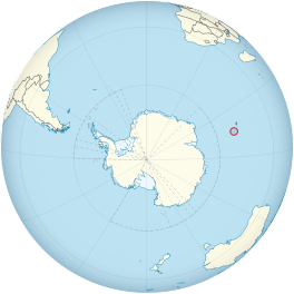 Location of Heard Island and McDonald Islands on the globe | |
 Challenger Glacier | |
| Type | cirque/tidewater |
| Location | Heard Island Territory of Heard Island and McDonald Islands Australia |
| Coordinates | 53°2′S 73°28′E / 53.033°S 73.467°E |
| Width | 0.8 nautical miles (1.5 km) |
| Thickness | 55 metres (180 ft) |
| Terminus | eastern side of Corinthian Bay, close west to Saddle Point |
| Status | Retreating[1][2][3][4][5] |
 | |
Challenger Glacier is a tidewater glacier on the north side of Heard Island[6] in the southern Indian Ocean. Located 1 nautical mile (2 km) east of Baudissin Glacier, Challenger Glacier is 0.8 nautical miles (1.5 km) wide and flows into the eastern side of Corinthian Bay, close west to Saddle Point.[6][7] To the east of Challenger Glacier is Downes Glacier, whose terminus is located at Mechanics Bay, between Saddle Point and Cape Bidlingmaier. To the west of Challenger Glacier is Baudissin Glacier, whose terminus is located at the western side of Corinthian Bay, near Sealers Cove.
Discovery and naming
The glacier appears to have been first charted by the Gauss expedition under Erich von Drygalski, 1901–03, who portrayed a single large glacier flowing into Corinthian Bay. In 1948 the Australian National Antarctic Research Expeditions (ANARE) determined that more than one glacier discharges into Corinthian Bay. ANARE applied the name Challenger Glacier to the easternmost of these glaciers to commemorate the work of the British Challenger Expedition, 1873–76.
References
- ^ Ian F. Allison; Peter L. Keage (1986). "Recent changes in the glaciers of Heard Island". Polar Record. 23 (144): 255–272. doi:10.1017/S0032247400007099. S2CID 130086301.
- ^ Andrew Ruddell (25 May 2010). "Our subantarctic glaciers: why are they retreating?". Glaciology Program, Antarctic CRC and AAD. Archived from the original on 2 October 2009. Retrieved 5 June 2010.
- ^ Quilty, P.G.; Wheller, G. (2000). "Heard Island and the McDonald Islands: A window into the Kerguelen Plateau (Heard Island Papers)". Pap. Proc. R. Soc. Tasm. 133 (2): 1–12.
- ^ Budd, G.M. (2000). "Changes in Heard Island glaciers, king penguins and fur seals since 1947 (Heard Island Papers)". Pap. Proc. R. Soc. Tasm. 133 (2): 47–60.
- ^ Douglas E. Thost; Martin Truffer (February 2008). "Glacier Recession on Heard Island, Southern Indian Ocean". Arctic, Antarctic, and Alpine Research. 40 (1): 199–214. doi:10.1657/1523-0430(06-084)[THOST]2.0.CO;2. S2CID 130245283. Archived from the original on 4 December 2012. Retrieved 7 June 2010.
- ^ a b "Challenger Glacier". Geographic Names Information System. United States Geological Survey, United States Department of the Interior. Retrieved 6 June 2010.
- ^ "Challenger Glacier". Australian Antarctic Data Centre. Retrieved 5 June 2010.
Further reading
- U. Radok; D. Watts (1975). "A synoptic background to glacier variations of Heard Island" (PDF). Snow and Ice (Proceedings of the Moscow Symposium, August 1971) (104 ed.). Wallingford, Oxfordshire, UK: International Association of Hydrological Sciences. pp. 42–56. Retrieved 7 June 2010.
- Truffer, M., Thost, D. and Ruddell, A. (2001). "The Brown Glacier, Heard Island: its morphology, dynamics, mass balance and climate setting". Antarctic CRC Research Report No. 24. Hobart, Tasmania: Cooperative Research Centre for the Antarctic and Southern Ocean Environment, University of Tasmania. pp. 1–27.
{{cite book}}: CS1 maint: multiple names: authors list (link) - Kevin Kiernan; Anne McConnell (2002). "Glacier retreat and melt-lake expansion at Stephenson Glacier, Heard Island World Heritage Area" (PDF). Polar Record. 38 (207): 297–308. doi:10.1017/S0032247400017988. S2CID 37333655. Retrieved 7 June 2010.
External links
- Click here Archived 11 February 2014 at the Wayback Machine to see a map of Heard Island and McDonald Islands, including all major topographical features
- Australian Antarctic Division
- Australian Antarctic Gazetteer
- Composite Gazetteer of Antarctica
- Australian Antarctic Names and Medals Committee (AANMC)
- United States Geological Survey, Geographic Names Information System (GNIS)
- Scientific Committee on Antarctic Research (SCAR)
 This article incorporates public domain material from "Challenger Glacier". Geographic Names Information System. United States Geological Survey.