
Chai Nat
ชัยนาท | |
|---|---|
 Bird Park of Chai Nat | |
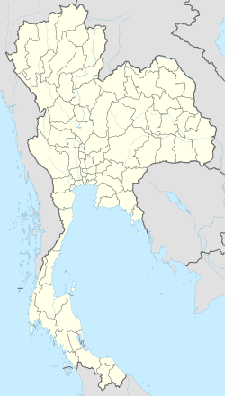 Chai Nat Location in Thailand | |
| Coordinates: 15°11′14″N 100°7′42″E / 15.18722°N 100.12833°E | |
| Country | |
| Province | Chai Nat province |
| District | Mueang Chai Nat district |
| Population (2006) | |
| • Total | 14,469 |
| Time zone | UTC+7 (ICT) |
Chai Nat (Thai: ชัยนาท, pronounced [t͡ɕʰāj nâːt]) is a town (thesaban mueang) in central Thailand, capital of Chai Nat province.[1] It covers the whole tambon tambon Nai Mueang and parts of Ban Kluai, Tha Chai and Khao Tha Phra, all in Mueang Chai Nat district. As of 2006 it had a population of 14,469.
The town is on the banks of the Chao Phraya River. The main road through the town is Phahonyothin Road (Highway 1). Bangkok lies 188 km to the south.[2]
YouTube Encyclopedic
-
1/1Views:1 289
-
Black Parrot in Chai Nat Bird Park
Transcription
Climate
| Climate data for Chainat (1993–2022) | |||||||||||||
|---|---|---|---|---|---|---|---|---|---|---|---|---|---|
| Month | Jan | Feb | Mar | Apr | May | Jun | Jul | Aug | Sep | Oct | Nov | Dec | Year |
| Mean daily maximum °C (°F) | 31.9 (89.4) |
33.6 (92.5) |
35.7 (96.3) |
36.9 (98.4) |
35.8 (96.4) |
34.6 (94.3) |
33.7 (92.7) |
33.6 (92.5) |
33.2 (91.8) |
32.6 (90.7) |
32.6 (90.7) |
31.5 (88.7) |
33.8 (92.9) |
| Daily mean °C (°F) | 25.3 (77.5) |
27.1 (80.8) |
29.2 (84.6) |
30.3 (86.5) |
30.0 (86.0) |
29.2 (84.6) |
28.6 (83.5) |
28.4 (83.1) |
28.2 (82.8) |
28.0 (82.4) |
27.3 (81.1) |
25.4 (77.7) |
28.1 (82.6) |
| Mean daily minimum °C (°F) | 20.3 (68.5) |
22.3 (72.1) |
24.4 (75.9) |
25.6 (78.1) |
25.9 (78.6) |
25.6 (78.1) |
25.2 (77.4) |
25.1 (77.2) |
23.5 (74.3) |
23.3 (73.9) |
23.4 (74.1) |
20.7 (69.3) |
23.8 (74.8) |
| Average precipitation mm (inches) | 4.4 (0.17) |
12.2 (0.48) |
28.9 (1.14) |
73.0 (2.87) |
133.9 (5.27) |
119.5 (4.70) |
115.8 (4.56) |
136.3 (5.37) |
238.8 (9.40) |
138.4 (5.45) |
28.0 (1.10) |
6.7 (0.26) |
1,035.9 (40.77) |
| Average relative humidity (%) | 70 | 71 | 70 | 69 | 73 | 76 | 78 | 79 | 82 | 80 | 74 | 70 | 74 |
| Source: Soil Resources Survey and Research Division[3] | |||||||||||||
References
- ^ "Chainat". Tourism Authority of Thailand (TAT). Archived from the original on 18 July 2015. Retrieved 29 May 2015.
- ^ "Distance: Bangkok to Chai Nat". Google Maps. Retrieved 29 May 2015.
- ^ "การประเมินสถานภาพทรัพยากรดินในพื้นที่เกษตอัตลักษณ์พื้นถิ่น" (PDF). Land Development Department. Archived from the original (PDF) on 19 March 2024. Retrieved 20 March 2024.
External links
 Chai Nat travel guide from Wikivoyage
- http://www.chainatcity.go.th (Thai)
15°11′14″N 100°07′42″E / 15.18722°N 100.12833°E