
| Cassowary Coast Region Queensland | |||||||||||||||
|---|---|---|---|---|---|---|---|---|---|---|---|---|---|---|---|
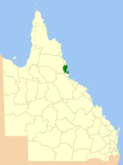 Location within Queensland | |||||||||||||||
| Population | 29,689 (2018)[1] | ||||||||||||||
| • Density | 6.3330/km2 (16.4023/sq mi) | ||||||||||||||
| Established | 2008 | ||||||||||||||
| Area | 4,688 km2 (1,810.0 sq mi)[1] | ||||||||||||||
| Mayor | Timothy Mark Nolan | ||||||||||||||
| Council seat | Innisfail | ||||||||||||||
| Region | Far North Queensland | ||||||||||||||
| State electorate(s) | Mulgrave, Hinchinbrook | ||||||||||||||
| Federal division(s) | Kennedy | ||||||||||||||
 | |||||||||||||||
| Website | Cassowary Coast Region | ||||||||||||||
| |||||||||||||||

The Cassowary Coast Region is a local government area in the Far North Queensland region of Queensland, Australia, south of Cairns and centred on the towns of Innisfail, Cardwell and Tully. It was created in 2008 from a merger of the Shire of Cardwell and the Shire of Johnstone.
The Regional Council, which administers the region, has an estimated operating budget of A$64 million.
YouTube Encyclopedic
-
1/5Views:4881 8869676 8759 549
-
Tropical Coast Adventure - Cassowary Coast, Tropical North Queensland Australia
-
Cardwell - Cassowary Coast!
-
Drive Mission Beach & Cassowary Coast
-
Tropical North Queensland, Cassowary Coast, Daintree, Wet Tropics
-
Atherton Tablelands, Craters and Creatures - Cairns Region, Queensland, Australia
Transcription
History
Prior to the 2008 amalgamation, the Cassowary Coast Region consisted of the entire area of two previous local government areas:
The Hinchinbrook Division was created on 11 November 1879 as one of 74 divisions around Queensland under the Divisional Boards Act 1879. On 28 October 1881, the Johnstone Division split away from it. On 18 January 1884, the Cardwell Division also split away.[2] With the passage of the Local Authorities Act 1902, both Cardwell and Johnstone became shires on 31 March 1903.
In July 2007, the Local Government Reform Commission released its report and recommended that Cardwell and Johnstone merge. Cardwell was in particular opposed because Johnstone was rated as "financially distressed" and its council had just been sacked by the state government.[3] On 15 March 2008, the two shires formally ceased to exist, and elections were held on the same day to elect six councillors and a mayor to the Regional Council.
Mayors
Wards and councillors
Cassowary Coast Regional Council | |
|---|---|
| Type | |
| Type | |
| Leadership | |
Mayor | Mark Nolan, Independent |
Deputy Mayor | Barry Barnes, Independent |
| Structure | |
| Seats | 7 elected representatives, including a Mayor and 6 councillors |
Political groups |
|
| Elections | |
Last election | 28 March 2020 |
Next election | 16 March 2024 |
Although the commission recommended the council be undivided with six councillors and a mayor, the gazetted form was that of six divisions each electing a single councillor, plus a mayor.
Below is the current council, elected in 2020:[8]
| Name | Ward | Notes |
|---|---|---|
| Mark Nolan | Mayor | Mayor |
| Barry Barnes | Division 1 | Deputy Mayor |
| Teresa Millwood | Division 2 | |
| Trudy Tschui | Division 3 | |
| Nicholas Pervan | Division 4 | |
| Jeff Baines | Division 5 | |
| Renee McLeod | Division 6 |
Towns and localities
The Cassowary Coast Region includes the following settlements:
1 - shared with Cairns Region
2 - shared with Tablelands Region
3 - shared with Cairns Region and Tablelands Region
Libraries
The Cassowary Coast Regional Council operate public libraries in Cardwell, Tully (Dorothy Jones Library), Innisfail and Wongaling Beach.[9]
Population
The total population recorded at each census before the foundation of the Cassowary Coast Region combines the population of its component entities prior to their amalgamation in 2008. Its population was officially recorded for the first time in the 2011 Census.
| Year | Population (Region total) |
Population (Johnstone) |
Population (Cardwell) |
|---|---|---|---|
| 1933 | 17,193 | 12,777 | 4,416 |
| 1947 | 16,611 | 12,265 | 4,346 |
| 1954 | 20,025 | 14,980 | 5,045 |
| 1961 | 20,967 | 15,784 | 5,183 |
| 1966 | 22,169 | 16,529 | 5,640 |
| 1971 | 21,614 | 15,878 | 5,736 |
| 1976 | 23,254 | 16,776 | 6,478 |
| 1981 | 25,291 | 17,438 | 7,853 |
| 1986 | 26,123 | 17,457 | 8,666 |
| 1991 | 29,066 | 19,184 | 9,882 |
| 1996 | 30,604 | 20,474 | 10,130 |
| 2001 | 30,145 | 19,511 | 10,634 |
| 2006 | 29,501 | 18,917 | 10,584 |
| 2011 | 27,668 | - | - |
| 2016 | 29,585 | - | - |
Heritage places
As part of preparing the Cassowary Coast Planning Scheme 2014, the council consulted with the region's heritage groups to compile a list of local heritage places.[10][11]
References
- ^ a b "3218.0 – Regional Population Growth, Australia, 2017-18: Population Estimates by Local Government Area (ASGS 2018), 2017 to 2018". Australian Bureau of Statistics. Australian Bureau of Statistics. 27 March 2019. Archived from the original on 27 March 2019. Retrieved 25 October 2019. Estimated resident population, 30 June 2018.
- ^ Queensland Archives. "Agency Details – Cardwell Divisional Board". Archived from the original on 16 March 2011. Retrieved 13 June 2011.
- ^ Queensland Local Government Reform Commission (July 2007). Report of the Local Government Reform Commission (PDF). Vol. 2. Local government Reform Commission. pp. 75–79. ISBN 978-1-921057-11-3. Archived (PDF) from the original on 7 April 2011. Retrieved 13 June 2011.
- ^ "2008 Cassowary Coast Regional Council - Mayoral Election - Election Summary". results.ecq.qld.gov.au. Archived from the original on 29 March 2016. Retrieved 4 December 2017.
- ^ "2012 Cassowary Coast Regional Council - Mayoral Election - Election Summary". results.ecq.qld.gov.au. Archived from the original on 20 March 2018. Retrieved 4 December 2017.
- ^ "2016 Cassowary Coast Regional Council - Mayoral Election - Election Summary". results.ecq.qld.gov.au. Archived from the original on 22 December 2020. Retrieved 4 December 2017.
- ^ "2020 Local Government Elections: Saturday, 28 March 2020". Electoral Commission of Queensland. 2020. Retrieved 16 June 2020.[dead link]
- ^ "Mayor and Councillors".
- ^ "Cassowary Coast Libraries". Public Libraries Connect. State Library of Queensland. 20 September 2006. Archived from the original on 3 February 2018. Retrieved 2 February 2018.
- ^ "Draft Cassowary Coast Planning Scheme 2014". Cassowary Coast Regional Council. Archived from the original on 27 May 2014. Retrieved 26 May 2014.
- ^ "Cassowary Coast Local Heritage Register". Cassowary Coast Regional Council. pp. 342–344. Retrieved 17 September 2022.
External links
- 2008 Election results – Mayoral
- 2008 Election results – Councillors
- University of Queensland: Queensland Places: Cassowary Coast Regional Council
- "Cassowary Coast Regional Council: Local Heritage Places" (PDF). Cassowary Coast Regional Council. May 2013. Archived (PDF) from the original on 26 May 2014. Retrieved 26 May 2014.
18°05′40.79″S 145°51′05.18″E / 18.0946639°S 145.8514389°E